| North Nashua River | |
|---|---|
| Location | |
| Country | United States |
| State | Massachusetts |
| Physical characteristics | |
| Source | |
| • coordinates | 42°34′28″N 71°50′12″W / 42.5745338°N 71.8367406°W |
| Mouth | |
• coordinates | 42°26′51″N 71°40′11″W / 42.4475920°N 71.6697911°W |
| Length | 19.9 mi (32.0 km) |
| Basin features | |
| River system | Nashua River |
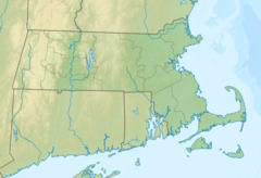
The North Nashua River is a river in northern Massachusetts. It rises from the Whitman River and Phillips Brook in Fitchburg, Massachusetts. It flows 19.9 miles (32.0 km), generally southeastward, past Fitchburg and joins the South Nashua River, about 5 miles (8.0 km) below its issuance from the Wachusett Reservoir, to form the Nashua River. [1] The river supplies over two million people with drinking water. [2]
See also
References
- ^ U.S. Geological Survey Geographic Names Information System: North Nashua River
- ^ "Nashua River, Massachusetts". National Wild and Scenic River System. National Wild and Scenic River System. Retrieved 1 January 2023.
