Norrie, Colorado | |
|---|---|
 The entrance to Norrie along Frying Pan Road at mile marker 28. | |
 Location of the Norrie CDP in
Pitkin County, Colorado. | |
 Norrie Location of the Norrie CDP in the
United States. | |
| Coordinates: 39°19′41″N 106°39′23″W / 39.3281314°N 106.6562751°W [1] | |
| Country | |
| State | |
| County | Pitkin County |
| Government | |
| • Type | unincorporated community |
| Area | |
| • Total | 0.188 sq mi (0.487 km2) |
| • Land | 0.188 sq mi (0.487 km2) |
| • Water | 0.000 sq mi (0.000 km2) |
| Elevation | 8,464 ft (2,580 m) |
| Population | |
| • Total | 7 |
| • Density | 37/sq mi (14/km2) |
| Time zone | UTC-7 ( MST) |
| • Summer ( DST) | UTC-6 ( MDT) |
| ZIP Code [4] |
Meredith 81642 |
| Area code | 970 |
| GNIS feature [2] | Norrie CDP |
Norrie (also known as the Norrie Colony) is a census-designated place (CDP) located in and governed by Pitkin County, Colorado, United States. The population of the Norrie CDP was 7 at the United States Census 2020. [3] The Meredith post office ( Zip Code 81642) serves the area. [4] The CDP is a part of the Glenwood Springs, CO Micropolitan Statistical Area.
History
Norrie was originally settled in the late 1880s. It began as a camp for railroad workers building the Colorado Midland Railway route along the Fryingpan River. The workers harvested trees used in the railroad construction, and they made ice in the local ponds, ice used in the railroad's refrigerator cars. Now, many privately-owned summer cabins line the community's quiet streets. [5]
Geography
The Norrie CDP has an area of 120 acres (0.487 km2), all land. [1]
Climate
The weather station at Nast Lake is 3 miles (4.83 km) south-east of Norrie, at an elevation of 8,700 feet (2,652 m).
| Climate data for Nast Lake, Colorado, 1991–2020 normals, 1985-2020 extremes: 8700ft (2652m) | |||||||||||||
|---|---|---|---|---|---|---|---|---|---|---|---|---|---|
| Month | Jan | Feb | Mar | Apr | May | Jun | Jul | Aug | Sep | Oct | Nov | Dec | Year |
| Record high °F (°C) | 67 (19) |
63 (17) |
75 (24) |
76 (24) |
87 (31) |
91 (33) |
94 (34) |
93 (34) |
88 (31) |
80 (27) |
71 (22) |
51 (11) |
94 (34) |
| Mean maximum °F (°C) | 52 (11) |
55 (13) |
61 (16) |
67 (19) |
77 (25) |
84 (29) |
87 (31) |
85 (29) |
81 (27) |
72 (22) |
61 (16) |
51 (11) |
88 (31) |
| Mean daily maximum °F (°C) | 36.5 (2.5) |
40.2 (4.6) |
47.5 (8.6) |
52.5 (11.4) |
62.4 (16.9) |
74.0 (23.3) |
79.2 (26.2) |
76.0 (24.4) |
69.4 (20.8) |
57.6 (14.2) |
45.2 (7.3) |
36.1 (2.3) |
56.4 (13.5) |
| Daily mean °F (°C) | 19.1 (−7.2) |
22.3 (−5.4) |
30.1 (−1.1) |
36.5 (2.5) |
45.0 (7.2) |
53.7 (12.1) |
59.3 (15.2) |
57.1 (13.9) |
50.5 (10.3) |
40.3 (4.6) |
29.2 (−1.6) |
19.2 (−7.1) |
38.5 (3.6) |
| Mean daily minimum °F (°C) | 1.4 (−17.0) |
4.2 (−15.4) |
12.5 (−10.8) |
20.4 (−6.4) |
28.3 (−2.1) |
33.5 (0.8) |
39.4 (4.1) |
38.0 (3.3) |
31.5 (−0.3) |
23.0 (−5.0) |
12.7 (−10.7) |
2.2 (−16.6) |
20.6 (−6.3) |
| Mean minimum °F (°C) | −18 (−28) |
−16 (−27) |
−7 (−22) |
5 (−15) |
19 (−7) |
26 (−3) |
32 (0) |
31 (−1) |
22 (−6) |
7 (−14) |
−8 (−22) |
−18 (−28) |
−21 (−29) |
| Record low °F (°C) | −32 (−36) |
−31 (−35) |
−20 (−29) |
−7 (−22) |
8 (−13) |
19 (−7) |
19 (−7) |
12 (−11) |
7 (−14) |
−10 (−23) |
−23 (−31) |
−32 (−36) |
−32 (−36) |
| Average precipitation inches (mm) | 2.10 (53) |
1.99 (51) |
2.18 (55) |
2.64 (67) |
1.81 (46) |
0.90 (23) |
1.46 (37) |
1.54 (39) |
1.29 (33) |
1.54 (39) |
1.86 (47) |
1.83 (46) |
21.14 (536) |
| Source 1: XMACIS2 [6] | |||||||||||||
| Source 2: NOAA (Precipitation) [7] | |||||||||||||
Demographics
| Year | Pop. | ±% |
|---|---|---|
| 2010 | 7 | — |
| 2020 | 7 | +0.0% |
| Source: United States Census Bureau | ||
The United States Census Bureau initially defined the Norrie CDP for the United States Census 2010.
See also
- Bibliography of Colorado
- Geography of Colorado
- History of Colorado
- Index of Colorado-related articles
- List of Colorado-related lists
- Outline of Colorado
References
- ^ a b c "State of Colorado Census Designated Places - BAS20 - Data as of January 1, 2020". United States Census Bureau. Retrieved December 26, 2020.
- ^ a b c "U.S. Board on Geographic Names: Domestic Names". United States Geological Survey. Retrieved December 26, 2020.
- ^ a b United States Census Bureau. "Norrie CDP, Colorado". Retrieved April 10, 2023.
- ^ a b "Look Up a ZIP Code". United States Postal Service. Retrieved December 26, 2020.
- ^ "Fryingpan Valley and Ruedi Reservoir visitor's guide" (PDF). Roaring Fork Conservancy. Retrieved October 23, 2020.
- ^ "xmACIS2". National Oceanic and Atmospheric Administration. Retrieved November 3, 2023.
- ^ "Nast Lake, Colorado 1991-2020 Monthly Normals". Retrieved November 3, 2023.
External links
 Media from Commons
 News from Wikinews
 Quotations from Wikiquote
 Travel information from Wikivoyage
Municipalities and communities of
Pitkin County, Colorado, United States | ||
|---|---|---|
| City | 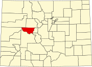 | |
| Towns | ||
| CDPs | ||
|
Unincorporated communities | ||
| Ghost towns | ||
| Footnotes | ‡This populated place also has portions in an adjacent county or counties | |
Norrie, Colorado | |
|---|---|
|
The entrance to Norrie along Frying Pan Road at mile marker 28. | |
|
Location of the Norrie CDP in
Pitkin County, Colorado. | |
Norrie Location of the Norrie CDP in the
United States. | |
| Coordinates: 39°19′41″N 106°39′23″W / 39.3281314°N 106.6562751°W [1] | |
| Country | |
| State | |
| County | Pitkin County |
| Government | |
| • Type | unincorporated community |
| Area | |
| • Total | 0.188 sq mi (0.487 km2) |
| • Land | 0.188 sq mi (0.487 km2) |
| • Water | 0.000 sq mi (0.000 km2) |
| Elevation | 8,464 ft (2,580 m) |
| Population | |
| • Total | 7 |
| • Density | 37/sq mi (14/km2) |
| Time zone | UTC-7 ( MST) |
| • Summer ( DST) | UTC-6 ( MDT) |
| ZIP Code [4] |
Meredith 81642 |
| Area code | 970 |
| GNIS feature [2] | Norrie CDP |
Norrie (also known as the Norrie Colony) is a census-designated place (CDP) located in and governed by Pitkin County, Colorado, United States. The population of the Norrie CDP was 7 at the United States Census 2020. [3] The Meredith post office ( Zip Code 81642) serves the area. [4] The CDP is a part of the Glenwood Springs, CO Micropolitan Statistical Area.
History
Norrie was originally settled in the late 1880s. It began as a camp for railroad workers building the Colorado Midland Railway route along the Fryingpan River. The workers harvested trees used in the railroad construction, and they made ice in the local ponds, ice used in the railroad's refrigerator cars. Now, many privately-owned summer cabins line the community's quiet streets. [5]
Geography
The Norrie CDP has an area of 120 acres (0.487 km2), all land. [1]
Climate
The weather station at Nast Lake is 3 miles (4.83 km) south-east of Norrie, at an elevation of 8,700 feet (2,652 m).
| Climate data for Nast Lake, Colorado, 1991–2020 normals, 1985-2020 extremes: 8700ft (2652m) | |||||||||||||
|---|---|---|---|---|---|---|---|---|---|---|---|---|---|
| Month | Jan | Feb | Mar | Apr | May | Jun | Jul | Aug | Sep | Oct | Nov | Dec | Year |
| Record high °F (°C) | 67 (19) |
63 (17) |
75 (24) |
76 (24) |
87 (31) |
91 (33) |
94 (34) |
93 (34) |
88 (31) |
80 (27) |
71 (22) |
51 (11) |
94 (34) |
| Mean maximum °F (°C) | 52 (11) |
55 (13) |
61 (16) |
67 (19) |
77 (25) |
84 (29) |
87 (31) |
85 (29) |
81 (27) |
72 (22) |
61 (16) |
51 (11) |
88 (31) |
| Mean daily maximum °F (°C) | 36.5 (2.5) |
40.2 (4.6) |
47.5 (8.6) |
52.5 (11.4) |
62.4 (16.9) |
74.0 (23.3) |
79.2 (26.2) |
76.0 (24.4) |
69.4 (20.8) |
57.6 (14.2) |
45.2 (7.3) |
36.1 (2.3) |
56.4 (13.5) |
| Daily mean °F (°C) | 19.1 (−7.2) |
22.3 (−5.4) |
30.1 (−1.1) |
36.5 (2.5) |
45.0 (7.2) |
53.7 (12.1) |
59.3 (15.2) |
57.1 (13.9) |
50.5 (10.3) |
40.3 (4.6) |
29.2 (−1.6) |
19.2 (−7.1) |
38.5 (3.6) |
| Mean daily minimum °F (°C) | 1.4 (−17.0) |
4.2 (−15.4) |
12.5 (−10.8) |
20.4 (−6.4) |
28.3 (−2.1) |
33.5 (0.8) |
39.4 (4.1) |
38.0 (3.3) |
31.5 (−0.3) |
23.0 (−5.0) |
12.7 (−10.7) |
2.2 (−16.6) |
20.6 (−6.3) |
| Mean minimum °F (°C) | −18 (−28) |
−16 (−27) |
−7 (−22) |
5 (−15) |
19 (−7) |
26 (−3) |
32 (0) |
31 (−1) |
22 (−6) |
7 (−14) |
−8 (−22) |
−18 (−28) |
−21 (−29) |
| Record low °F (°C) | −32 (−36) |
−31 (−35) |
−20 (−29) |
−7 (−22) |
8 (−13) |
19 (−7) |
19 (−7) |
12 (−11) |
7 (−14) |
−10 (−23) |
−23 (−31) |
−32 (−36) |
−32 (−36) |
| Average precipitation inches (mm) | 2.10 (53) |
1.99 (51) |
2.18 (55) |
2.64 (67) |
1.81 (46) |
0.90 (23) |
1.46 (37) |
1.54 (39) |
1.29 (33) |
1.54 (39) |
1.86 (47) |
1.83 (46) |
21.14 (536) |
| Source 1: XMACIS2 [6] | |||||||||||||
| Source 2: NOAA (Precipitation) [7] | |||||||||||||
Demographics
| Year | Pop. | ±% |
|---|---|---|
| 2010 | 7 | — |
| 2020 | 7 | +0.0% |
| Source: United States Census Bureau | ||
The United States Census Bureau initially defined the Norrie CDP for the United States Census 2010.
See also
- Bibliography of Colorado
- Geography of Colorado
- History of Colorado
- Index of Colorado-related articles
- List of Colorado-related lists
- Outline of Colorado
References
- ^ a b c "State of Colorado Census Designated Places - BAS20 - Data as of January 1, 2020". United States Census Bureau. Retrieved December 26, 2020.
- ^ a b c "U.S. Board on Geographic Names: Domestic Names". United States Geological Survey. Retrieved December 26, 2020.
- ^ a b United States Census Bureau. "Norrie CDP, Colorado". Retrieved April 10, 2023.
- ^ a b "Look Up a ZIP Code". United States Postal Service. Retrieved December 26, 2020.
- ^ "Fryingpan Valley and Ruedi Reservoir visitor's guide" (PDF). Roaring Fork Conservancy. Retrieved October 23, 2020.
- ^ "xmACIS2". National Oceanic and Atmospheric Administration. Retrieved November 3, 2023.
- ^ "Nast Lake, Colorado 1991-2020 Monthly Normals". Retrieved November 3, 2023.
External links
-
Media from Commons
-
News from Wikinews
-
Quotations from Wikiquote
-
Travel information from Wikivoyage
Municipalities and communities of
Pitkin County, Colorado, United States | ||
|---|---|---|
| City | | |
| Towns | ||
| CDPs | ||
|
Unincorporated communities | ||
| Ghost towns | ||
| Footnotes | ‡This populated place also has portions in an adjacent county or counties | |