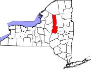
Nobleboro, New York | |
|---|---|
| Coordinates: 43°23′45″N 74°51′43″W / 43.39583°N 74.86194°W | |
| Country | United States |
| State | New York |
| County | Herkimer |
| Town | Ohio |
| Elevation | 1,430 [1] ft (436 m) |
| Time zone | UTC-5 ( Eastern (EST)) |
| • Summer ( DST) | UTC-4 (EDT) |
| ZIP code | 13324 |
| Area code(s) | 315 |
Nobleboro, formally known as Noblesboro, is a hamlet located in the town of Ohio in Herkimer County, New York, United States. The South Branch West Canada Creek converges with the West Canada Creek in the hamlet.
The name "Noblesboro", now Nobleboro, is derived from its situation at the boundary of a royal grant to Sir William Johnson.[ citation needed] The remains of a pulpwood boom and rossing mill on West Canada Creek, are located in Nobleboro and is commemorated today with a scenic overlook and kiosk.[ citation needed]
- ^ "Nobleboro". Geographic Names Information System. United States Geological Survey, United States Department of the Interior. Retrieved November 5, 2017.


