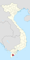
Photos • Location
Nhà Mát | |
|---|---|
| Country | |
| Province | Bạc Liêu |
| City | Bạc Liêu |
| Time zone | UTC+07:00 (Indochina Time) |
Nhà Mát is a ward (phường) of Bạc Liêu city in Bạc Liêu Province, Vietnam. [1]
References
- ^ "Administrative subdivisions". General Statistics Office of Vietnam. To find information at reference, go to row 95, then row 954, and it is listed on row 31831.
9°40′N 106°34′E / 9.667°N 106.567°E
