Neuhaus am Rennweg | |
|---|---|
 Church in Neuhaus am Rennweg | |
 Coat of arms | |
Location of Neuhaus am Rennweg within Sonneberg district 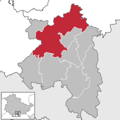 | |
 Neuhaus am Rennweg  Neuhaus am Rennweg | |
| Coordinates: 50°31′N 11°09′E / 50.517°N 11.150°E | |
| Country | Germany |
| State | Thuringia |
| District | Sonneberg |
| Government | |
| • Mayor (2024–30) | Uwe Scheler [1] |
| Area | |
| • Total | 108.22 km2 (41.78 sq mi) |
| Elevation | 830 m (2,720 ft) |
| Population (2022-12-31)
[2] | |
| • Total | 8,927 |
| • Density | 82/km2 (210/sq mi) |
| Time zone | UTC+01:00 ( CET) |
| • Summer ( DST) | UTC+02:00 ( CEST) |
| Postal codes | 98724, 98739 |
| Dialling codes | 03679, 036701 |
| Vehicle registration | SON, NH |
| Website | www.neuhaus-am-rennweg.de |
Neuhaus am Rennweg is a town in the district of Sonneberg, in Thuringia, Germany. It is situated in the Thuringian Forest, 17 km north of Sonneberg, and 22 km southwest of Saalfeld. The former municipalities Lichte and Piesau were merged into Neuhaus am Rennweg in January 2019.
| Climate data for Neuhaus am Rennweg: 845m (1991−2020) | |||||||||||||
|---|---|---|---|---|---|---|---|---|---|---|---|---|---|
| Month | Jan | Feb | Mar | Apr | May | Jun | Jul | Aug | Sep | Oct | Nov | Dec | Year |
| Mean daily maximum °C (°F) | −0.5 (31.1) |
0.5 (32.9) |
4.3 (39.7) |
9.8 (49.6) |
14.1 (57.4) |
17.4 (63.3) |
19.5 (67.1) |
19.3 (66.7) |
14.5 (58.1) |
9.2 (48.6) |
3.8 (38.8) |
0.4 (32.7) |
9.4 (48.8) |
| Daily mean °C (°F) | −2.6 (27.3) |
−2.0 (28.4) |
1.1 (34.0) |
5.8 (42.4) |
9.9 (49.8) |
13.1 (55.6) |
15.1 (59.2) |
15.0 (59.0) |
10.8 (51.4) |
6.2 (43.2) |
1.6 (34.9) |
−1.6 (29.1) |
6.0 (42.9) |
| Mean daily minimum °C (°F) | −4.5 (23.9) |
−4.2 (24.4) |
−1.6 (29.1) |
2.1 (35.8) |
6.0 (42.8) |
9.2 (48.6) |
11.3 (52.3) |
11.3 (52.3) |
7.7 (45.9) |
3.8 (38.8) |
−0.3 (31.5) |
−3.5 (25.7) |
3.1 (37.6) |
| Average precipitation mm (inches) | 117.4 (4.62) |
91.1 (3.59) |
90.9 (3.58) |
63.2 (2.49) |
86.1 (3.39) |
84.2 (3.31) |
119.6 (4.71) |
87.1 (3.43) |
89.7 (3.53) |
96.6 (3.80) |
99.8 (3.93) |
129.7 (5.11) |
1,155.4 (45.49) |
| Average precipitation days (≥ 1.0 mm) | 20.2 | 17.6 | 18.5 | 14.6 | 15.8 | 15.7 | 16.7 | 15.3 | 14.5 | 18.0 | 19.5 | 21.5 | 207.9 |
| Average snowy days (≥ 1.0 cm) | 27.9 | 26.5 | 23.8 | 6.7 | 0.1 | 0.0 | 0.0 | 0.0 | 0.0 | 1.9 | 9.7 | 23.8 | 121.5 |
| Average relative humidity (%) | 92.8 | 89.5 | 85.1 | 75.3 | 75.7 | 76.2 | 75.7 | 76.2 | 83.4 | 90.4 | 94.0 | 93.9 | 84.0 |
| Mean monthly sunshine hours | 48.1 | 69.4 | 112.0 | 160.6 | 187.0 | 194.5 | 203.0 | 196.8 | 142.2 | 98.6 | 47.6 | 41.1 | 1,492.6 |
| Source: NOAA [3] | |||||||||||||
- ^ Gewählte Bürgermeister - aktuelle Landesübersicht, Freistaat Thüringen. Retrieved 25 June 2024.
- ^ "Bevölkerung der Gemeinden, erfüllenden Gemeinden und Verwaltungsgemeinschaften in Thüringen Gebietsstand: 31.12.2022" (in German). Thüringer Landesamt für Statistik. June 2023.
- ^ "Neuhaus am Rennweg Climate Normals 1991-2020". National Oceanic and Atmospheric Administration. Retrieved September 4, 2023.
Towns and municipalities in
Sonneberg (district) | ||
|---|---|---|
| International | |
|---|---|
| National | |
| Geographic | |
|
| This Sonneberg district location article is a stub. You can help Wikipedia by expanding it. |
Neuhaus am Rennweg | |
|---|---|
|
Church in Neuhaus am Rennweg | |
|
Coat of arms | |
Location of Neuhaus am Rennweg within Sonneberg district | |
Neuhaus am Rennweg Neuhaus am Rennweg | |
| Coordinates: 50°31′N 11°09′E / 50.517°N 11.150°E | |
| Country | Germany |
| State | Thuringia |
| District | Sonneberg |
| Government | |
| • Mayor (2024–30) | Uwe Scheler [1] |
| Area | |
| • Total | 108.22 km2 (41.78 sq mi) |
| Elevation | 830 m (2,720 ft) |
| Population (2022-12-31)
[2] | |
| • Total | 8,927 |
| • Density | 82/km2 (210/sq mi) |
| Time zone | UTC+01:00 ( CET) |
| • Summer ( DST) | UTC+02:00 ( CEST) |
| Postal codes | 98724, 98739 |
| Dialling codes | 03679, 036701 |
| Vehicle registration | SON, NH |
| Website | www.neuhaus-am-rennweg.de |
Neuhaus am Rennweg is a town in the district of Sonneberg, in Thuringia, Germany. It is situated in the Thuringian Forest, 17 km north of Sonneberg, and 22 km southwest of Saalfeld. The former municipalities Lichte and Piesau were merged into Neuhaus am Rennweg in January 2019.
| Climate data for Neuhaus am Rennweg: 845m (1991−2020) | |||||||||||||
|---|---|---|---|---|---|---|---|---|---|---|---|---|---|
| Month | Jan | Feb | Mar | Apr | May | Jun | Jul | Aug | Sep | Oct | Nov | Dec | Year |
| Mean daily maximum °C (°F) | −0.5 (31.1) |
0.5 (32.9) |
4.3 (39.7) |
9.8 (49.6) |
14.1 (57.4) |
17.4 (63.3) |
19.5 (67.1) |
19.3 (66.7) |
14.5 (58.1) |
9.2 (48.6) |
3.8 (38.8) |
0.4 (32.7) |
9.4 (48.8) |
| Daily mean °C (°F) | −2.6 (27.3) |
−2.0 (28.4) |
1.1 (34.0) |
5.8 (42.4) |
9.9 (49.8) |
13.1 (55.6) |
15.1 (59.2) |
15.0 (59.0) |
10.8 (51.4) |
6.2 (43.2) |
1.6 (34.9) |
−1.6 (29.1) |
6.0 (42.9) |
| Mean daily minimum °C (°F) | −4.5 (23.9) |
−4.2 (24.4) |
−1.6 (29.1) |
2.1 (35.8) |
6.0 (42.8) |
9.2 (48.6) |
11.3 (52.3) |
11.3 (52.3) |
7.7 (45.9) |
3.8 (38.8) |
−0.3 (31.5) |
−3.5 (25.7) |
3.1 (37.6) |
| Average precipitation mm (inches) | 117.4 (4.62) |
91.1 (3.59) |
90.9 (3.58) |
63.2 (2.49) |
86.1 (3.39) |
84.2 (3.31) |
119.6 (4.71) |
87.1 (3.43) |
89.7 (3.53) |
96.6 (3.80) |
99.8 (3.93) |
129.7 (5.11) |
1,155.4 (45.49) |
| Average precipitation days (≥ 1.0 mm) | 20.2 | 17.6 | 18.5 | 14.6 | 15.8 | 15.7 | 16.7 | 15.3 | 14.5 | 18.0 | 19.5 | 21.5 | 207.9 |
| Average snowy days (≥ 1.0 cm) | 27.9 | 26.5 | 23.8 | 6.7 | 0.1 | 0.0 | 0.0 | 0.0 | 0.0 | 1.9 | 9.7 | 23.8 | 121.5 |
| Average relative humidity (%) | 92.8 | 89.5 | 85.1 | 75.3 | 75.7 | 76.2 | 75.7 | 76.2 | 83.4 | 90.4 | 94.0 | 93.9 | 84.0 |
| Mean monthly sunshine hours | 48.1 | 69.4 | 112.0 | 160.6 | 187.0 | 194.5 | 203.0 | 196.8 | 142.2 | 98.6 | 47.6 | 41.1 | 1,492.6 |
| Source: NOAA [3] | |||||||||||||
- ^ Gewählte Bürgermeister - aktuelle Landesübersicht, Freistaat Thüringen. Retrieved 25 June 2024.
- ^ "Bevölkerung der Gemeinden, erfüllenden Gemeinden und Verwaltungsgemeinschaften in Thüringen Gebietsstand: 31.12.2022" (in German). Thüringer Landesamt für Statistik. June 2023.
- ^ "Neuhaus am Rennweg Climate Normals 1991-2020". National Oceanic and Atmospheric Administration. Retrieved September 4, 2023.
Towns and municipalities in
Sonneberg (district) | ||
|---|---|---|
| International | |
|---|---|
| National | |
| Geographic | |
|
| This Sonneberg district location article is a stub. You can help Wikipedia by expanding it. |