This page is one of two listing the National Register of Historic Places listings in Texas' Gulf Coast.
The Gulf Coast region is an area of 13 counties defined by the Texas Comptroller for economic reporting, as mapped here. It includes the city of Houston and all of the Texas Panhandle by most definitions of that term. The region included 2020 population of about 7.3 million, or 25 percent of Texas' population, with Harris County having 65 percent of that, and Houston alone having about 32 percent of that. [1]
This page includes all of the Gulf Coast region besides Harris County (Houston plus); for the latter please see that
This
National Park Service list is complete through
NPS recent listings posted May 24, 2024.
[2]
To see all locations together in a map, click on "Map all coordinates using OpenSourceMap" at right.
Austin County
(not to be confused with the City of Austin, in Travis County)
.jpg)
.jpg)

.jpg)


Brazoria County
| [3] | Name on the Register [6] | Image | Date listed [4] | Location | City or town | Description |
|---|---|---|---|---|---|---|
| 1 | Alvin Gulf, Colorado and Santa Fe Railway Passenger Depot | .jpg) |
March 6, 2019 ( #100003467) |
200 Depot Centre Blvd. 29°25′29″N 95°14′35″W / 29.424584°N 95.243150°W | Alvin | |
| 2 | Brazoria Bridge | .jpg) |
June 14, 1991 ( #91000783) |
0.9 mi. E of
TX 36 on
TX 332 29°03′15″N 95°33′25″W / 29.054167°N 95.556944°W | Brazoria | Recorded Texas Historic Landmark |
| 3 | Alden B. Dow Office and Lake Jackson City Hall |  |
March 1, 2010 ( #10000050) |
101 S. Parking Place 29°02′26″N 95°26′55″W / 29.04069°N 95.44856°W | Lake Jackson | |
| 4 | Durazno Plantation | .jpg) |
September 2, 1980 ( #80004081) |
S of Jones Creek off TX 36 28°57′22″N 95°26′57″W / 28.956111°N 95.449167°W | Jones Creek | |
| 5 | East Columbia Historic District | .jpg) |
October 28, 1991 ( #91001602) |
S. Main St. 29°08′31″N 95°36′54″W / 29.141944°N 95.615°W | East Columbia | Includes Recorded Texas Historic Landmarks |
| 6 | Gazebo for James Richard Marmion | .jpg) |
October 22, 2004 ( #04001173) |
1214 County Rd. 29°02′34″N 95°38′40″W / 29.042778°N 95.644444°W | Sweeny | Sculpture by Dionicio Rodriguez |
| 7 | GEN. C. B. COMSTOCK (dredge) Shipwreck Site |  |
July 6, 1995 ( #94001119) |
Address restricted
[5] | Surfside Beach | |
| 8 | John McCroskey Log House |  |
August 28, 1975 ( #75001958) |
2 mi. NE of Cedar Lake on Stringfellow Ranch 28°56′22″N 95°36′54″W / 28.939444°N 95.615°W | Cedar Lake | |
| 9 | Old Brazoria County Courthouse |  |
March 12, 1979 ( #79002922) |
Public Sq. 29°10′08″N 95°25′52″W / 29.168889°N 95.431111°W | Angleton | State Antiquities Landmark, Recorded Texas Historic Landmark |
| 10 | Palapa Table for James Richard Marmion | .jpg) |
October 22, 2004 ( #04001172) |
1214 County Rd. 29°02′38″N 95°38′51″W / 29.043889°N 95.6475°W | Sweeny | Sculpture by Dionicio Rodriguez |
| 11 | Henry Smith Statue |  |
October 19, 2018 ( #100003040) |
Intersection of N Brooks & W Smith Sts. 29°02′49″N 95°34′14″W / 29.047071°N 95.570426°W | Brazoria | In honor of Henry Smith (Texas governor) who lived in Brazoria for a while. Recorded Texas Historic Landmark |
| 12 | Ammon Underwood House | .jpg) |
June 24, 1976 ( #76002011) |
505 Main St. 29°08′25″N 95°37′02″W / 29.140278°N 95.617222°W | East Columbia | Recorded Texas Historic Landmark; relocated in 2005 due to river encroachment |
| 13 | Varner-Hogg Plantation | .jpg) |
April 9, 1980 ( #80004082) |
2 mi. NE of West Columbia off
FM 2852 29°09′47″N 95°38′25″W / 29.163056°N 95.640278°W | West Columbia | State Historic Site, State Antiquities Landmark, Recorded Texas Historic Landmark |
Chambers County
| [3] | Name on the Register | Image | Date listed [4] | Location | City or town | Description |
|---|---|---|---|---|---|---|
| 1 | Archeological Site 41 CH 110 |  |
July 14, 1971 ( #71000924) |
Address restricted
[5] | Cove | |
| 2 | Chambers County Courthouse |  |
April 25, 2008 ( #08000339) |
404 Washington St., 29°46′09″N 94°41′05″W / 29.769167°N 94.684722°W | Anahuac | |
| 3 | Chambersea |  |
November 19, 1979 ( #79002925) |
Washington and Cummings Sts 29°46′15″N 94°41′05″W / 29.770833°N 94.684722°W | Anahuac | State Antiquities Landmark, Recorded Texas Historic Landmark; General Thomas Jefferson Chambers House |
| 4 | Fort Anahuac |  |
July 1, 1981 ( #81000626) |
Corner of Main St. and Chambers 29°45′24″N 94°41′17″W / 29.756667°N 94.688056°W | Anahuac | State Antiquities Landmark |
| 5 | Old Wallisville Town Site | |
March 30, 1982 ( #82004495) |
Address restricted
[5] | Wallisville | |
| 6 | Orcoquisac Archeological District | |
July 14, 1971 ( #71000925) |
Address restricted
[5] | Wallisville |
Colorado County
| [3] | Name on the Register | Image | Date listed [4] | Location | City or town | Description |
|---|---|---|---|---|---|---|
| 1 | Colorado County Courthouse |  |
July 12, 1976 ( #76002015) |
Bounded by Milam, Spring, Travis and Walnut Sts. 29°42′21″N 96°32′23″W / 29.705833°N 96.539722°W | Columbus | State Antiquities Landmark, Recorded Texas Historic Landmark; part of Colorado County Courthouse Historic District; Neoclassical building erected in 1890-1891 in the form of a Greek cross |
| 2 | Colorado County Courthouse Historic District |  |
June 23, 1978 ( #78002907) |
Roughly bounded by Preston, Walnut, Milam, Front, Washington, and Live Oak Sts. 29°42′22″N 96°32′26″W / 29.706111°N 96.540556°W | Columbus | Includes State Antiquities Landmark, several Recorded Texas Historic Landmarks |
| 3 | Eagle Lake Commercial Historic District |  |
June 5, 2007 ( #07000494) |
100-416 E. Main St., 101-108 W. Main St., 101-124 Commerce St., 101-201 N. McCarty Ave., and 100-203 E. Post Office St. 29°35′21″N 96°20′02″W / 29.589167°N 96.333889°W | Eagle Lake | |
| 4 | Harrison-Hastedt House |  |
March 22, 2004 ( #04000231) |
236 Preston St. 29°42′32″N 96°32′16″W / 29.708889°N 96.537778°W | Columbus | Recorded Texas Historic Landmark |
| 5 | Old Spanish Trail from US 90 to I-10 |  |
April 16, 2013 ( #13000176) |
County Road 268 between
U.S. Route 90 and a northern access road for
I-10 29°42′23″N 96°31′27″W / 29.7065°N 96.5243°W | Columbus | |
| 6 | Stafford Bank and Opera House |  |
May 8, 1973 ( #73002276) |
Milan and Spring Sts. 29°42′19″N 96°32′25″W / 29.705278°N 96.540278°W | Columbus | Recorded Texas Historic Landmark; part of Colorado County Courthouse Historic District; Second Empire style building completed in 1886. |
| 7 | State Highway 3 Bridge at the Colorado River |  |
October 10, 1996 ( #96001111) |
U.S. Route 90, 0.6 miles east of its junction with Loop 329 29°42′23″N 96°32′11″W / 29.706389°N 96.536389°W | Columbus | Three-span Parker through truss bridge built in 1932. |
Fort Bend County


.jpg)


Galveston County
| [3] | Name on the Register [6] | Image | Date listed [4] | Location | City or town | Description |
|---|---|---|---|---|---|---|
| 1 | American National Insurance Company (ANICO) |  |
May 20, 2021 ( #100006539) |
1 Moody Ave. (1902 Market St.) 29°18′24″N 94°47′24″W / 29.3068°N 94.7900°W | Galveston | AKA One Moody Plaza. |
| 2 | Ashton Villa |  |
October 28, 1969 ( #69000204) |
2328 Broadway 29°17′59″N 94°47′33″W / 29.2997°N 94.7925°W | Galveston | Recorded Texas Historic Landmark |
| 3 | Bayou Brae Historic District | May 24, 2021 ( #100006547) |
All properties on Bayou Dr., Brae Ln., Coryell St., Oboe Trail, Woodwind Way, and Viola Dr. 29°31′36″N 95°04′35″W / 29.5267°N 95.0764°W | League City | ||
| 4 | Henry Beissner House |  |
April 3, 1978 ( #78002929) |
2818 Ball Ave. 29°18′01″N 94°47′56″W / 29.3003°N 94.7989°W | Galveston | |
| 5 | Bishop's Palace |  |
August 25, 1970 ( #70000746) |
1402 Ave. J (Broadway) 29°18′17″N 94°46′55″W / 29.3047°N 94.7819°W | Galveston | Recorded Texas Historic Landmark, part of East End Historic District |
| 6 | Broadway Cemetery Historic District | .jpg) |
June 13, 2014 ( #14000340) |
6 blocks between Broadway Ave., Ave. L, 43rd & 40th Sts. 29°17′37″N 94°48′46″W / 29.2935°N 94.8129°W | Galveston | |
| 7 | Building at 1921–1921 1/2 Avenue D |  |
August 14, 1984 ( #84001671) |
1921–1921 1/2 Ave. D 29°18′21″N 94°47′23″W / 29.3058°N 94.7897°W | Galveston | Historic Resources of the Galveston Central Business District MRA |
| 8 | Building at 1925–1927 Market Street | .jpg) |
August 14, 1984 ( #84001668) |
1925–1927 Market St. 29°18′25″N 94°47′29″W / 29.3069°N 94.7914°W | Galveston | Historic Resources of the Galveston Central Business District MRA |
| 9 | Cedar Lawn Historic District |  |
December 20, 2002 ( #02001570) |
Bounded by 45th. St., 48th St., Ave. L, and Ave. N, 29°17′23″N 94°49′04″W / 29.2897°N 94.8178°W | Galveston | |
| 10 | City Hall |  |
August 14, 1984 ( #84001676) |
823 25th St. 29°18′01″N 94°47′43″W / 29.3003°N 94.7953°W | Galveston | Historic Resources of the Galveston Central Business District MRA |
| 11 | City National Bank |  |
August 14, 1984 ( #84001680) |
2219 Market St 29°18′20″N 94°47′36″W / 29.3055°N 94.7933°W | Galveston | Historic Resources of the Galveston Central Business District MRA |
| 12 | Congregation Beth Jacob |  |
January 4, 2024 ( #100009737) |
2401 Avenue K 29°17′55″N 94°47′34″W / 29.2986°N 94.7929°W | Galveston | |
| 13 | Frank B. Davison House |  |
June 29, 1976 ( #76002033) |
109 3rd Ave. 29°23′13″N 94°53′42″W / 29.3869°N 94.895°W | Texas City | State Antiquities Landmark, Recorded Texas Historic Landmark |
| 14 | Denver Court Historic District |  |
January 14, 2002 ( #01001471) |
Roughly bounded by Aves. S1/2 and U1/2, 43rd and 52nd Sts. 29°16′39″N 94°48′54″W / 29.2775°N 94.815°W | Galveston | |
| 15 | East End Historic District | .jpg) |
May 30, 1975 ( #75001979) |
Irregular pattern including both sides of Broadway and Market Sts. 29°18′16″N 94°46′58″W / 29.3044°N 94.7828°W | Galveston | Includes Recorded Texas Historic Landmarks |
| 16 | Eiband's |  |
August 14, 1984 ( #84001683) |
2001 Central Plaza 29°18′16″N 94°47′32″W / 29.3044°N 94.7922°W | Galveston | Historic Resources of the Galveston Central Business District MRA |
| 17 | ELISSA | .jpg) |
March 21, 1978 ( #78002930) |
Pier 21, 21st Street and Harborside Drive 29°18′34″N 94°47′37″W / 29.30946667°N 94.7936°W | Galveston | |
| 18 | Falstaff Brewery |  |
August 29, 2018 ( #100002841) |
3302 Church St. (Ave. F) 29°18′03″N 94°48′22″W / 29.3007°N 94.8061°W | Galveston | This structure is currently abandoned |
| 19 | First Evangelical Lutheran Church | .jpg) |
August 14, 1984 ( #84001688) |
2401 Ave. G 29°18′09″N 94°47′39″W / 29.3025°N 94.7942°W | Galveston | Recorded Texas Historic Landmark; Historic Resources of the Galveston Central Business District MRA |
| 20 | First Presbyterian Church |  |
January 29, 1979 ( #79002942) |
1903 Church St. 29°18′15″N 94°47′19″W / 29.3042°N 94.7886°W | Galveston | Recorded Texas Historic Landmark |
| 21 | Fort Travis |  |
March 30, 2005 ( #05000247) |
TX 87 at Loop 108 29°21′53″N 94°45′29″W / 29.3647°N 94.7581°W | Port Bolivar | State Antiquities Landmark |
| 22 | Galveston Causeway |  |
December 12, 1976 ( #76002028) |
Spans Galveston Bay from Virginia Point to Galveston Island 29°17′51″N 94°53′12″W / 29.2975°N 94.8867°W | Galveston | State Antiquities Landmark |
| 23 | Galveston, Houston & Henderson (GH&H) Freight Depot | _Freight_Depot_--_Galveston.jpg) |
January 10, 2020 ( #100004866) |
325 33rd St. 29°18′09″N 94°48′20″W / 29.3025°N 94.8055°W | Galveston | |
| 24 | Galveston Orphans Home |  |
March 21, 1979 ( #79002943) |
1315 21st St. 29°17′50″N 94°47′19″W / 29.297222°N 94.788611°W | Galveston | Recorded Texas Historic Landmark |
| 25 | Galveston Seawall |  |
August 18, 1977 ( #77001443) |
Seawall Blvd. 29°18′09″N 94°46′27″W / 29.3025°N 94.774167°W | Galveston | State Antiquities Landmark |
| 26 | Galveston US Post Office, Custom House and Courthouse |  |
April 25, 2001 ( #01000438) |
601 25th St. (Rosenberg St.)
[7] 29°18′08″N 94°47′45″W / 29.302222°N 94.795833°W | Galveston | |
| 27 | Galvez Hotel |  |
April 4, 1979 ( #79002944) |
2024 Seawall Blvd. 29°17′32″N 94°47′08″W / 29.292222°N 94.785556°W | Galveston | Recorded Texas Historic Landmark |
| 28 | Garten Verein Pavilion |  |
July 20, 1977 ( #77001444) |
27th St. and Avenue O (Kempner Park) 29°17′34″N 94°47′41″W / 29.292778°N 94.794722°W | Galveston | State Antiquities Landmark, Recorded Texas Historic Landmark |
| 29 | Grace Episcopal Church |  |
April 3, 1975 ( #75001980) |
1115 36th St. 29°17′39″N 94°48′23″W / 29.294167°N 94.806389°W | Galveston | Recorded Texas Historic Landmark |
| 30 | Grand Opera House |  |
January 2, 1974 ( #74002071) |
2012–2020 Ave. E 29°17′47″N 94°47′26″W / 29.296389°N 94.790556°W | Galveston | Recorded Texas Historic Landmark |
| 31 | John Hagemann House |  |
June 1, 1982 ( #82004505) |
3301 Ave. L 29°17′40″N 94°48′47″W / 29.294444°N 94.813056°W | Galveston | Recorded Texas Historic Landmark |
| 32 | House at 2017–2023 Avenue I |  |
August 14, 1984 ( #84001698) |
2017–2023 Ave. I 29°18′05″N 94°47′07″W / 29.301389°N 94.785278°W | Galveston | Historic Resources of the Galveston Central Business District MRA |
| 33 | House at 2528 Postoffice St. | .jpg) |
August 14, 1984 ( #84001700) |
2528 Postoffice St. 29°18′13″N 94°47′49″W / 29.303611°N 94.796944°W | Galveston | Historic Resources of the Galveston Central Business District MRA |
| 34 | Sealy Hutchings House |  |
July 29, 1994 ( #94000796) |
2805 Ave. O 29°17′31″N 94°47′44″W / 29.291944°N 94.795556°W | Galveston | |
| 35 | I.O.O.F. Lodge |  |
August 14, 1984 ( #84001703) |
505 20th St. 29°18′18″N 94°47′24″W / 29.305°N 94.79°W | Galveston | Historic Resources of the Galveston Central Business District MRA |
| 36 | Illies Building-Justine Apartments |  |
August 22, 1995 ( #95001028) |
503 21st St. 29°17′49″N 94°46′56″W / 29.296944°N 94.782222°W | Galveston | Historic Resources of the Galveston Central Business District MRA |
| 37 | Daniel Webster Kempner House |  |
March 30, 1979 ( #79002945) |
2504 Ave. O 29°17′35″N 94°47′34″W / 29.293056°N 94.792778°W | Galveston | Part of Silk Stocking Residential Historic District |
| 38 | Jean Lafitte Hotel |  |
August 14, 1984 ( #84001705) |
2105 Ave. F 29°18′14″N 94°47′27″W / 29.303889°N 94.790833°W | Galveston | Historic Resources of the Galveston Central Business District MRA |
| 39 | Lasker Home for Homeless Children |  |
April 14, 1983 ( #83003140) |
1019 16th St. 29°18′02″N 94°47′01″W / 29.300556°N 94.783611°W | Galveston | Recorded Texas Historic Landmark; part of Lost Bayou Historic District |
| 40 | E.S. Levy Building |  |
November 13, 2003 ( #03001163) |
2221–2225 Market St. 29°18′17″N 94°47′36″W / 29.304722°N 94.793333°W | Galveston | Historic Resources of the Galveston Central Business District MRA |
| 41 | Lost Bayou Historic District |  |
June 19, 2017 ( #100001224) |
Roughly bounded by Broadway, Ave. N, 14th & 21st Sts. 29°17′58″N 94°47′06″W / 29.299416°N 94.784990°W | Galveston | Includes Recorded Texas Historic Landmarks |
| 42 | Marschner Building |  |
August 14, 1984 ( #84001706) |
1914–1916 Mechanic St. 29°18′26″N 94°47′23″W / 29.307222°N 94.789722°W | Galveston | Recorded Texas Historic Landmark; Historic Resources of the Galveston Central Business District MRA |
| 43 | McKinney-McDonald House |  |
May 4, 1976 ( #76002030) |
926 Winnie St. 29°18′24″N 94°46′39″W / 29.306667°N 94.7775°W | Galveston | |
| 44 | Melrose Apartment Building |  |
October 14, 1998 ( #98001246) |
2002 Post Office St. 29°18′19″N 94°47′26″W / 29.305278°N 94.790556°W | Galveston | Historic Resources of the Galveston Central Business District MRA |
| 45 | Michel B. Menard House |  |
December 12, 1976 ( #76002031) |
1605 33rd St. 29°17′27″N 94°48′06″W / 29.290833°N 94.801667°W | Galveston | |
| 46 | Merimax Building |  |
January 24, 1985 ( #85000121) |
521 22nd St. 29°18′15″N 94°47′32″W / 29.304124°N 94.792335°W | Galveston | Historic Resources of the Galveston Central Business District MRA |
| 47 | Model Laundry |  |
August 14, 1984 ( #84001707) |
513–523 25th St. 29°18′10″N 94°47′45″W / 29.302778°N 94.795833°W | Galveston | Historic Resources of the Galveston Central Business District MRA |
| 48 | Col. Hugh B. and Helen Moore House |  |
October 28, 1994 ( #94001241) |
8 Ninth Ave., N. 29°23′38″N 94°54′10″W / 29.393889°N 94.902778°W | Texas City | Recorded Texas Historic Landmark |
| 49 | Mosquito Fleet Berth, Pier 19 |  |
April 21, 1975 ( #75001981) |
N end of 20th St., Pier 19 29°18′39″N 94°47′25″W / 29.310833°N 94.790278°W | Galveston | State Antiquities Landmark |
| 50 | Old Galveston Customhouse |  |
August 25, 1970 ( #70000747) |
Southeast corner 20th and Post Office (Ave. E) Sts. 29°18′18″N 94°47′23″W / 29.305°N 94.789722°W | Galveston | |
| 51 | Parkland Apartments | January 7, 2022 ( #100007354) |
3916 Winnie St. (Ave. G) 29°17′52″N 94°48′43″W / 29.2979°N 94.8119°W | Galveston | ||
| 52 | Pix Building |  |
August 14, 1984 ( #84001713) |
2128 Postoffice St. 29°18′18″N 94°47′32″W / 29.305°N 94.792222°W | Galveston | Historic Resources of the Galveston Central Business District MRA |
| 53 | Point Bolivar Lighthouse |  |
August 18, 1977 ( #77001445) |
TX 87 29°22′00″N 94°46′00″W / 29.366667°N 94.766667°W | Port Bolivar | |
| 54 | Powhatan House |  |
October 6, 1975 ( #75001982) |
3427 Ave. O 29°17′24″N 94°48′11″W / 29.29°N 94.803056°W | Galveston | Recorded Texas Historic Landmark |
| 55 | Quigg-Baulard House |  |
September 17, 2015 ( #15000618) |
2628 Broadway 29°17′57″N 94°47′48″W / 29.299228°N 94.796545°W | Galveston | Recorded Texas Historic Landmark |
| 56 | Reedy Chapel-AME Church |  |
September 14, 1984 ( #84001717) |
2013 Broadway 29°18′00″N 94°47′19″W / 29.3°N 94.788611°W | Galveston | Recorded Texas Historic Landmark |
| 57 | Robinson Building |  |
August 14, 1984 ( #84001720) |
2009–2011 Postoffice St. 29°18′17″N 94°47′26″W / 29.304722°N 94.790556°W | Galveston | Historic Resources of the Galveston Central Business District MRA |
| 58 | Rosenberg Library |  |
August 14, 1984 ( #84001722) |
2310 Sealy St. 29°18′03″N 94°47′34″W / 29.300833°N 94.792778°W | Galveston | Historic Resources of the Galveston Central Business District MRA |
| 59 | Rosewood Cemetery | February 9, 2024 ( #100009946) |
2825 63rd Street 29°16′24″N 94°49′56″W / 29.2734°N 94.8322°W | Galveston | ||
| 60 | Scottish Rite Cathedral |  |
August 14, 1984 ( #84001724) |
2128 Church St. 29°18′14″N 94°47′30″W / 29.303889°N 94.791667°W | Galveston | Historic Resources of the Galveston Central Business District MRA |
| 61 | George Sealy House |  |
October 28, 1969 ( #69000205) |
2424 Broadway 29°17′59″N 94°47′37″W / 29.299722°N 94.793611°W | Galveston | Recorded Texas Historic Landmark |
| 62 | The Settlement Historic District |  |
May 17, 2010 ( #10000268) |
Centered on the intersection of N Bell Dr and the 100 block of S Bell Dr with cross-streets Carver Ave and Eunice St 29°22′58″N 94°58′38″W / 29.382778°N 94.977222°W | Texas City | |
| 63 | M. W. Shaw Building |  |
August 14, 1984 ( #84001728) |
2427 Ave. D 29°18′16″N 94°47′45″W / 29.304444°N 94.795833°W | Galveston | Historic Resources of the Galveston Central Business District MRA |
| 64 | Silk Stocking Residential Historic District | 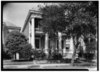 |
May 10, 1996 ( #96000539) |
Roughly bounded by Ave. K, 23rd St., Ave. P, and 26th St. 29°17′42″N 94°47′30″W / 29.295°N 94.791667°W | Galveston | Includes Recorded Texas Historic Landmarks |
| 65 | Ashbel Smith Building |  |
October 28, 1969 ( #69000203) |
914–916 Ave. B 29°18′48″N 94°46′44″W / 29.313333°N 94.778889°W | Galveston | State Antiquities Landmark, Recorded Texas Historic Landmark |
| 66 | SS SELMA (steamship) |  |
January 5, 1994 ( #93001449) |
Within the channel between Galveston and Port Bolivar 29°20′39″N 94°47′11″W / 29.344276°N 94.786407°W | Galveston | |
| 67 | St. Joseph's Church |  |
December 12, 1976 ( #76002032) |
2202 Ave. K 29°17′57″N 94°47′26″W / 29.299167°N 94.790556°W | Galveston | Recorded Texas Historic Landmark |
| 68 | St. Mary's Cathedral |  |
June 4, 1973 ( #73001964) |
2011 Church Ave. 29°18′14″N 94°47′24″W / 29.303889°N 94.79°W | Galveston | Recorded Texas Historic Landmark |
| 69 | Star Drug Store |  |
August 14, 1984 ( #84001731) |
510 23rd St. 29°18′14″N 94°47′35″W / 29.303889°N 94.793056°W | Galveston | Historic Resources of the Galveston Central Business District MRA |
| 70 | Steffens-Drewa House Complex |  |
December 1, 1988 ( #88002671) |
2701, 2705, and 2709 Ave. O 29°17′32″N 94°47′40″W / 29.292222°N 94.794444°W | Galveston | |
| 71 | The Strand Historic District | .jpg) |
January 26, 1970 ( #70000748) |
Roughly bounded by Ave. A, 20th St., alley between Aves. C and D, and railroad depot 29°18′23″N 94°47′37″W / 29.306389°N 94.793611°W | Galveston | Includes Recorded Texas Historic Landmarks |
| 72 | Stringfellow Orchards |  |
February 27, 2013 ( #13000043) |
7902 TX 6 29°21′00″N 95°01′01″W / 29.35011°N 95.01708°W | Hitchcock | |
| 73 | Sweeney-Royston House |  |
September 1, 1978 ( #78002931) |
2402 Ave. L 29°17′52″N 94°47′32″W / 29.297778°N 94.792222°W | Galveston | Recorded Texas Historic Landmark; part of Silk Stocking Residential Historic District |
| 74 | Texas Building |  |
August 14, 1984 ( #84001734) |
2200 Central Plaza 29°18′18″N 94°47′33″W / 29.305032°N 94.792604°W | Galveston | Historic Resources of the Galveston Central Business District MRA |
| 75 | Texas Heroes Monument | .jpg) |
August 14, 1984 ( #84001737) |
25th and Broadway 29°17′57″N 94°47′39″W / 29.299167°N 94.794167°W | Galveston | Historic Resources of the Galveston Central Business District MRA |
| 76 | Trinity Protestant Episcopal Church |  |
September 4, 1979 ( #79002946) |
22nd St. and Ave. G 29°18′08″N 94°47′31″W / 29.302222°N 94.791944°W | Galveston | Includes Recorded Texas Historic Landmarks |
| 77 | Trueheart-Adriance Building |  |
July 14, 1971 ( #71000933) |
212 22nd St. 29°18′24″N 94°47′33″W / 29.306667°N 94.7925°W | Galveston | Recorded Texas Historic Landmark; part of The Strand Historic District |
| 78 | U.S. National Bank |  |
August 14, 1984 ( #84001739) |
2201 Ave. D 29°18′19″N 94°47′34″W / 29.305278°N 94.792778°W | Galveston | Historic Resources of the Galveston Central Business District MRA |
| 79 | USS CAVALLA (submarine) |  |
May 27, 2008 ( #08000477) |
East End of Seawolf Park 29°20′09″N 94°46′46″W / 29.335833°N 94.779444°W | Galveston | |
| 80 | USS HATTERAS (41GV68) |  |
January 28, 1977 ( #77001567) |
Address restricted
[5] | Galveston | Sunk 20 miles (32 km) off the Galveston coast during the Civil War. |
| 81 | USS STEWART | _underway_at_sea,_circa_in_1943_(NH_108845).jpg) |
July 12, 2007 ( #07000689) |
East End of Seawolf Park 29°20′09″N 94°46′46″W / 29.335833°N 94.779444°W | Galveston | |
| 82 | Samuel May Williams House |  |
July 14, 1971 ( #71000934) |
3601 Ave. P 29°17′16″N 94°48′15″W / 29.287778°N 94.804167°W | Galveston | Recorded Texas Historic Landmark |
| 83 | Willis-Moody Mansion |  |
May 13, 1994 ( #94000410) |
2618 Broadway 29°17′57″N 94°47′46″W / 29.299167°N 94.796111°W | Galveston | Recorded Texas Historic Landmark |
Liberty County


Matagorda County
| [3] | Name on the Register [6] | Image | Date listed [4] | Location | City or town | Description |
|---|---|---|---|---|---|---|
| 1 | Bay City Post Office |  |
May 12, 2009 ( #09000307) |
2100 Ave. F 28°58′59″N 95°58′12″W / 28.982953°N 95.970053°W | Bay City | |
| 2 | Bay City USO Building |  |
June 14, 2006 ( #06000512) |
2105 Ave. M 28°59′04″N 95°57′44″W / 28.984444°N 95.962222°W | Bay City | Recorded Texas Historic Landmark |
| 3 | Blessing Masonic Lodge No. 411 | .jpg) |
February 4, 2011 ( #10001222) |
619 Ave B, FM 616 28°52′34″N 96°13′08″W / 28.876111°N 96.218958°W | Blessing | Recorded Texas Historic Landmark |
| 4 | Christ Episcopal Church |  |
April 10, 2012 ( #12000196) |
206 Cypress Street 28°41′33″N 95°58′03″W / 28.69238°N 95.96738°W | Matagorda | Recorded Texas Historic Landmark |
| 5 | Hensley-Gusman House |  |
October 4, 2006 ( #06000927) |
2120 Sixth St. 28°58′56″N 95°57′52″W / 28.982222°N 95.964444°W | Bay City | Recorded Texas Historic Landmark |
| 6 | R. J. Hill Building |  |
October 14, 2009 ( #09000840) |
401 Commerce St. 28°42′01″N 96°12′54″W / 28.700369°N 96.2151°W | Palacios | Recorded Texas Historic Landmark |
| 7 | Judge William Shields Holman House |  |
February 4, 2011 ( #10001223) |
2504 Avenue K 28°58′43″N 95°57′51″W / 28.978611°N 95.964167°W | Bay City | Recorded Texas Historic Landmark; part of South Side Residential Historic District |
| 8 | Hotel Blessing | .jpg) |
February 1, 1979 ( #79002993) |
Ave. B 28°52′17″N 96°13′19″W / 28.871389°N 96.221944°W | Blessing | Recorded Texas Historic Landmark |
| 9 | Luther Hotel |  |
May 10, 2010 ( #10000251) |
408 S Bay Blvd. 28°41′58″N 96°12′57″W / 28.699444°N 96.215833°W | Palacios | Recorded Texas Historic Landmark |
| 10 | Matagorda Cemetery |  |
June 15, 2006 ( #06000511) |
Jct. of TX 60 at Matagorda Cty Rds 259 and 260 28°42′10″N 95°57′20″W / 28.702778°N 95.955556°W | Matagorda | |
| 11 | Matagorda County Monument |  |
April 19, 2018 ( #100002351) |
1700 7th St. 28°58′58″N 95°58′11″W / 28.982859°N 95.969634°W | Bay City | |
| 12 | Price-Farwell House |  |
October 14, 2009 ( #09000841) |
308 S. Bay Blvd. 28°41′55″N 96°12′50″W / 28.698625°N 96.213969°W | Palacios | Recorded Texas Historic Landmark |
| 13 | South Side Residential Historic District |  |
May 30, 2007 ( #07000496) |
Roughly bounded by Ave. F, 2nd St., Ave. G, Ave. K, 4th St., Ave J, 5th St., 4th St. 28°48′57″N 95°57′59″W / 28.815833°N 95.966389°W | Bay City | Includes Recorded Texas Historic Landmark |
Montgomery County
| [3] | Name on the Register | Image | Date listed [4] | Location | City or town | Description |
|---|---|---|---|---|---|---|
| 1 | Kirbee Kiln Site | August 28, 1973 ( #73001970) |
Address Restricted | Montgomery | Manufacturing Site of mid-19th-century Texas stoneware pottery. 41MQ38 | |
| 2 | Montgomery County Hospital | April 12, 2024 ( #100010230) |
301 S. 1st Street 30°18′29″N 95°27′10″W / 30.3080°N 95.4528°W | Montgomery |
Walker County
| [3] | Name on the Register | Image | Date listed [4] | Location | City or town | Description |
|---|---|---|---|---|---|---|
| 1 | Austin Hall |  |
January 2, 2013 ( #12001134) |
1741 University Ave. 30°42′56″N 95°33′00″W / 30.71556°N 95.55006°W | Huntsville | State Antiquities Landmark, Recorded Texas Historic Landmark; on the campus of Sam Houston State University |
| 2 | Josey Boy Scout Lodge and Keeper's Cabin |  |
July 23, 2018 ( #100002700) |
2201 Ave. M 30°42′33″N 95°33′07″W / 30.709240°N 95.551859°W | Huntsville | |
| 3 | Sam Houston House | _in_Huntsville,_Texas.JPG) |
May 30, 1974 ( #74002097) |
Ave. L, Sam Houston State University 30°42′53″N 95°33′10″W / 30.714722°N 95.552778°W | Huntsville | State Antiquities Landmark, includes additional State Antiquities Landmark and Recorded Texas Historic Landmarks; also known as Woodland |
| 4 | Riverside Swinging Bridge |  |
September 12, 1979 ( #79003020) |
NE of Riverside 30°51′26″N 95°23′46″W / 30.857222°N 95.396111°W | Riverside | Extends into Trinity County |
| 5 | State Highway 19 Bridge at Trinity River |  |
December 1, 2004 ( #04001290) |
TX 19, on the Trinity/Walker county line 30°51′35″N 95°23′55″W / 30.859722°N 95.398611°W | Riverside | Historic Bridges of Texas, 1866-1945 MPS, extends into Trinity County |
| 6 | John W. Thomason House |  |
August 11, 1982 ( #82004528) |
1207 Ave. J 30°43′21″N 95°32′54″W / 30.7225°N 95.548333°W | Huntsville | [1] The Thomason House is the birthplace and home of noted Texas author and illustrator John William Thomason, Jr. He was commissioned a second lieutenant i n the Marine Corps and was assigned to the Pacific Fleet during World War II . All of the books and short stories Thomason wrote were illustrated with pen and ink sketches and dealt with Texas, theMarines, and his experiences i n the service. Several of his short stories frequently appeared in the Saturday Evening Post. Thomason wrote and illustrate d for Charles Scribner and Sons Publishers, producing such masterpieces as J. E. B. Stuart (1933) and Fix Bayonets (1926). Some of his other noted works include Marines and Others (1929) Salt Winds and Gold Dust (1934) and Lone Star Preacher (1941). California on March 12, 1944. |
Waller County
| [3] | Name on the Register | Image | Date listed [4] | Location | City or town | Description |
|---|---|---|---|---|---|---|
| 1 | L.C. Anderson Hall |  |
June 3, 1999 ( #99000611) |
L.W. Minor St., building #0541 30°05′38″N 95°59′26″W / 30.093889°N 95.990625°W | Prairie View | Prairie View A&M University MPS |
| 2 | W.R. Banks Library |  |
June 3, 1999 ( #99000612) |
L.W. Minor St., building #0508 30°05′36″N 95°59′21″W / 30.093403°N 95.989236°W | Prairie View | Prairie View A&M University MPS |
| 3 | Annie Laurie Evans Hall |  |
June 3, 1999 ( #99000613) |
L.W. Minor St., building #0544 30°05′37″N 95°59′25″W / 30.093542°N 95.990208°W | Prairie View | Prairie View A&M University MPS |
| 4 | Hilliard Hall | June 3, 1999 ( #99000614) |
A.G. Cleaver St., building #0537 30°05′42″N 95°58′48″W / 30.095117°N 95.980103°W | Prairie View | Prairie View A&M University MPS | |
| 5 | Liendo Plantation | .jpg) |
June 21, 1971 ( #71000970) |
2 mi (3.2 km). NE of Hempstead off FM 1488 30°05′47″N 96°01′47″W / 30.096389°N 96.029722°W | Hempstead | Recorded Texas Historic Landmark |
| 6 | Veterinary Hospital |  |
June 3, 1999 ( #99000617) |
E.M. Norris St., building #0517 30°05′37″N 95°59′03″W / 30.0935°N 95.9841°W | Prairie View | Prairie View A&M University MPS |
| 7 | G.R. Woolfolk Social and Political Science Building |  |
June 3, 1999 ( #99000616) |
A.G. Cleaver St., building #0503 30°05′41″N 95°59′20″W / 30.094722°N 95.988958°W | Prairie View | Prairie View A&M University MPS |
Wharton County
| [3] | Name on the Register [6] | Image | Date listed [4] | Location | City or town | Description |
|---|---|---|---|---|---|---|
| 1 | Stephen F. Austin Elementary School | February 1, 2022 ( #100007404) |
500 Abell St. 29°18′46″N 96°05′32″W / 29.3128°N 96.0922°W | Wharton | ||
| 2 | Willie Banker Jr. House |  |
March 18, 1993 ( #93000118) |
401 N. Rusk 29°18′49″N 96°05′52″W / 29.31372°N 96.09783°W | Wharton | |
| 3 | Moses Bernstein House | March 18, 1993 ( #93000116) |
1705 N. Richmond 29°19′35″N 96°05′51″W / 29.326310°N 96.097411°W | Wharton | Historic and Architectural Resources of Wharton MPS | |
| 4 | Bolton-Outlar House |  |
March 18, 1993 ( #93000108) |
517 N. Richmond 29°18′57″N 96°06′05″W / 29.315778°N 96.101265°W | Wharton | Historic and Architectural Resources of Wharton MPS |
| 5 | Colorado River Bridge |  |
March 18, 1993 ( #93000117) |
S. Richmond Rd. (Old US 59) across the Colorado R. 29°18′30″N 96°06′13″W / 29.308333°N 96.103611°W | Wharton | Historic and Architectural Resources of Wharton MPS |
| 6 | Wiley J. Croom House |  |
March 18, 1993 ( #93000099) |
205 E. Milam 29°18′38″N 96°05′55″W / 29.31067°N 96.0987232°W | Wharton | Historic and Architectural Resources of Wharton MPS |
| 7 | F. F. Dannon House | March 18, 1993 ( #93000095) |
612 W. Caney 29°18′49″N 96°06′19″W / 29.313652°N 96.105228°W | Wharton | Historic and Architectural Resources of Wharton MPS | |
| 8 | Dr. Green Davidson House |  |
March 18, 1993 ( #93000111) |
404 Bolton 29°18′56″N 96°06′07″W / 29.315528°N 96.102028°W | Wharton | Historic and Architectural Resources of Wharton MPS |
| 9 | Ben and Mary Davis House |  |
March 18, 1993 ( #93000104) |
100 S. Resident 29°18′37″N 96°05′54″W / 29.31015°N 96.09823°W | Wharton | Historic and Architectural Resources of Wharton MPS |
| 10 | Nettie Elkins House |  |
March 18, 1993 ( #93000114) |
109 E. Alabama 29°18′50″N 96°05′54″W / 29.313833°N 96.09831°W | Wharton | Historic and Architectural Resources of Wharton MPS |
| 11 | E. Clyde and Mary Elliott House |  |
March 18, 1993 ( #93000122) |
707 N. Walnut 29°18′57″N 96°05′37″W / 29.315827°N 96.093736°W | Wharton | Historic and Architectural Resources of Wharton MPS |
| 12 | Old First Methodist Episcopal Church South |  |
March 18, 1993 ( #93000097) |
200 N. Fulton 29°18′46″N 96°05′56″W / 29.312814°N 96.099025°W | Wharton | Historic and Architectural Resources of Wharton MPS |
| 13 | Henry B. Garrett House |  |
March 18, 1993 ( #93000098) |
504 N. Fulton 29°18′56″N 96°05′46″W / 29.315588°N 96.096045°W | Wharton | Historic and Architectural Resources of Wharton MPS |
| 14 | John A. and Sophie Garrett House |  |
March 18, 1993 ( #93000115) |
401 E. Alabama 29°18′47″N 96°05′44″W / 29.313023°N 96.095449°W | Wharton | Historic and Architectural Resources of Wharton MPS |
| 15 | George C. and Annie Gifford House |  |
March 18, 1993 ( #93000096) |
615 W. Caney 29°18′47″N 96°06′20″W / 29.313165°N 96.105469°W | Wharton | Historic and Architectural Resources of Wharton MPS |
| 16 | Joseph Andrew Hamilton House |  |
March 18, 1993 ( #93000106) |
325 N. Richmond 29°18′53″N 96°06′09″W / 29.314819°N 96.102451°W | Wharton | Recorded Texas Historic Landmark; Historic and Architectural Resources of Wharton MPS |
| 17 | Gerard A. Harrison House |  |
March 18, 1993 ( #93000112) |
209 E. Caney 29°18′42″N 96°05′53″W / 29.311564°N 96.098016°W | Wharton | Historic and Architectural Resources of Wharton MPS |
| 18 | Harrison-Dennis House |  |
March 18, 1993 ( #93000110) |
409 W. Burleson 29°18′38″N 96°06′13″W / 29.310556°N 96.103611°W | Wharton | Historic and Architectural Resources of Wharton MPS |
| 19 | Edwin Hawes House |  |
March 18, 1993 ( #93000102) |
309 N. Resident 29°18′45″N 96°05′50″W / 29.312602°N 96.0973°W | Wharton | Recorded Texas Historic Landmark |
| 20 | Edwin Hawes Jr. House | March 18, 1993 ( #93000105) |
119 S. Resident 29°18′34″N 96°05′51″W / 29.309444°N 96.0975°W | Wharton | Historic and Architectural Resources of Wharton MPS; demolished | |
| 21 | House at 401 North Richmond |  |
March 18, 1993 ( #93000107) |
401 N. Richmond 29°18′54″N 96°06′08″W / 29.315127°N 96.102120°W | Wharton | Historic and Architectural Resources of Wharton MPS |
| 22 | House at 512 North Resident |  |
March 18, 1993 ( #93000103) |
512 N. Resident 29°18′54″N 96°05′43″W / 29.315°N 96.095278°W | Wharton | Historic and Architectural Resources of Wharton MPS |
| 23 | Linn Street Historic District |  |
March 18, 1993 ( #93000124) |
Roughly, the 500 blocks of Richmond Rd. and Houston St. and the 100-200 blocks of Linn St. 29°18′56″N 96°05′59″W / 29.315556°N 96.099722°W | Wharton | Historic and Architectural Resources of Wharton MPS |
| 24 | Merrell-Roten House |  |
March 18, 1993 ( #93000113) |
520 Ave. A 29°18′56″N 96°05′34″W / 29.315494°N 96.092711°W | Wharton | Historic and Architectural Resources of Wharton MPS |
| 25 | Moran-Moore House |  |
March 18, 1993 ( #93000120) |
501 N. Walnut 29°18′51″N 96°05′40″W / 29.314037°N 96.094410°W | Wharton | Historic and Architectural Resources of Wharton MPS |
| 26 | J. H. Speaker House |  |
March 18, 1993 ( #93000109) |
414 E. Alabama 29°18′45″N 96°05′42″W / 29.312404°N 96.095117°W | Wharton | Historic and Architectural Resources of Wharton MPS |
| 27 | St. John's Evangelical Lutheran Church |  |
March 18, 1993 ( #93000100) |
612 N. Pecan 29°18′55″N 96°05′40″W / 29.315284°N 96.094576°W | Wharton | Historic and Architectural Resources of Wharton MPS |
| 28 | Texas and New Orleans Railroad Bridge |  |
March 18, 1993 ( #93000123) |
Southern Pacific RR tracks, 0.25 mi (0.40 km). W of Old US 59, over the Colorado R. 29°18′26″N 96°06′23″W / 29.307222°N 96.106389°W | Wharton | Historic and Architectural Resources of Wharton MPS |
| 29 | Texas and New Orleans Railroad Depot |  |
March 18, 1993 ( #93000119) |
100 block of N. Sunset 29°18′49″N 96°06′23″W / 29.31364°N 96.10638°W | Wharton | Historic and Architectural Resources of Wharton MPS |
| 30 | West Milam Street Mercantile Historic District |  |
March 18, 1993 ( #93000125) |
Roughly 637-668 W. Milam St. 29°18′46″N 96°06′23″W / 29.312833°N 96.106368°W | Wharton | Historic and Architectural Resources of Wharton MPS |
| 31 | Wharton County Courthouse Historic Commercial District |  |
November 5, 1991 ( #91001624) |
Roughly bounded by the alley N of Milam St., Rusk St., Elm St. and Richmond St. 29°18′38″N 96°06′03″W / 29.31055°N 96.10083°W | Wharton | Includes State Antiquities Landmarks, Recorded Texas Historic Landmark |
| 32 | Louis F. Worthing House |  |
March 18, 1993 ( #93000121) |
620 N. Walnut 29°18′55″N 96°05′36″W / 29.315147°N 96.093348°W | Wharton | Historic and Architectural Resources of Wharton MPS |
References
- ^ "The Gulf Coast Region 2022 Regional Report". Texas Comptroller of Public Accounts. Retrieved April 3, 2023.
- ^ National Park Service, United States Department of the Interior, "National Register of Historic Places: Weekly List Actions", retrieved May 24, 2024.
- ^ a b c d e f g h i j k l Numbers represent an alphabetical ordering by significant words. Various colorings, defined here, differentiate National Historic Landmarks and historic districts from other NRHP buildings, structures, sites or objects.
- ^ a b c d e f g h i j k l The eight-digit number below each date is the number assigned to each location in the National Register Information System database, which can be viewed by clicking the number.
- ^ a b c d e f g h Federal and state laws and practices restrict general public access to information regarding the specific location of this resource. In some cases, this is to protect archeological sites from vandalism, while in other cases it is restricted at the request of the owner. See: Knoerl, John; Miller, Diane; Shrimpton, Rebecca H. (1990), Guidelines for Restricting Information about Historic and Prehistoric Resources, National Register Bulletin, National Park Service, U.S. Department of the Interior, OCLC 20706997.
- ^ a b c d "National Register Information System". National Register of Historic Places. National Park Service. July 9, 2010.
- ^ Address based on USPS website and United States District & Bankruptcy Court website. Accessed April 10, 2016.
This page is one of two listing the National Register of Historic Places listings in Texas' Gulf Coast.
The Gulf Coast region is an area of 13 counties defined by the Texas Comptroller for economic reporting, as mapped here. It includes the city of Houston and all of the Texas Panhandle by most definitions of that term. The region included 2020 population of about 7.3 million, or 25 percent of Texas' population, with Harris County having 65 percent of that, and Houston alone having about 32 percent of that. [1]
This page includes all of the Gulf Coast region besides Harris County (Houston plus); for the latter please see that
This
National Park Service list is complete through
NPS recent listings posted May 24, 2024.
[2]
To see all locations together in a map, click on "Map all coordinates using OpenSourceMap" at right.
Austin County
(not to be confused with the City of Austin, in Travis County)
Brazoria County
| [3] | Name on the Register [6] | Image | Date listed [4] | Location | City or town | Description |
|---|---|---|---|---|---|---|
| 1 | Alvin Gulf, Colorado and Santa Fe Railway Passenger Depot | |
March 6, 2019 ( #100003467) |
200 Depot Centre Blvd. 29°25′29″N 95°14′35″W / 29.424584°N 95.243150°W | Alvin | |
| 2 | Brazoria Bridge | |
June 14, 1991 ( #91000783) |
0.9 mi. E of
TX 36 on
TX 332 29°03′15″N 95°33′25″W / 29.054167°N 95.556944°W | Brazoria | Recorded Texas Historic Landmark |
| 3 | Alden B. Dow Office and Lake Jackson City Hall | |
March 1, 2010 ( #10000050) |
101 S. Parking Place 29°02′26″N 95°26′55″W / 29.04069°N 95.44856°W | Lake Jackson | |
| 4 | Durazno Plantation | |
September 2, 1980 ( #80004081) |
S of Jones Creek off TX 36 28°57′22″N 95°26′57″W / 28.956111°N 95.449167°W | Jones Creek | |
| 5 | East Columbia Historic District | |
October 28, 1991 ( #91001602) |
S. Main St. 29°08′31″N 95°36′54″W / 29.141944°N 95.615°W | East Columbia | Includes Recorded Texas Historic Landmarks |
| 6 | Gazebo for James Richard Marmion | |
October 22, 2004 ( #04001173) |
1214 County Rd. 29°02′34″N 95°38′40″W / 29.042778°N 95.644444°W | Sweeny | Sculpture by Dionicio Rodriguez |
| 7 | GEN. C. B. COMSTOCK (dredge) Shipwreck Site | |
July 6, 1995 ( #94001119) |
Address restricted
[5] | Surfside Beach | |
| 8 | John McCroskey Log House | |
August 28, 1975 ( #75001958) |
2 mi. NE of Cedar Lake on Stringfellow Ranch 28°56′22″N 95°36′54″W / 28.939444°N 95.615°W | Cedar Lake | |
| 9 | Old Brazoria County Courthouse | |
March 12, 1979 ( #79002922) |
Public Sq. 29°10′08″N 95°25′52″W / 29.168889°N 95.431111°W | Angleton | State Antiquities Landmark, Recorded Texas Historic Landmark |
| 10 | Palapa Table for James Richard Marmion | |
October 22, 2004 ( #04001172) |
1214 County Rd. 29°02′38″N 95°38′51″W / 29.043889°N 95.6475°W | Sweeny | Sculpture by Dionicio Rodriguez |
| 11 | Henry Smith Statue | |
October 19, 2018 ( #100003040) |
Intersection of N Brooks & W Smith Sts. 29°02′49″N 95°34′14″W / 29.047071°N 95.570426°W | Brazoria | In honor of Henry Smith (Texas governor) who lived in Brazoria for a while. Recorded Texas Historic Landmark |
| 12 | Ammon Underwood House | |
June 24, 1976 ( #76002011) |
505 Main St. 29°08′25″N 95°37′02″W / 29.140278°N 95.617222°W | East Columbia | Recorded Texas Historic Landmark; relocated in 2005 due to river encroachment |
| 13 | Varner-Hogg Plantation | |
April 9, 1980 ( #80004082) |
2 mi. NE of West Columbia off
FM 2852 29°09′47″N 95°38′25″W / 29.163056°N 95.640278°W | West Columbia | State Historic Site, State Antiquities Landmark, Recorded Texas Historic Landmark |
Chambers County
| [3] | Name on the Register | Image | Date listed [4] | Location | City or town | Description |
|---|---|---|---|---|---|---|
| 1 | Archeological Site 41 CH 110 | |
July 14, 1971 ( #71000924) |
Address restricted
[5] | Cove | |
| 2 | Chambers County Courthouse | |
April 25, 2008 ( #08000339) |
404 Washington St., 29°46′09″N 94°41′05″W / 29.769167°N 94.684722°W | Anahuac | |
| 3 | Chambersea | |
November 19, 1979 ( #79002925) |
Washington and Cummings Sts 29°46′15″N 94°41′05″W / 29.770833°N 94.684722°W | Anahuac | State Antiquities Landmark, Recorded Texas Historic Landmark; General Thomas Jefferson Chambers House |
| 4 | Fort Anahuac | |
July 1, 1981 ( #81000626) |
Corner of Main St. and Chambers 29°45′24″N 94°41′17″W / 29.756667°N 94.688056°W | Anahuac | State Antiquities Landmark |
| 5 | Old Wallisville Town Site | |
March 30, 1982 ( #82004495) |
Address restricted
[5] | Wallisville | |
| 6 | Orcoquisac Archeological District | |
July 14, 1971 ( #71000925) |
Address restricted
[5] | Wallisville |
Colorado County
| [3] | Name on the Register | Image | Date listed [4] | Location | City or town | Description |
|---|---|---|---|---|---|---|
| 1 | Colorado County Courthouse | |
July 12, 1976 ( #76002015) |
Bounded by Milam, Spring, Travis and Walnut Sts. 29°42′21″N 96°32′23″W / 29.705833°N 96.539722°W | Columbus | State Antiquities Landmark, Recorded Texas Historic Landmark; part of Colorado County Courthouse Historic District; Neoclassical building erected in 1890-1891 in the form of a Greek cross |
| 2 | Colorado County Courthouse Historic District | |
June 23, 1978 ( #78002907) |
Roughly bounded by Preston, Walnut, Milam, Front, Washington, and Live Oak Sts. 29°42′22″N 96°32′26″W / 29.706111°N 96.540556°W | Columbus | Includes State Antiquities Landmark, several Recorded Texas Historic Landmarks |
| 3 | Eagle Lake Commercial Historic District | |
June 5, 2007 ( #07000494) |
100-416 E. Main St., 101-108 W. Main St., 101-124 Commerce St., 101-201 N. McCarty Ave., and 100-203 E. Post Office St. 29°35′21″N 96°20′02″W / 29.589167°N 96.333889°W | Eagle Lake | |
| 4 | Harrison-Hastedt House | |
March 22, 2004 ( #04000231) |
236 Preston St. 29°42′32″N 96°32′16″W / 29.708889°N 96.537778°W | Columbus | Recorded Texas Historic Landmark |
| 5 | Old Spanish Trail from US 90 to I-10 | |
April 16, 2013 ( #13000176) |
County Road 268 between
U.S. Route 90 and a northern access road for
I-10 29°42′23″N 96°31′27″W / 29.7065°N 96.5243°W | Columbus | |
| 6 | Stafford Bank and Opera House | |
May 8, 1973 ( #73002276) |
Milan and Spring Sts. 29°42′19″N 96°32′25″W / 29.705278°N 96.540278°W | Columbus | Recorded Texas Historic Landmark; part of Colorado County Courthouse Historic District; Second Empire style building completed in 1886. |
| 7 | State Highway 3 Bridge at the Colorado River | |
October 10, 1996 ( #96001111) |
U.S. Route 90, 0.6 miles east of its junction with Loop 329 29°42′23″N 96°32′11″W / 29.706389°N 96.536389°W | Columbus | Three-span Parker through truss bridge built in 1932. |
Fort Bend County
Galveston County
| [3] | Name on the Register [6] | Image | Date listed [4] | Location | City or town | Description |
|---|---|---|---|---|---|---|
| 1 | American National Insurance Company (ANICO) | |
May 20, 2021 ( #100006539) |
1 Moody Ave. (1902 Market St.) 29°18′24″N 94°47′24″W / 29.3068°N 94.7900°W | Galveston | AKA One Moody Plaza. |
| 2 | Ashton Villa | |
October 28, 1969 ( #69000204) |
2328 Broadway 29°17′59″N 94°47′33″W / 29.2997°N 94.7925°W | Galveston | Recorded Texas Historic Landmark |
| 3 | Bayou Brae Historic District | May 24, 2021 ( #100006547) |
All properties on Bayou Dr., Brae Ln., Coryell St., Oboe Trail, Woodwind Way, and Viola Dr. 29°31′36″N 95°04′35″W / 29.5267°N 95.0764°W | League City | ||
| 4 | Henry Beissner House | |
April 3, 1978 ( #78002929) |
2818 Ball Ave. 29°18′01″N 94°47′56″W / 29.3003°N 94.7989°W | Galveston | |
| 5 | Bishop's Palace | |
August 25, 1970 ( #70000746) |
1402 Ave. J (Broadway) 29°18′17″N 94°46′55″W / 29.3047°N 94.7819°W | Galveston | Recorded Texas Historic Landmark, part of East End Historic District |
| 6 | Broadway Cemetery Historic District | |
June 13, 2014 ( #14000340) |
6 blocks between Broadway Ave., Ave. L, 43rd & 40th Sts. 29°17′37″N 94°48′46″W / 29.2935°N 94.8129°W | Galveston | |
| 7 | Building at 1921–1921 1/2 Avenue D | |
August 14, 1984 ( #84001671) |
1921–1921 1/2 Ave. D 29°18′21″N 94°47′23″W / 29.3058°N 94.7897°W | Galveston | Historic Resources of the Galveston Central Business District MRA |
| 8 | Building at 1925–1927 Market Street | |
August 14, 1984 ( #84001668) |
1925–1927 Market St. 29°18′25″N 94°47′29″W / 29.3069°N 94.7914°W | Galveston | Historic Resources of the Galveston Central Business District MRA |
| 9 | Cedar Lawn Historic District | |
December 20, 2002 ( #02001570) |
Bounded by 45th. St., 48th St., Ave. L, and Ave. N, 29°17′23″N 94°49′04″W / 29.2897°N 94.8178°W | Galveston | |
| 10 | City Hall | |
August 14, 1984 ( #84001676) |
823 25th St. 29°18′01″N 94°47′43″W / 29.3003°N 94.7953°W | Galveston | Historic Resources of the Galveston Central Business District MRA |
| 11 | City National Bank | |
August 14, 1984 ( #84001680) |
2219 Market St 29°18′20″N 94°47′36″W / 29.3055°N 94.7933°W | Galveston | Historic Resources of the Galveston Central Business District MRA |
| 12 | Congregation Beth Jacob | |
January 4, 2024 ( #100009737) |
2401 Avenue K 29°17′55″N 94°47′34″W / 29.2986°N 94.7929°W | Galveston | |
| 13 | Frank B. Davison House | |
June 29, 1976 ( #76002033) |
109 3rd Ave. 29°23′13″N 94°53′42″W / 29.3869°N 94.895°W | Texas City | State Antiquities Landmark, Recorded Texas Historic Landmark |
| 14 | Denver Court Historic District | |
January 14, 2002 ( #01001471) |
Roughly bounded by Aves. S1/2 and U1/2, 43rd and 52nd Sts. 29°16′39″N 94°48′54″W / 29.2775°N 94.815°W | Galveston | |
| 15 | East End Historic District | |
May 30, 1975 ( #75001979) |
Irregular pattern including both sides of Broadway and Market Sts. 29°18′16″N 94°46′58″W / 29.3044°N 94.7828°W | Galveston | Includes Recorded Texas Historic Landmarks |
| 16 | Eiband's | |
August 14, 1984 ( #84001683) |
2001 Central Plaza 29°18′16″N 94°47′32″W / 29.3044°N 94.7922°W | Galveston | Historic Resources of the Galveston Central Business District MRA |
| 17 | ELISSA | |
March 21, 1978 ( #78002930) |
Pier 21, 21st Street and Harborside Drive 29°18′34″N 94°47′37″W / 29.30946667°N 94.7936°W | Galveston | |
| 18 | Falstaff Brewery | |
August 29, 2018 ( #100002841) |
3302 Church St. (Ave. F) 29°18′03″N 94°48′22″W / 29.3007°N 94.8061°W | Galveston | This structure is currently abandoned |
| 19 | First Evangelical Lutheran Church | |
August 14, 1984 ( #84001688) |
2401 Ave. G 29°18′09″N 94°47′39″W / 29.3025°N 94.7942°W | Galveston | Recorded Texas Historic Landmark; Historic Resources of the Galveston Central Business District MRA |
| 20 | First Presbyterian Church | |
January 29, 1979 ( #79002942) |
1903 Church St. 29°18′15″N 94°47′19″W / 29.3042°N 94.7886°W | Galveston | Recorded Texas Historic Landmark |
| 21 | Fort Travis | |
March 30, 2005 ( #05000247) |
TX 87 at Loop 108 29°21′53″N 94°45′29″W / 29.3647°N 94.7581°W | Port Bolivar | State Antiquities Landmark |
| 22 | Galveston Causeway | |
December 12, 1976 ( #76002028) |
Spans Galveston Bay from Virginia Point to Galveston Island 29°17′51″N 94°53′12″W / 29.2975°N 94.8867°W | Galveston | State Antiquities Landmark |
| 23 | Galveston, Houston & Henderson (GH&H) Freight Depot | |
January 10, 2020 ( #100004866) |
325 33rd St. 29°18′09″N 94°48′20″W / 29.3025°N 94.8055°W | Galveston | |
| 24 | Galveston Orphans Home | |
March 21, 1979 ( #79002943) |
1315 21st St. 29°17′50″N 94°47′19″W / 29.297222°N 94.788611°W | Galveston | Recorded Texas Historic Landmark |
| 25 | Galveston Seawall | |
August 18, 1977 ( #77001443) |
Seawall Blvd. 29°18′09″N 94°46′27″W / 29.3025°N 94.774167°W | Galveston | State Antiquities Landmark |
| 26 | Galveston US Post Office, Custom House and Courthouse | |
April 25, 2001 ( #01000438) |
601 25th St. (Rosenberg St.)
[7] 29°18′08″N 94°47′45″W / 29.302222°N 94.795833°W | Galveston | |
| 27 | Galvez Hotel | |
April 4, 1979 ( #79002944) |
2024 Seawall Blvd. 29°17′32″N 94°47′08″W / 29.292222°N 94.785556°W | Galveston | Recorded Texas Historic Landmark |
| 28 | Garten Verein Pavilion | |
July 20, 1977 ( #77001444) |
27th St. and Avenue O (Kempner Park) 29°17′34″N 94°47′41″W / 29.292778°N 94.794722°W | Galveston | State Antiquities Landmark, Recorded Texas Historic Landmark |
| 29 | Grace Episcopal Church | |
April 3, 1975 ( #75001980) |
1115 36th St. 29°17′39″N 94°48′23″W / 29.294167°N 94.806389°W | Galveston | Recorded Texas Historic Landmark |
| 30 | Grand Opera House | |
January 2, 1974 ( #74002071) |
2012–2020 Ave. E 29°17′47″N 94°47′26″W / 29.296389°N 94.790556°W | Galveston | Recorded Texas Historic Landmark |
| 31 | John Hagemann House | |
June 1, 1982 ( #82004505) |
3301 Ave. L 29°17′40″N 94°48′47″W / 29.294444°N 94.813056°W | Galveston | Recorded Texas Historic Landmark |
| 32 | House at 2017–2023 Avenue I | |
August 14, 1984 ( #84001698) |
2017–2023 Ave. I 29°18′05″N 94°47′07″W / 29.301389°N 94.785278°W | Galveston | Historic Resources of the Galveston Central Business District MRA |
| 33 | House at 2528 Postoffice St. | |
August 14, 1984 ( #84001700) |
2528 Postoffice St. 29°18′13″N 94°47′49″W / 29.303611°N 94.796944°W | Galveston | Historic Resources of the Galveston Central Business District MRA |
| 34 | Sealy Hutchings House | |
July 29, 1994 ( #94000796) |
2805 Ave. O 29°17′31″N 94°47′44″W / 29.291944°N 94.795556°W | Galveston | |
| 35 | I.O.O.F. Lodge | |
August 14, 1984 ( #84001703) |
505 20th St. 29°18′18″N 94°47′24″W / 29.305°N 94.79°W | Galveston | Historic Resources of the Galveston Central Business District MRA |
| 36 | Illies Building-Justine Apartments | |
August 22, 1995 ( #95001028) |
503 21st St. 29°17′49″N 94°46′56″W / 29.296944°N 94.782222°W | Galveston | Historic Resources of the Galveston Central Business District MRA |
| 37 | Daniel Webster Kempner House | |
March 30, 1979 ( #79002945) |
2504 Ave. O 29°17′35″N 94°47′34″W / 29.293056°N 94.792778°W | Galveston | Part of Silk Stocking Residential Historic District |
| 38 | Jean Lafitte Hotel | |
August 14, 1984 ( #84001705) |
2105 Ave. F 29°18′14″N 94°47′27″W / 29.303889°N 94.790833°W | Galveston | Historic Resources of the Galveston Central Business District MRA |
| 39 | Lasker Home for Homeless Children | |
April 14, 1983 ( #83003140) |
1019 16th St. 29°18′02″N 94°47′01″W / 29.300556°N 94.783611°W | Galveston | Recorded Texas Historic Landmark; part of Lost Bayou Historic District |
| 40 | E.S. Levy Building | |
November 13, 2003 ( #03001163) |
2221–2225 Market St. 29°18′17″N 94°47′36″W / 29.304722°N 94.793333°W | Galveston | Historic Resources of the Galveston Central Business District MRA |
| 41 | Lost Bayou Historic District | |
June 19, 2017 ( #100001224) |
Roughly bounded by Broadway, Ave. N, 14th & 21st Sts. 29°17′58″N 94°47′06″W / 29.299416°N 94.784990°W | Galveston | Includes Recorded Texas Historic Landmarks |
| 42 | Marschner Building | |
August 14, 1984 ( #84001706) |
1914–1916 Mechanic St. 29°18′26″N 94°47′23″W / 29.307222°N 94.789722°W | Galveston | Recorded Texas Historic Landmark; Historic Resources of the Galveston Central Business District MRA |
| 43 | McKinney-McDonald House | |
May 4, 1976 ( #76002030) |
926 Winnie St. 29°18′24″N 94°46′39″W / 29.306667°N 94.7775°W | Galveston | |
| 44 | Melrose Apartment Building | |
October 14, 1998 ( #98001246) |
2002 Post Office St. 29°18′19″N 94°47′26″W / 29.305278°N 94.790556°W | Galveston | Historic Resources of the Galveston Central Business District MRA |
| 45 | Michel B. Menard House | |
December 12, 1976 ( #76002031) |
1605 33rd St. 29°17′27″N 94°48′06″W / 29.290833°N 94.801667°W | Galveston | |
| 46 | Merimax Building | |
January 24, 1985 ( #85000121) |
521 22nd St. 29°18′15″N 94°47′32″W / 29.304124°N 94.792335°W | Galveston | Historic Resources of the Galveston Central Business District MRA |
| 47 | Model Laundry | |
August 14, 1984 ( #84001707) |
513–523 25th St. 29°18′10″N 94°47′45″W / 29.302778°N 94.795833°W | Galveston | Historic Resources of the Galveston Central Business District MRA |
| 48 | Col. Hugh B. and Helen Moore House | |
October 28, 1994 ( #94001241) |
8 Ninth Ave., N. 29°23′38″N 94°54′10″W / 29.393889°N 94.902778°W | Texas City | Recorded Texas Historic Landmark |
| 49 | Mosquito Fleet Berth, Pier 19 | |
April 21, 1975 ( #75001981) |
N end of 20th St., Pier 19 29°18′39″N 94°47′25″W / 29.310833°N 94.790278°W | Galveston | State Antiquities Landmark |
| 50 | Old Galveston Customhouse | |
August 25, 1970 ( #70000747) |
Southeast corner 20th and Post Office (Ave. E) Sts. 29°18′18″N 94°47′23″W / 29.305°N 94.789722°W | Galveston | |
| 51 | Parkland Apartments | January 7, 2022 ( #100007354) |
3916 Winnie St. (Ave. G) 29°17′52″N 94°48′43″W / 29.2979°N 94.8119°W | Galveston | ||
| 52 | Pix Building | |
August 14, 1984 ( #84001713) |
2128 Postoffice St. 29°18′18″N 94°47′32″W / 29.305°N 94.792222°W | Galveston | Historic Resources of the Galveston Central Business District MRA |
| 53 | Point Bolivar Lighthouse | |
August 18, 1977 ( #77001445) |
TX 87 29°22′00″N 94°46′00″W / 29.366667°N 94.766667°W | Port Bolivar | |
| 54 | Powhatan House | |
October 6, 1975 ( #75001982) |
3427 Ave. O 29°17′24″N 94°48′11″W / 29.29°N 94.803056°W | Galveston | Recorded Texas Historic Landmark |
| 55 | Quigg-Baulard House | |
September 17, 2015 ( #15000618) |
2628 Broadway 29°17′57″N 94°47′48″W / 29.299228°N 94.796545°W | Galveston | Recorded Texas Historic Landmark |
| 56 | Reedy Chapel-AME Church | |
September 14, 1984 ( #84001717) |
2013 Broadway 29°18′00″N 94°47′19″W / 29.3°N 94.788611°W | Galveston | Recorded Texas Historic Landmark |
| 57 | Robinson Building | |
August 14, 1984 ( #84001720) |
2009–2011 Postoffice St. 29°18′17″N 94°47′26″W / 29.304722°N 94.790556°W | Galveston | Historic Resources of the Galveston Central Business District MRA |
| 58 | Rosenberg Library | |
August 14, 1984 ( #84001722) |
2310 Sealy St. 29°18′03″N 94°47′34″W / 29.300833°N 94.792778°W | Galveston | Historic Resources of the Galveston Central Business District MRA |
| 59 | Rosewood Cemetery | February 9, 2024 ( #100009946) |
2825 63rd Street 29°16′24″N 94°49′56″W / 29.2734°N 94.8322°W | Galveston | ||
| 60 | Scottish Rite Cathedral | |
August 14, 1984 ( #84001724) |
2128 Church St. 29°18′14″N 94°47′30″W / 29.303889°N 94.791667°W | Galveston | Historic Resources of the Galveston Central Business District MRA |
| 61 | George Sealy House | |
October 28, 1969 ( #69000205) |
2424 Broadway 29°17′59″N 94°47′37″W / 29.299722°N 94.793611°W | Galveston | Recorded Texas Historic Landmark |
| 62 | The Settlement Historic District | |
May 17, 2010 ( #10000268) |
Centered on the intersection of N Bell Dr and the 100 block of S Bell Dr with cross-streets Carver Ave and Eunice St 29°22′58″N 94°58′38″W / 29.382778°N 94.977222°W | Texas City | |
| 63 | M. W. Shaw Building | |
August 14, 1984 ( #84001728) |
2427 Ave. D 29°18′16″N 94°47′45″W / 29.304444°N 94.795833°W | Galveston | Historic Resources of the Galveston Central Business District MRA |
| 64 | Silk Stocking Residential Historic District | |
May 10, 1996 ( #96000539) |
Roughly bounded by Ave. K, 23rd St., Ave. P, and 26th St. 29°17′42″N 94°47′30″W / 29.295°N 94.791667°W | Galveston | Includes Recorded Texas Historic Landmarks |
| 65 | Ashbel Smith Building | |
October 28, 1969 ( #69000203) |
914–916 Ave. B 29°18′48″N 94°46′44″W / 29.313333°N 94.778889°W | Galveston | State Antiquities Landmark, Recorded Texas Historic Landmark |
| 66 | SS SELMA (steamship) | |
January 5, 1994 ( #93001449) |
Within the channel between Galveston and Port Bolivar 29°20′39″N 94°47′11″W / 29.344276°N 94.786407°W | Galveston | |
| 67 | St. Joseph's Church | |
December 12, 1976 ( #76002032) |
2202 Ave. K 29°17′57″N 94°47′26″W / 29.299167°N 94.790556°W | Galveston | Recorded Texas Historic Landmark |
| 68 | St. Mary's Cathedral | |
June 4, 1973 ( #73001964) |
2011 Church Ave. 29°18′14″N 94°47′24″W / 29.303889°N 94.79°W | Galveston | Recorded Texas Historic Landmark |
| 69 | Star Drug Store | |
August 14, 1984 ( #84001731) |
510 23rd St. 29°18′14″N 94°47′35″W / 29.303889°N 94.793056°W | Galveston | Historic Resources of the Galveston Central Business District MRA |
| 70 | Steffens-Drewa House Complex | |
December 1, 1988 ( #88002671) |
2701, 2705, and 2709 Ave. O 29°17′32″N 94°47′40″W / 29.292222°N 94.794444°W | Galveston | |
| 71 | The Strand Historic District | |
January 26, 1970 ( #70000748) |
Roughly bounded by Ave. A, 20th St., alley between Aves. C and D, and railroad depot 29°18′23″N 94°47′37″W / 29.306389°N 94.793611°W | Galveston | Includes Recorded Texas Historic Landmarks |
| 72 | Stringfellow Orchards | |
February 27, 2013 ( #13000043) |
7902 TX 6 29°21′00″N 95°01′01″W / 29.35011°N 95.01708°W | Hitchcock | |
| 73 | Sweeney-Royston House | |
September 1, 1978 ( #78002931) |
2402 Ave. L 29°17′52″N 94°47′32″W / 29.297778°N 94.792222°W | Galveston | Recorded Texas Historic Landmark; part of Silk Stocking Residential Historic District |
| 74 | Texas Building | |
August 14, 1984 ( #84001734) |
2200 Central Plaza 29°18′18″N 94°47′33″W / 29.305032°N 94.792604°W | Galveston | Historic Resources of the Galveston Central Business District MRA |
| 75 | Texas Heroes Monument | |
August 14, 1984 ( #84001737) |
25th and Broadway 29°17′57″N 94°47′39″W / 29.299167°N 94.794167°W | Galveston | Historic Resources of the Galveston Central Business District MRA |
| 76 | Trinity Protestant Episcopal Church | |
September 4, 1979 ( #79002946) |
22nd St. and Ave. G 29°18′08″N 94°47′31″W / 29.302222°N 94.791944°W | Galveston | Includes Recorded Texas Historic Landmarks |
| 77 | Trueheart-Adriance Building | |
July 14, 1971 ( #71000933) |
212 22nd St. 29°18′24″N 94°47′33″W / 29.306667°N 94.7925°W | Galveston | Recorded Texas Historic Landmark; part of The Strand Historic District |
| 78 | U.S. National Bank | |
August 14, 1984 ( #84001739) |
2201 Ave. D 29°18′19″N 94°47′34″W / 29.305278°N 94.792778°W | Galveston | Historic Resources of the Galveston Central Business District MRA |
| 79 | USS CAVALLA (submarine) | |
May 27, 2008 ( #08000477) |
East End of Seawolf Park 29°20′09″N 94°46′46″W / 29.335833°N 94.779444°W | Galveston | |
| 80 | USS HATTERAS (41GV68) | |
January 28, 1977 ( #77001567) |
Address restricted
[5] | Galveston | Sunk 20 miles (32 km) off the Galveston coast during the Civil War. |
| 81 | USS STEWART | |
July 12, 2007 ( #07000689) |
East End of Seawolf Park 29°20′09″N 94°46′46″W / 29.335833°N 94.779444°W | Galveston | |
| 82 | Samuel May Williams House | |
July 14, 1971 ( #71000934) |
3601 Ave. P 29°17′16″N 94°48′15″W / 29.287778°N 94.804167°W | Galveston | Recorded Texas Historic Landmark |
| 83 | Willis-Moody Mansion | |
May 13, 1994 ( #94000410) |
2618 Broadway 29°17′57″N 94°47′46″W / 29.299167°N 94.796111°W | Galveston | Recorded Texas Historic Landmark |
Liberty County
Matagorda County
| [3] | Name on the Register [6] | Image | Date listed [4] | Location | City or town | Description |
|---|---|---|---|---|---|---|
| 1 | Bay City Post Office | |
May 12, 2009 ( #09000307) |
2100 Ave. F 28°58′59″N 95°58′12″W / 28.982953°N 95.970053°W | Bay City | |
| 2 | Bay City USO Building | |
June 14, 2006 ( #06000512) |
2105 Ave. M 28°59′04″N 95°57′44″W / 28.984444°N 95.962222°W | Bay City | Recorded Texas Historic Landmark |
| 3 | Blessing Masonic Lodge No. 411 | |
February 4, 2011 ( #10001222) |
619 Ave B, FM 616 28°52′34″N 96°13′08″W / 28.876111°N 96.218958°W | Blessing | Recorded Texas Historic Landmark |
| 4 | Christ Episcopal Church | |
April 10, 2012 ( #12000196) |
206 Cypress Street 28°41′33″N 95°58′03″W / 28.69238°N 95.96738°W | Matagorda | Recorded Texas Historic Landmark |
| 5 | Hensley-Gusman House | |
October 4, 2006 ( #06000927) |
2120 Sixth St. 28°58′56″N 95°57′52″W / 28.982222°N 95.964444°W | Bay City | Recorded Texas Historic Landmark |
| 6 | R. J. Hill Building | |
October 14, 2009 ( #09000840) |
401 Commerce St. 28°42′01″N 96°12′54″W / 28.700369°N 96.2151°W | Palacios | Recorded Texas Historic Landmark |
| 7 | Judge William Shields Holman House | |
February 4, 2011 ( #10001223) |
2504 Avenue K 28°58′43″N 95°57′51″W / 28.978611°N 95.964167°W | Bay City | Recorded Texas Historic Landmark; part of South Side Residential Historic District |
| 8 | Hotel Blessing | |
February 1, 1979 ( #79002993) |
Ave. B 28°52′17″N 96°13′19″W / 28.871389°N 96.221944°W | Blessing | Recorded Texas Historic Landmark |
| 9 | Luther Hotel | |
May 10, 2010 ( #10000251) |
408 S Bay Blvd. 28°41′58″N 96°12′57″W / 28.699444°N 96.215833°W | Palacios | Recorded Texas Historic Landmark |
| 10 | Matagorda Cemetery | |
June 15, 2006 ( #06000511) |
Jct. of TX 60 at Matagorda Cty Rds 259 and 260 28°42′10″N 95°57′20″W / 28.702778°N 95.955556°W | Matagorda | |
| 11 | Matagorda County Monument | |
April 19, 2018 ( #100002351) |
1700 7th St. 28°58′58″N 95°58′11″W / 28.982859°N 95.969634°W | Bay City | |
| 12 | Price-Farwell House | |
October 14, 2009 ( #09000841) |
308 S. Bay Blvd. 28°41′55″N 96°12′50″W / 28.698625°N 96.213969°W | Palacios | Recorded Texas Historic Landmark |
| 13 | South Side Residential Historic District | |
May 30, 2007 ( #07000496) |
Roughly bounded by Ave. F, 2nd St., Ave. G, Ave. K, 4th St., Ave J, 5th St., 4th St. 28°48′57″N 95°57′59″W / 28.815833°N 95.966389°W | Bay City | Includes Recorded Texas Historic Landmark |
Montgomery County
| [3] | Name on the Register | Image | Date listed [4] | Location | City or town | Description |
|---|---|---|---|---|---|---|
| 1 | Kirbee Kiln Site | August 28, 1973 ( #73001970) |
Address Restricted | Montgomery | Manufacturing Site of mid-19th-century Texas stoneware pottery. 41MQ38 | |
| 2 | Montgomery County Hospital | April 12, 2024 ( #100010230) |
301 S. 1st Street 30°18′29″N 95°27′10″W / 30.3080°N 95.4528°W | Montgomery |
Walker County
| [3] | Name on the Register | Image | Date listed [4] | Location | City or town | Description |
|---|---|---|---|---|---|---|
| 1 | Austin Hall | |
January 2, 2013 ( #12001134) |
1741 University Ave. 30°42′56″N 95°33′00″W / 30.71556°N 95.55006°W | Huntsville | State Antiquities Landmark, Recorded Texas Historic Landmark; on the campus of Sam Houston State University |
| 2 | Josey Boy Scout Lodge and Keeper's Cabin | |
July 23, 2018 ( #100002700) |
2201 Ave. M 30°42′33″N 95°33′07″W / 30.709240°N 95.551859°W | Huntsville | |
| 3 | Sam Houston House | |
May 30, 1974 ( #74002097) |
Ave. L, Sam Houston State University 30°42′53″N 95°33′10″W / 30.714722°N 95.552778°W | Huntsville | State Antiquities Landmark, includes additional State Antiquities Landmark and Recorded Texas Historic Landmarks; also known as Woodland |
| 4 | Riverside Swinging Bridge | |
September 12, 1979 ( #79003020) |
NE of Riverside 30°51′26″N 95°23′46″W / 30.857222°N 95.396111°W | Riverside | Extends into Trinity County |
| 5 | State Highway 19 Bridge at Trinity River | |
December 1, 2004 ( #04001290) |
TX 19, on the Trinity/Walker county line 30°51′35″N 95°23′55″W / 30.859722°N 95.398611°W | Riverside | Historic Bridges of Texas, 1866-1945 MPS, extends into Trinity County |
| 6 | John W. Thomason House | |
August 11, 1982 ( #82004528) |
1207 Ave. J 30°43′21″N 95°32′54″W / 30.7225°N 95.548333°W | Huntsville | [1] The Thomason House is the birthplace and home of noted Texas author and illustrator John William Thomason, Jr. He was commissioned a second lieutenant i n the Marine Corps and was assigned to the Pacific Fleet during World War II . All of the books and short stories Thomason wrote were illustrated with pen and ink sketches and dealt with Texas, theMarines, and his experiences i n the service. Several of his short stories frequently appeared in the Saturday Evening Post. Thomason wrote and illustrate d for Charles Scribner and Sons Publishers, producing such masterpieces as J. E. B. Stuart (1933) and Fix Bayonets (1926). Some of his other noted works include Marines and Others (1929) Salt Winds and Gold Dust (1934) and Lone Star Preacher (1941). California on March 12, 1944. |
Waller County
| [3] | Name on the Register | Image | Date listed [4] | Location | City or town | Description |
|---|---|---|---|---|---|---|
| 1 | L.C. Anderson Hall | |
June 3, 1999 ( #99000611) |
L.W. Minor St., building #0541 30°05′38″N 95°59′26″W / 30.093889°N 95.990625°W | Prairie View | Prairie View A&M University MPS |
| 2 | W.R. Banks Library | |
June 3, 1999 ( #99000612) |
L.W. Minor St., building #0508 30°05′36″N 95°59′21″W / 30.093403°N 95.989236°W | Prairie View | Prairie View A&M University MPS |
| 3 | Annie Laurie Evans Hall | |
June 3, 1999 ( #99000613) |
L.W. Minor St., building #0544 30°05′37″N 95°59′25″W / 30.093542°N 95.990208°W | Prairie View | Prairie View A&M University MPS |
| 4 | Hilliard Hall | June 3, 1999 ( #99000614) |
A.G. Cleaver St., building #0537 30°05′42″N 95°58′48″W / 30.095117°N 95.980103°W | Prairie View | Prairie View A&M University MPS | |
| 5 | Liendo Plantation | |
June 21, 1971 ( #71000970) |
2 mi (3.2 km). NE of Hempstead off FM 1488 30°05′47″N 96°01′47″W / 30.096389°N 96.029722°W | Hempstead | Recorded Texas Historic Landmark |
| 6 | Veterinary Hospital | |
June 3, 1999 ( #99000617) |
E.M. Norris St., building #0517 30°05′37″N 95°59′03″W / 30.0935°N 95.9841°W | Prairie View | Prairie View A&M University MPS |
| 7 | G.R. Woolfolk Social and Political Science Building | |
June 3, 1999 ( #99000616) |
A.G. Cleaver St., building #0503 30°05′41″N 95°59′20″W / 30.094722°N 95.988958°W | Prairie View | Prairie View A&M University MPS |
Wharton County
| [3] | Name on the Register [6] | Image | Date listed [4] | Location | City or town | Description |
|---|---|---|---|---|---|---|
| 1 | Stephen F. Austin Elementary School | February 1, 2022 ( #100007404) |
500 Abell St. 29°18′46″N 96°05′32″W / 29.3128°N 96.0922°W | Wharton | ||
| 2 | Willie Banker Jr. House | |
March 18, 1993 ( #93000118) |
401 N. Rusk 29°18′49″N 96°05′52″W / 29.31372°N 96.09783°W | Wharton | |
| 3 | Moses Bernstein House | March 18, 1993 ( #93000116) |
1705 N. Richmond 29°19′35″N 96°05′51″W / 29.326310°N 96.097411°W | Wharton | Historic and Architectural Resources of Wharton MPS | |
| 4 | Bolton-Outlar House | |
March 18, 1993 ( #93000108) |
517 N. Richmond 29°18′57″N 96°06′05″W / 29.315778°N 96.101265°W | Wharton | Historic and Architectural Resources of Wharton MPS |
| 5 | Colorado River Bridge | |
March 18, 1993 ( #93000117) |
S. Richmond Rd. (Old US 59) across the Colorado R. 29°18′30″N 96°06′13″W / 29.308333°N 96.103611°W | Wharton | Historic and Architectural Resources of Wharton MPS |
| 6 | Wiley J. Croom House | |
March 18, 1993 ( #93000099) |
205 E. Milam 29°18′38″N 96°05′55″W / 29.31067°N 96.0987232°W | Wharton | Historic and Architectural Resources of Wharton MPS |
| 7 | F. F. Dannon House | March 18, 1993 ( #93000095) |
612 W. Caney 29°18′49″N 96°06′19″W / 29.313652°N 96.105228°W | Wharton | Historic and Architectural Resources of Wharton MPS | |
| 8 | Dr. Green Davidson House | |
March 18, 1993 ( #93000111) |
404 Bolton 29°18′56″N 96°06′07″W / 29.315528°N 96.102028°W | Wharton | Historic and Architectural Resources of Wharton MPS |
| 9 | Ben and Mary Davis House | |
March 18, 1993 ( #93000104) |
100 S. Resident 29°18′37″N 96°05′54″W / 29.31015°N 96.09823°W | Wharton | Historic and Architectural Resources of Wharton MPS |
| 10 | Nettie Elkins House | |
March 18, 1993 ( #93000114) |
109 E. Alabama 29°18′50″N 96°05′54″W / 29.313833°N 96.09831°W | Wharton | Historic and Architectural Resources of Wharton MPS |
| 11 | E. Clyde and Mary Elliott House | |
March 18, 1993 ( #93000122) |
707 N. Walnut 29°18′57″N 96°05′37″W / 29.315827°N 96.093736°W | Wharton | Historic and Architectural Resources of Wharton MPS |
| 12 | Old First Methodist Episcopal Church South | |
March 18, 1993 ( #93000097) |
200 N. Fulton 29°18′46″N 96°05′56″W / 29.312814°N 96.099025°W | Wharton | Historic and Architectural Resources of Wharton MPS |
| 13 | Henry B. Garrett House | |
March 18, 1993 ( #93000098) |
504 N. Fulton 29°18′56″N 96°05′46″W / 29.315588°N 96.096045°W | Wharton | Historic and Architectural Resources of Wharton MPS |
| 14 | John A. and Sophie Garrett House | |
March 18, 1993 ( #93000115) |
401 E. Alabama 29°18′47″N 96°05′44″W / 29.313023°N 96.095449°W | Wharton | Historic and Architectural Resources of Wharton MPS |
| 15 | George C. and Annie Gifford House | |
March 18, 1993 ( #93000096) |
615 W. Caney 29°18′47″N 96°06′20″W / 29.313165°N 96.105469°W | Wharton | Historic and Architectural Resources of Wharton MPS |
| 16 | Joseph Andrew Hamilton House | |
March 18, 1993 ( #93000106) |
325 N. Richmond 29°18′53″N 96°06′09″W / 29.314819°N 96.102451°W | Wharton | Recorded Texas Historic Landmark; Historic and Architectural Resources of Wharton MPS |
| 17 | Gerard A. Harrison House | |
March 18, 1993 ( #93000112) |
209 E. Caney 29°18′42″N 96°05′53″W / 29.311564°N 96.098016°W | Wharton | Historic and Architectural Resources of Wharton MPS |
| 18 | Harrison-Dennis House | |
March 18, 1993 ( #93000110) |
409 W. Burleson 29°18′38″N 96°06′13″W / 29.310556°N 96.103611°W | Wharton | Historic and Architectural Resources of Wharton MPS |
| 19 | Edwin Hawes House | |
March 18, 1993 ( #93000102) |
309 N. Resident 29°18′45″N 96°05′50″W / 29.312602°N 96.0973°W | Wharton | Recorded Texas Historic Landmark |
| 20 | Edwin Hawes Jr. House | March 18, 1993 ( #93000105) |
119 S. Resident 29°18′34″N 96°05′51″W / 29.309444°N 96.0975°W | Wharton | Historic and Architectural Resources of Wharton MPS; demolished | |
| 21 | House at 401 North Richmond | |
March 18, 1993 ( #93000107) |
401 N. Richmond 29°18′54″N 96°06′08″W / 29.315127°N 96.102120°W | Wharton | Historic and Architectural Resources of Wharton MPS |
| 22 | House at 512 North Resident | |
March 18, 1993 ( #93000103) |
512 N. Resident 29°18′54″N 96°05′43″W / 29.315°N 96.095278°W | Wharton | Historic and Architectural Resources of Wharton MPS |
| 23 | Linn Street Historic District | |
March 18, 1993 ( #93000124) |
Roughly, the 500 blocks of Richmond Rd. and Houston St. and the 100-200 blocks of Linn St. 29°18′56″N 96°05′59″W / 29.315556°N 96.099722°W | Wharton | Historic and Architectural Resources of Wharton MPS |
| 24 | Merrell-Roten House | |
March 18, 1993 ( #93000113) |
520 Ave. A 29°18′56″N 96°05′34″W / 29.315494°N 96.092711°W | Wharton | Historic and Architectural Resources of Wharton MPS |
| 25 | Moran-Moore House | |
March 18, 1993 ( #93000120) |
501 N. Walnut 29°18′51″N 96°05′40″W / 29.314037°N 96.094410°W | Wharton | Historic and Architectural Resources of Wharton MPS |
| 26 | J. H. Speaker House | |
March 18, 1993 ( #93000109) |
414 E. Alabama 29°18′45″N 96°05′42″W / 29.312404°N 96.095117°W | Wharton | Historic and Architectural Resources of Wharton MPS |
| 27 | St. John's Evangelical Lutheran Church | |
March 18, 1993 ( #93000100) |
612 N. Pecan 29°18′55″N 96°05′40″W / 29.315284°N 96.094576°W | Wharton | Historic and Architectural Resources of Wharton MPS |
| 28 | Texas and New Orleans Railroad Bridge | |
March 18, 1993 ( #93000123) |
Southern Pacific RR tracks, 0.25 mi (0.40 km). W of Old US 59, over the Colorado R. 29°18′26″N 96°06′23″W / 29.307222°N 96.106389°W | Wharton | Historic and Architectural Resources of Wharton MPS |
| 29 | Texas and New Orleans Railroad Depot | |
March 18, 1993 ( #93000119) |
100 block of N. Sunset 29°18′49″N 96°06′23″W / 29.31364°N 96.10638°W | Wharton | Historic and Architectural Resources of Wharton MPS |
| 30 | West Milam Street Mercantile Historic District | |
March 18, 1993 ( #93000125) |
Roughly 637-668 W. Milam St. 29°18′46″N 96°06′23″W / 29.312833°N 96.106368°W | Wharton | Historic and Architectural Resources of Wharton MPS |
| 31 | Wharton County Courthouse Historic Commercial District | |
November 5, 1991 ( #91001624) |
Roughly bounded by the alley N of Milam St., Rusk St., Elm St. and Richmond St. 29°18′38″N 96°06′03″W / 29.31055°N 96.10083°W | Wharton | Includes State Antiquities Landmarks, Recorded Texas Historic Landmark |
| 32 | Louis F. Worthing House | |
March 18, 1993 ( #93000121) |
620 N. Walnut 29°18′55″N 96°05′36″W / 29.315147°N 96.093348°W | Wharton | Historic and Architectural Resources of Wharton MPS |
References
- ^ "The Gulf Coast Region 2022 Regional Report". Texas Comptroller of Public Accounts. Retrieved April 3, 2023.
- ^ National Park Service, United States Department of the Interior, "National Register of Historic Places: Weekly List Actions", retrieved May 24, 2024.
- ^ a b c d e f g h i j k l Numbers represent an alphabetical ordering by significant words. Various colorings, defined here, differentiate National Historic Landmarks and historic districts from other NRHP buildings, structures, sites or objects.
- ^ a b c d e f g h i j k l The eight-digit number below each date is the number assigned to each location in the National Register Information System database, which can be viewed by clicking the number.
- ^ a b c d e f g h Federal and state laws and practices restrict general public access to information regarding the specific location of this resource. In some cases, this is to protect archeological sites from vandalism, while in other cases it is restricted at the request of the owner. See: Knoerl, John; Miller, Diane; Shrimpton, Rebecca H. (1990), Guidelines for Restricting Information about Historic and Prehistoric Resources, National Register Bulletin, National Park Service, U.S. Department of the Interior, OCLC 20706997.
- ^ a b c d "National Register Information System". National Register of Historic Places. National Park Service. July 9, 2010.
- ^ Address based on USPS website and United States District & Bankruptcy Court website. Accessed April 10, 2016.