
This is a detailed table of the National Register of Historic Places listing in Oglala Lakota County, South Dakota.
This is intended to be a detailed table of the property on the National Register of Historic Places in Oglala Lakota County, South Dakota, United States. Latitude and longitude coordinates are provided for this property; they may be seen in a Google map. [1]
There is 1 property listed on the National Register in the county. It is a National Historic Landmark.
This
National Park Service list is complete through
NPS recent listings posted April 12, 2024.
[2]
Current listing
| [3] | Name on the Register [4] | Image | Date listed [5] | Location | City or town | Description |
|---|---|---|---|---|---|---|
| 1 | Wounded Knee National Historic Landmark |  |
October 15, 1966 ( #66000719) |
11 miles west of Batesland on the
Pine Ridge Indian Reservation 43°08′33″N 102°21′54″W / 43.142500°N 102.365000°W | Batesland |
References
- ^ The latitude and longitude information provided in this table was derived originally from the National Register Information System, which has been found to be fairly accurate for about 99% of listings. Some locations in this table may have been corrected to current GPS standards.
- ^ National Park Service, United States Department of the Interior, "National Register of Historic Places: Weekly List Actions", retrieved April 12, 2024.
- ^ Numbers represent an alphabetical ordering by significant words. Various colorings, defined here, differentiate National Historic Landmarks and historic districts from other NRHP buildings, structures, sites or objects.
- ^ "National Register Information System". National Register of Historic Places. National Park Service. April 24, 2008.
- ^ The eight-digit number below each date is the number assigned to each location in the National Register Information System database, which can be viewed by clicking the number.

Municipalities and communities of
Oglala Lakota County, South Dakota, United States | ||
|---|---|---|
| Town | 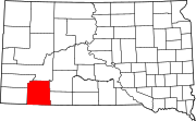 | |
| CDPs | ||
|
Unincorporated communities | ||
| Indian reservation | ||
| Footnotes | ‡This populated place also has portions in an adjacent county or counties | |
This is a detailed table of the National Register of Historic Places listing in Oglala Lakota County, South Dakota.
This is intended to be a detailed table of the property on the National Register of Historic Places in Oglala Lakota County, South Dakota, United States. Latitude and longitude coordinates are provided for this property; they may be seen in a Google map. [1]
There is 1 property listed on the National Register in the county. It is a National Historic Landmark.
This
National Park Service list is complete through
NPS recent listings posted April 12, 2024.
[2]
Current listing
| [3] | Name on the Register [4] | Image | Date listed [5] | Location | City or town | Description |
|---|---|---|---|---|---|---|
| 1 | Wounded Knee National Historic Landmark | |
October 15, 1966 ( #66000719) |
11 miles west of Batesland on the
Pine Ridge Indian Reservation 43°08′33″N 102°21′54″W / 43.142500°N 102.365000°W | Batesland |
References
- ^ The latitude and longitude information provided in this table was derived originally from the National Register Information System, which has been found to be fairly accurate for about 99% of listings. Some locations in this table may have been corrected to current GPS standards.
- ^ National Park Service, United States Department of the Interior, "National Register of Historic Places: Weekly List Actions", retrieved April 12, 2024.
- ^ Numbers represent an alphabetical ordering by significant words. Various colorings, defined here, differentiate National Historic Landmarks and historic districts from other NRHP buildings, structures, sites or objects.
- ^ "National Register Information System". National Register of Historic Places. National Park Service. April 24, 2008.
- ^ The eight-digit number below each date is the number assigned to each location in the National Register Information System database, which can be viewed by clicking the number.
Municipalities and communities of
Oglala Lakota County, South Dakota, United States | ||
|---|---|---|
| Town | | |
| CDPs | ||
|
Unincorporated communities | ||
| Indian reservation | ||
| Footnotes | ‡This populated place also has portions in an adjacent county or counties | |