Photos • Location
| National Highway 6 | |
|---|---|
|
Arabic: الطريق السريع الوطنى 6 French: Route Nationale 6 | |
 | |
 | |
| Route information | |
| Length | 37 km (23 mi) |
| Major junctions | |
| From | Junction with National Highway 1 |
| To | As Eyla |
| Location | |
| Country | Djibouti |
| Highway system | |
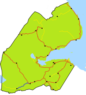
The RN-6 National Highway is a national highway in southwestern Djibouti. The highway begins at 11°06′32″N 42°20′47″E / 11.10889°N 42.34639°E, at a junction with National Highway 1 near Dikhil. It passes through the town of As Eyla and ends at the village of Kouta Bouyya ( 11°00′55″N 41°58′37″E / 11.01528°N 41.97694°E).
| National Highway 6 | |
|---|---|
|
Arabic: الطريق السريع الوطنى 6 French: Route Nationale 6 | |
 | |
 | |
| Route information | |
| Length | 37 km (23 mi) |
| Major junctions | |
| From | Junction with National Highway 1 |
| To | As Eyla |
| Location | |
| Country | Djibouti |
| Highway system | |
The RN-6 National Highway is a national highway in southwestern Djibouti. The highway begins at 11°06′32″N 42°20′47″E / 11.10889°N 42.34639°E, at a junction with National Highway 1 near Dikhil. It passes through the town of As Eyla and ends at the village of Kouta Bouyya ( 11°00′55″N 41°58′37″E / 11.01528°N 41.97694°E).
