Photos • Location

The park's visitor centre
| Nant Mill | |
|---|---|
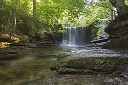
 A waterfall in its woodlands, downstream along the
River Clywedog, from the park's visitor centre. | |
| Type | Country park |
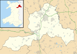
| Location | Wrexham County Borough, Wales |
| Coordinates | 53°02′36″N 3°03′40″W / 53.0433°N 3.0610°W |
| Operated by | Wrexham County Borough Council |
| Status | Open all year |

Nant Mill is a country park in Wrexham County Borough, Wales. [1] It is managed by Wrexham County Borough Council and named after a historic corn mill located on the site. It forms part of the Clywedog Trail and includes a visitor centre and two woods, Nant Wood and Plas Power, from which Offa's Dyke can be seen.
| Nant Mill | |
|---|---|
 A waterfall in its woodlands, downstream along the
River Clywedog, from the park's visitor centre. | |
| Type | Country park |
| Location | Wrexham County Borough, Wales |
| Coordinates | 53°02′36″N 3°03′40″W / 53.0433°N 3.0610°W |
| Operated by | Wrexham County Borough Council |
| Status | Open all year |

Nant Mill is a country park in Wrexham County Borough, Wales. [1] It is managed by Wrexham County Borough Council and named after a historic corn mill located on the site. It forms part of the Clywedog Trail and includes a visitor centre and two woods, Nant Wood and Plas Power, from which Offa's Dyke can be seen.

