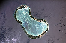
Mwanuku or Manuku or Eten is a settlement located on
Tabuaeranatoll,
Kiribati.[1] Eten is the most south village on the atoll.
Aramari is the village to north.
In the 2010 census 184 people were recorded as living in Eten.[1]
References
^
ab"21. Tabuaeran"(PDF). Office of Te Beretitent - Republic of Kiribati Island Report Series. 2012. Retrieved 28 April 2015.