Photos • Location
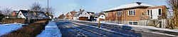
Mundelstrup seen to the north on Gl. Viborgvej


Mundelstrup is a village in east Jutland, Denmark, with a population of 420 (1 January 2024). [1] It's located approximately 13 kilometres (8.1 mi) from central Aarhus. [2]
- ^ BY3: Population 1. January by urban areas The Mobile Statbank from Statistics Denmark
- ^ "Mundelstrup". Retrieved 2014-04-05.
| Populated places |
|  | ||
|---|---|---|---|---|
| Nature & Geography | ||||
| Landmarks | ||||
| Transport & Infrastructure | ||||
56°12′N 10°04′E / 56.200°N 10.067°E
|
| This article about a location in the Central Denmark Region is a stub. You can help Wikipedia by expanding it. |
Mundelstrup is a village in east Jutland, Denmark, with a population of 420 (1 January 2024). [1] It's located approximately 13 kilometres (8.1 mi) from central Aarhus. [2]
- ^ BY3: Population 1. January by urban areas The Mobile Statbank from Statistics Denmark
- ^ "Mundelstrup". Retrieved 2014-04-05.
| Populated places |
| | ||
|---|---|---|---|---|
| Nature & Geography | ||||
| Landmarks | ||||
| Transport & Infrastructure | ||||
56°12′N 10°04′E / 56.200°N 10.067°E
|
| This article about a location in the Central Denmark Region is a stub. You can help Wikipedia by expanding it. |