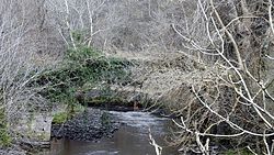
Mousemill New Bridge | |
|---|---|
| Coordinates | 55°40′41″N 3°48′00″W / 55.6780°N 3.8001°W |
| Carries | Pedestrians and vehicles |
| Crosses | Mouse Water [1] |
| Locale | Kirkfieldbank, Lanark, South Lanarkshire, Scotland |
| Maintained by | South Lanarkshire Council |
| Preceded by | Cartland Bridge |
| Followed by | Crossford Bridge |
| History | |
| Construction end | Early 19th Century [2] |
| Replaces | Mousemill Old Bridge |
| Location | |
|
| |
Mousemill Bridge is a crossing of the Mouse Water on Mousemill Road, just north of Kirkfieldbank. There are two bridges at the site, the present day road bridge and the old Mousemill Bridge which previously formed part of the road between Lanark and Hamilton through Kirkfieldbank [3] but is today solely used by pedestrians.
Mousemill Old Bridge | |
|---|---|
 Remains of Mousemill Old Bridge | |
| Coordinates | 55°41′N 3°48′W / 55.68°N 3.8°W |
| Carries | Pedestrians |
| Crosses | Mouse Water |
| Locale | Kirkfieldbank, Lanark, South Lanarkshire, Scotland |
| Preceded by | Cartland Bridge |
| Followed by | Crossford Bridge |
| History | |
| Construction end | c. 1649 [2] |
| Location | |
|
| |
The old Mousemill Bridge originated as a wooden bridge and was first mentioned in 1587. [2] A stone bridge replaced the wooden one around 1649. [4] It is a Category B listed building with Historic Environment Scotland, being listed in 1971. [5] [6]
- ^ "Mousemill New Bridge". Canmore. Royal Commission on the Ancient and Historical Monuments of Scotland. Retrieved 9 August 2014.
- ^ a b c "Mousemill Old Bridge". Canmore. Royal Commission on the Ancient and Historical Monuments of Scotland. Retrieved 9 August 2014.
- ^ "Upper and Lower Clydesdale: River Crossings and Placenames". Old Roads of Scotland. Retrieved 9 August 2014.
- ^ Robertson, Tom. "33. Ayrshire and Lanarkshire Rivers" (PDF). Dr Tom's Books. Archived from the original (PDF) on 14 August 2014. Retrieved 9 August 2014.
- ^ Historic Environment Scotland. "Mousemill Bridge (Category B Listed Building) (LB13060)". Retrieved 28 March 2019.
- ^ "Mousemill Bridge, Kirkfieldbank". British Listed Buildings. Retrieved 9 August 2014.
Mousemill New Bridge | |
|---|---|
| Coordinates | 55°40′41″N 3°48′00″W / 55.6780°N 3.8001°W |
| Carries | Pedestrians and vehicles |
| Crosses | Mouse Water [1] |
| Locale | Kirkfieldbank, Lanark, South Lanarkshire, Scotland |
| Maintained by | South Lanarkshire Council |
| Preceded by | Cartland Bridge |
| Followed by | Crossford Bridge |
| History | |
| Construction end | Early 19th Century [2] |
| Replaces | Mousemill Old Bridge |
| Location | |
|
| |
Mousemill Bridge is a crossing of the Mouse Water on Mousemill Road, just north of Kirkfieldbank. There are two bridges at the site, the present day road bridge and the old Mousemill Bridge which previously formed part of the road between Lanark and Hamilton through Kirkfieldbank [3] but is today solely used by pedestrians.
Mousemill Old Bridge | |
|---|---|
 Remains of Mousemill Old Bridge | |
| Coordinates | 55°41′N 3°48′W / 55.68°N 3.8°W |
| Carries | Pedestrians |
| Crosses | Mouse Water |
| Locale | Kirkfieldbank, Lanark, South Lanarkshire, Scotland |
| Preceded by | Cartland Bridge |
| Followed by | Crossford Bridge |
| History | |
| Construction end | c. 1649 [2] |
| Location | |
|
| |
The old Mousemill Bridge originated as a wooden bridge and was first mentioned in 1587. [2] A stone bridge replaced the wooden one around 1649. [4] It is a Category B listed building with Historic Environment Scotland, being listed in 1971. [5] [6]
- ^ "Mousemill New Bridge". Canmore. Royal Commission on the Ancient and Historical Monuments of Scotland. Retrieved 9 August 2014.
- ^ a b c "Mousemill Old Bridge". Canmore. Royal Commission on the Ancient and Historical Monuments of Scotland. Retrieved 9 August 2014.
- ^ "Upper and Lower Clydesdale: River Crossings and Placenames". Old Roads of Scotland. Retrieved 9 August 2014.
- ^ Robertson, Tom. "33. Ayrshire and Lanarkshire Rivers" (PDF). Dr Tom's Books. Archived from the original (PDF) on 14 August 2014. Retrieved 9 August 2014.
- ^ Historic Environment Scotland. "Mousemill Bridge (Category B Listed Building) (LB13060)". Retrieved 28 March 2019.
- ^ "Mousemill Bridge, Kirkfieldbank". British Listed Buildings. Retrieved 9 August 2014.