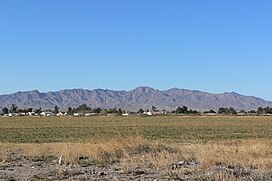
| Mount Manchester | |
|---|---|
 View looking west (Dead Mountains trend S-N) | |
| Highest point | |
| Elevation | 3,602 ft (1,098 m) NAVD 88 [1] |
| Prominence | 1,287 ft (392 m) [2] |
| Coordinates | 35°01′40″N 114°44′56″W / 35.027808986°N 114.748938169°W [1] |
| Geography | |
| Location | San Bernardino County, California, U.S. |
| Parent range | Dead Mountains |
| Climbing | |
| Easiest route | Hike |
Mount Manchester is the highest peak in the Dead Mountains of extreme northeastern San Bernardino County, California, in the Mojave Desert.
Dead Mountains wilderness
Mount Manchester is the highest point of the Bureau of Land Management wilderness area which comprises most of the Dead Mountains. [3]
The Dead Mountains border the Colorado River on the east, and the Piute Wash of the Piute Valley on the west. Piute Wash drains south, then turns east for 8 miles (13 km) at the southern end of the mountain range to meet the Colorado River.
The Dead Mountains are located about 12 mi (19 km) north of Needles, California, just southwest of the Nevada state line. The closest communities to the wilderness area are Laughlin, Nevada, and Bullhead City and Fort Mohave, Arizona, located across the Colorado River to the east of the mountain range. The wilderness area can be accessed via unpaved roads west of Needles Highway, which connects Needles with Laughlin, Nevada and Nevada State Highway 163. More unpaved roads provide access to the Dead Mountains Wilderness from U.S. Highway 95, which runs north–south on the west side of the mountain range and connects Interstate 40 with the Las Vegas metropolitan area.
 |
 (Pinnacle NE of Mount Manchester is identifier) |
See also
References
- ^ a b "Dead". NGS Data Sheet. National Geodetic Survey, National Oceanic and Atmospheric Administration, United States Department of Commerce. Retrieved 2011-07-13.
- ^ "Mount Manchester, California". Peakbagger.com. Retrieved 2022-10-06.
- ^ Dead Mountains Wilderness Archived 2009-03-05 at the Wayback Machine
External links
| Mount Manchester | |
|---|---|
 View looking west (Dead Mountains trend S-N) | |
| Highest point | |
| Elevation | 3,602 ft (1,098 m) NAVD 88 [1] |
| Prominence | 1,287 ft (392 m) [2] |
| Coordinates | 35°01′40″N 114°44′56″W / 35.027808986°N 114.748938169°W [1] |
| Geography | |
| Location | San Bernardino County, California, U.S. |
| Parent range | Dead Mountains |
| Climbing | |
| Easiest route | Hike |
Mount Manchester is the highest peak in the Dead Mountains of extreme northeastern San Bernardino County, California, in the Mojave Desert.
Dead Mountains wilderness
Mount Manchester is the highest point of the Bureau of Land Management wilderness area which comprises most of the Dead Mountains. [3]
The Dead Mountains border the Colorado River on the east, and the Piute Wash of the Piute Valley on the west. Piute Wash drains south, then turns east for 8 miles (13 km) at the southern end of the mountain range to meet the Colorado River.
The Dead Mountains are located about 12 mi (19 km) north of Needles, California, just southwest of the Nevada state line. The closest communities to the wilderness area are Laughlin, Nevada, and Bullhead City and Fort Mohave, Arizona, located across the Colorado River to the east of the mountain range. The wilderness area can be accessed via unpaved roads west of Needles Highway, which connects Needles with Laughlin, Nevada and Nevada State Highway 163. More unpaved roads provide access to the Dead Mountains Wilderness from U.S. Highway 95, which runs north–south on the west side of the mountain range and connects Interstate 40 with the Las Vegas metropolitan area.
 |
 (Pinnacle NE of Mount Manchester is identifier) |
See also
References
- ^ a b "Dead". NGS Data Sheet. National Geodetic Survey, National Oceanic and Atmospheric Administration, United States Department of Commerce. Retrieved 2011-07-13.
- ^ "Mount Manchester, California". Peakbagger.com. Retrieved 2022-10-06.
- ^ Dead Mountains Wilderness Archived 2009-03-05 at the Wayback Machine
External links