This article needs additional citations for
verification. (April 2013) |
Mount Hope, San Diego | |
|---|---|
| Mount Hope | |
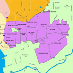
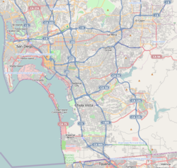
 Mount Hope is located in the southeastern area of the city of San Diego | |
| Coordinates: 32°42′48″N 117°06′42″W / 32.7132°N 117.1118°W | |
| Country | |
| State | |
| County | |
| City | |
| ZIP Code | 92102 |
Mount Hope is an ethnically diverse, hilly urban neighborhood of the City of San Diego, California. Located in the southeastern portion of the city, Mount Hope is named for the large municipal Mount Hope Cemetery, which encompasses approximately 115 acres (0.47 km2) of the community. The neighborhood contains a mixture of residential, industrial, commercial, and cemetery uses.
Background
Located within the community is an unincorporated area encompassing the Greenwood Cemetery, a private cemetery. [1] Within Greenwood Cemetery, is the Cathedral Mausoleum which was built in 1919, which grew to the largest single building mausoleum in the world. [2]
Geography
State Route 94 (Martin Luther King Jr. Freeway) is the northern boundary, Interstate 805 is the eastern boundary, Interstate 15 is the western boundary, and Imperial Avenue is the southern boundary. The major San Diego thoroughfare Market Street runs through this community.
Demographics
Mount Hope is a diverse neighborhood and home to one of the highest concentrations of Latinos in the City. Current demographics for the neighborhood are as follows: people of Hispanic/Latino heritage make up 77.0%, followed by African-Americans at 10.0%, Asian at 7.2%, non-Hispanic Whites 4.8%, and Mixed Race at 1.0%. [3]
Government
Mount Hope is located within the 9th City Council District, currently represented by Sean Elo-Rivera. It is part of the Southeastern San Diego Planning Area. [4]
Education
Mount Hope is served primarily by the San Diego Unified School District.
References
- ^ "Central Sector" (PDF). Development Services Department, Planning Division. City of San Diego. Retrieved April 29, 2013.
- ^ Bissell, Laurie (1982). Scharf, Thomas (ed.). "San Diego Cemeteries: A Brief Guide". The Journal of San Diego History. 28 (4). San Diego Historical Society. Retrieved April 29, 2013.
- ^ ""Race and Ethnicity in Mt. Hope, San Diego, California"". Statistical Atlas. Retrieved November 22, 2020.
- ^ "Mount Hope". City Council District 9. Retrieved November 22, 2020.
32°42′48″N 117°06′42″W / 32.7132°N 117.1118°W
This article needs additional citations for
verification. (April 2013) |
Mount Hope, San Diego | |
|---|---|
| Mount Hope | |
 Mount Hope is located in the southeastern area of the city of San Diego | |
| Coordinates: 32°42′48″N 117°06′42″W / 32.7132°N 117.1118°W | |
| Country | |
| State | |
| County | |
| City | |
| ZIP Code | 92102 |
Mount Hope is an ethnically diverse, hilly urban neighborhood of the City of San Diego, California. Located in the southeastern portion of the city, Mount Hope is named for the large municipal Mount Hope Cemetery, which encompasses approximately 115 acres (0.47 km2) of the community. The neighborhood contains a mixture of residential, industrial, commercial, and cemetery uses.
Background
Located within the community is an unincorporated area encompassing the Greenwood Cemetery, a private cemetery. [1] Within Greenwood Cemetery, is the Cathedral Mausoleum which was built in 1919, which grew to the largest single building mausoleum in the world. [2]
Geography
State Route 94 (Martin Luther King Jr. Freeway) is the northern boundary, Interstate 805 is the eastern boundary, Interstate 15 is the western boundary, and Imperial Avenue is the southern boundary. The major San Diego thoroughfare Market Street runs through this community.
Demographics
Mount Hope is a diverse neighborhood and home to one of the highest concentrations of Latinos in the City. Current demographics for the neighborhood are as follows: people of Hispanic/Latino heritage make up 77.0%, followed by African-Americans at 10.0%, Asian at 7.2%, non-Hispanic Whites 4.8%, and Mixed Race at 1.0%. [3]
Government
Mount Hope is located within the 9th City Council District, currently represented by Sean Elo-Rivera. It is part of the Southeastern San Diego Planning Area. [4]
Education
Mount Hope is served primarily by the San Diego Unified School District.
References
- ^ "Central Sector" (PDF). Development Services Department, Planning Division. City of San Diego. Retrieved April 29, 2013.
- ^ Bissell, Laurie (1982). Scharf, Thomas (ed.). "San Diego Cemeteries: A Brief Guide". The Journal of San Diego History. 28 (4). San Diego Historical Society. Retrieved April 29, 2013.
- ^ ""Race and Ethnicity in Mt. Hope, San Diego, California"". Statistical Atlas. Retrieved November 22, 2020.
- ^ "Mount Hope". City Council District 9. Retrieved November 22, 2020.
32°42′48″N 117°06′42″W / 32.7132°N 117.1118°W
