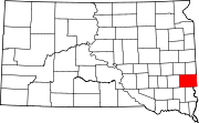
Morefield is an unincorporated community in central Minnehaha County in Sverdrup Township, South Dakota, United States. Morefield is 2 miles (3 km) northeast of Crooks, along an abandoned Chicago, Milwaukee, St. Paul and Pacific rail line that ran from Renner to Madison. It is also 3 miles (5 km) north of the Renner/Crooks exit on Interstate 29 (and one-half mile east of the interstate) on County road 133.
History
Founded in 1902, Morefield was a busy country community center. Morefield was named by Norwegian settlers for a Norwegian word, Meråker, which means more field.
External links
43°41′20″N 96°46′15″W / 43.68889°N 96.77083°W
