Photos • Location
You can help expand this article with text translated from
the corresponding article in Italian. (June 2010) Click [show] for important translation instructions.
|
| Monte Priaforà | |
|---|---|
 | |
| Highest point | |
| Elevation | 1,659 m (5,443 ft) |
| Coordinates | 45°47′13″N 11°19′08″E / 45.78694°N 11.31889°E |
| Geography | |
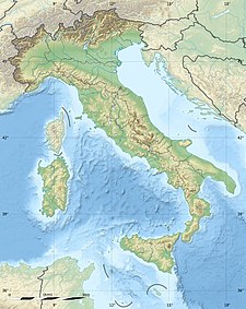
Monte Priaforà is a mountain of the Veneto, Italy. It has an elevation of 1,659 metres. It is part of the Little Dolomites with Cima Palon (the highest peak).[ citation needed] Like the surrounding peaks, Mount Priaforà is made up of rocks from the Triassic and Jurassic periods. [1]
- ^ Liverio Carollo, Hiking Guide of the Valleys of Posina, Lakes and the Plateau of Tonezza, II ed, 1996 Serenissima editrice, C.A.I. sezione Thiene, pp. 23-25.
You can help expand this article with text translated from
the corresponding article in Italian. (June 2010) Click [show] for important translation instructions.
|
| Monte Priaforà | |
|---|---|
 | |
| Highest point | |
| Elevation | 1,659 m (5,443 ft) |
| Coordinates | 45°47′13″N 11°19′08″E / 45.78694°N 11.31889°E |
| Geography | |
Monte Priaforà is a mountain of the Veneto, Italy. It has an elevation of 1,659 metres. It is part of the Little Dolomites with Cima Palon (the highest peak).[ citation needed] Like the surrounding peaks, Mount Priaforà is made up of rocks from the Triassic and Jurassic periods. [1]
- ^ Liverio Carollo, Hiking Guide of the Valleys of Posina, Lakes and the Plateau of Tonezza, II ed, 1996 Serenissima editrice, C.A.I. sezione Thiene, pp. 23-25.
