Mittie, Louisiana | |
|---|---|
 Mittie, Louisiana  Mittie, Louisiana | |
| Coordinates: 30°42′25″N 92°54′25″W / 30.70694°N 92.90694°W | |
| Country | United States |
| State | Louisiana |
| Parish | Allen |
| Elevation | 92 ft (28 m) |
| Time zone | UTC-6 ( Central (CST)) |
| • Summer ( DST) | UTC-5 (CDT) |
| ZIP code | 70654 |
| Area code | 337 |
| GNIS feature ID | 543479 [1] |
Mittie is an unincorporated community in Allen Parish, Louisiana, United States. The community is located on Louisiana Highway 26, 10.5 miles (16.9 km) northwest of Oberlin. Mittie has a post office with ZIP code 70654. [2] [3]
Mittie is named after Mittie Burnett (Burnitt), the first postmaster. The post office was once located on the east side of Whiskey Chitto, but was moved to the west side by Clinton Smith and his wife Oma Simmons Smith, who had the post office located inside Smith's Grocery, now Highway 26 Convenience. Mittie has been located in present site since 1929. Whiskey Chitto Creek runs between the two locations of Mittie. This section of the stream was the site of the beginning of the Calcasieu Log War of 1877-1879, when federal agents virtually shut down logging operations along the streams of Imperial Calcasieu Parish. See article on Whiskey Chitto Creek.
- ^ "Mittie". Geographic Names Information System. United States Geological Survey, United States Department of the Interior.
- ^ United States Postal Service. "USPS - Look Up a ZIP Code". Retrieved February 20, 2015.
- ^ "Postmaster Finder - Post Offices by ZIP Code". United States Postal Service. Retrieved February 20, 2015.
Municipalities and communities of
Allen Parish, Louisiana, United States | ||
|---|---|---|
| City | 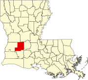 | |
| Towns | ||
| Villages | ||
|
Unincorporated communities |
| |
| Indian reservation | ||
| Footnotes | ‡This populated place also has portions in an adjacent county or counties | |
|
| This Louisiana state location article is a stub. You can help Wikipedia by expanding it. |
Mittie, Louisiana | |
|---|---|
Mittie, Louisiana Mittie, Louisiana | |
| Coordinates: 30°42′25″N 92°54′25″W / 30.70694°N 92.90694°W | |
| Country | United States |
| State | Louisiana |
| Parish | Allen |
| Elevation | 92 ft (28 m) |
| Time zone | UTC-6 ( Central (CST)) |
| • Summer ( DST) | UTC-5 (CDT) |
| ZIP code | 70654 |
| Area code | 337 |
| GNIS feature ID | 543479 [1] |
Mittie is an unincorporated community in Allen Parish, Louisiana, United States. The community is located on Louisiana Highway 26, 10.5 miles (16.9 km) northwest of Oberlin. Mittie has a post office with ZIP code 70654. [2] [3]
Mittie is named after Mittie Burnett (Burnitt), the first postmaster. The post office was once located on the east side of Whiskey Chitto, but was moved to the west side by Clinton Smith and his wife Oma Simmons Smith, who had the post office located inside Smith's Grocery, now Highway 26 Convenience. Mittie has been located in present site since 1929. Whiskey Chitto Creek runs between the two locations of Mittie. This section of the stream was the site of the beginning of the Calcasieu Log War of 1877-1879, when federal agents virtually shut down logging operations along the streams of Imperial Calcasieu Parish. See article on Whiskey Chitto Creek.
- ^ "Mittie". Geographic Names Information System. United States Geological Survey, United States Department of the Interior.
- ^ United States Postal Service. "USPS - Look Up a ZIP Code". Retrieved February 20, 2015.
- ^ "Postmaster Finder - Post Offices by ZIP Code". United States Postal Service. Retrieved February 20, 2015.
Municipalities and communities of
Allen Parish, Louisiana, United States | ||
|---|---|---|
| City | | |
| Towns | ||
| Villages | ||
|
Unincorporated communities |
| |
| Indian reservation | ||
| Footnotes | ‡This populated place also has portions in an adjacent county or counties | |
|
| This Louisiana state location article is a stub. You can help Wikipedia by expanding it. |