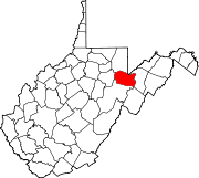
Photos • Location
Mill Run, West Virginia | |
|---|---|
| Coordinates: 39°00′53″N 79°32′48″W / 39.01472°N 79.54667°W | |
| Country | United States |
| State | West Virginia |
| County | Tucker |
| Elevation | 1,906 ft (581 m) |
| GNIS feature ID | 1689383 [1] |
Mill Run is a ghost town in Tucker County, West Virginia, United States. Mill Run was located on the Dry Fork 3 miles (4.8 km) northwest of Red Creek. Mill Run appeared on Soil Conservation Service maps as late as 1921.
References

