Mettet
Metet (
Walloon) | |
|---|---|
 Mettet town hall | |
 Flag  Coat of arms | |
 Mettet Location in Belgium
Location of Mettet in Namur Province  | |
| Coordinates: 50°19′N 04°40′E / 50.317°N 4.667°E | |
| Country | |
| Community | French Community |
| Region | Wallonia |
| Province | Namur |
| Arrondissement | Namur |
| Government | |
| • Mayor | Yves Delforge |
| • Governing party/ies | ICAP-Oxygène-ROPS |
| Area | |
| • Total | 116.97 km2 (45.16 sq mi) |
| Population (2018-01-01)
[1] | |
| • Total | 13,037 |
| • Density | 110/km2 (290/sq mi) |
| Postal codes | 5640, 5641, 5644, 5646 |
| NIS code | 92087 |
| Area codes | 071 |
| Website | www.mettet.be |
Mettet (French pronunciation: [mɛ.tɛ]; Walloon: Metet) is a municipality of Wallonia located in the province of Namur, Belgium.
On 1 January 2006 Mettet had 11,977 inhabitants. The total area is 116.78 km², giving a population density of 103 inhabitants per km².
The municipality consists of the following districts: Biesme, Biesmerée, Ermeton-sur-Biert, Furnaux, Graux, Mettet, Oret, Saint-Gérard, and Stave.
Circuit Jules Tacheny
In Mettet there is a race track, Circuit Jules Tacheny Mettet, for motorbikes and cars.
Notable people
- Alain Crépin (1954–), conductor and musician
See also
-
 St. John the Baptist church
 -
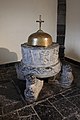 Baptismal font of Furnaux


References
- ^ "Wettelijke Bevolking per gemeente op 1 januari 2018". Statbel. Retrieved 9 March 2019.
External links
-
 Media related to
Mettet at Wikimedia Commons
Media related to
Mettet at Wikimedia Commons - Official website (in French)
- Official website of race track "Jules Tacheny" (in French and Dutch)
- Motorbike Race Circuit "Jules Tacheny" (in French)
- Mettet d'autrefois, Site of old postcards and old photographs of Mettet. Collection of PIERRE HUBOT
Places adjacent to Mettet | |
|---|---|
Municipalities in the
province of Namur,
Wallonia | ||
|---|---|---|
| Dinant |  | |
| Namur | ||
| Philippeville | ||
Bold indicates
cities | ||
| International | |
|---|---|
| National | |
| Geographic | |
| Other | |
|
| This Namur Province location article is a stub. You can help Wikipedia by expanding it. |
Mettet
Metet (
Walloon) | |
|---|---|
|
Mettet town hall | |
|
Flag Coat of arms | |
Mettet Location in Belgium
Location of Mettet in Namur Province | |
| Coordinates: 50°19′N 04°40′E / 50.317°N 4.667°E | |
| Country | |
| Community | French Community |
| Region | Wallonia |
| Province | Namur |
| Arrondissement | Namur |
| Government | |
| • Mayor | Yves Delforge |
| • Governing party/ies | ICAP-Oxygène-ROPS |
| Area | |
| • Total | 116.97 km2 (45.16 sq mi) |
| Population (2018-01-01)
[1] | |
| • Total | 13,037 |
| • Density | 110/km2 (290/sq mi) |
| Postal codes | 5640, 5641, 5644, 5646 |
| NIS code | 92087 |
| Area codes | 071 |
| Website | www.mettet.be |
Mettet (French pronunciation: [mɛ.tɛ]; Walloon: Metet) is a municipality of Wallonia located in the province of Namur, Belgium.
On 1 January 2006 Mettet had 11,977 inhabitants. The total area is 116.78 km², giving a population density of 103 inhabitants per km².
The municipality consists of the following districts: Biesme, Biesmerée, Ermeton-sur-Biert, Furnaux, Graux, Mettet, Oret, Saint-Gérard, and Stave.
Circuit Jules Tacheny
In Mettet there is a race track, Circuit Jules Tacheny Mettet, for motorbikes and cars.
Notable people
- Alain Crépin (1954–), conductor and musician
See also
-
St. John the Baptist church
-
Baptismal font of Furnaux
References
- ^ "Wettelijke Bevolking per gemeente op 1 januari 2018". Statbel. Retrieved 9 March 2019.
External links
-
Media related to
Mettet at Wikimedia Commons
- Official website (in French)
- Official website of race track "Jules Tacheny" (in French and Dutch)
- Motorbike Race Circuit "Jules Tacheny" (in French)
- Mettet d'autrefois, Site of old postcards and old photographs of Mettet. Collection of PIERRE HUBOT
Places adjacent to Mettet | |
|---|---|
Municipalities in the
province of Namur,
Wallonia | ||
|---|---|---|
| Dinant | | |
| Namur | ||
| Philippeville | ||
Bold indicates
cities | ||
| International | |
|---|---|
| National | |
| Geographic | |
| Other | |
|
| This Namur Province location article is a stub. You can help Wikipedia by expanding it. |