| Melville Glacier | |
|---|---|
| Melville Gletscher | |
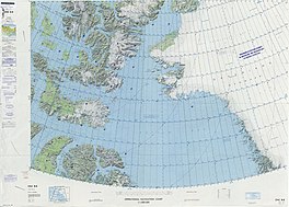
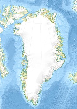
 Map of Northwestern Greenland | |
| Type | Tidal outlet glacier |
| Location | Greenland |
| Coordinates | 77°44′N 66°39′W / 77.733°N 66.650°W |
| Width | 2 km (1.2 mi) |
| Terminus |
Inglefield Fjord Baffin Bay |
| Status | Retreating [1] |
Melville Glacier ( Danish: Melville Gletscher), is a glacier in northwestern Greenland. [2] Administratively it belongs to the Avannaata municipality.
This glacier was named by Robert Peary after Chief Engineer George W. Melville (1841 – 1912), Chief of the Bureau of Steam Engineering. [3]
The Melville Glacier discharges from the Greenland Ice Sheet and has its terminus in the northern side of the head of the Inglefield Fjord just north of Josephine Peary Island. Its last stretch lies between two nunataks: Mount Lee in the east separates it from the Farquhar Glacier to the east, and Mount Asserson, in the west, separates it from the Sharp Glacier to the west. [2]
The Melville Glacier flows roughly from NE to SW. In the same manner as its neighboring glaciers, it has retreated by approximately 1 km (0.62 mi) in the period between the 1980s and 2014. [1]
 |
- ^ a b Ice front and flow speed variations of marine-terminating outlet glaciers along the coast of Prudhoe Land, northwestern Greenland
- ^ a b "Melville Gletscher". Mapcarta. Retrieved 31 March 2019.
- ^ Robert Neff Keely, Gwilym George Davis, In Arctic Seas: the Voyage of the Kite with the Peary Expedition, 2011 p. 373
| Melville Glacier | |
|---|---|
| Melville Gletscher | |
 Map of Northwestern Greenland | |
| Type | Tidal outlet glacier |
| Location | Greenland |
| Coordinates | 77°44′N 66°39′W / 77.733°N 66.650°W |
| Width | 2 km (1.2 mi) |
| Terminus |
Inglefield Fjord Baffin Bay |
| Status | Retreating [1] |
Melville Glacier ( Danish: Melville Gletscher), is a glacier in northwestern Greenland. [2] Administratively it belongs to the Avannaata municipality.
This glacier was named by Robert Peary after Chief Engineer George W. Melville (1841 – 1912), Chief of the Bureau of Steam Engineering. [3]
The Melville Glacier discharges from the Greenland Ice Sheet and has its terminus in the northern side of the head of the Inglefield Fjord just north of Josephine Peary Island. Its last stretch lies between two nunataks: Mount Lee in the east separates it from the Farquhar Glacier to the east, and Mount Asserson, in the west, separates it from the Sharp Glacier to the west. [2]
The Melville Glacier flows roughly from NE to SW. In the same manner as its neighboring glaciers, it has retreated by approximately 1 km (0.62 mi) in the period between the 1980s and 2014. [1]
 |
- ^ a b Ice front and flow speed variations of marine-terminating outlet glaciers along the coast of Prudhoe Land, northwestern Greenland
- ^ a b "Melville Gletscher". Mapcarta. Retrieved 31 March 2019.
- ^ Robert Neff Keely, Gwilym George Davis, In Arctic Seas: the Voyage of the Kite with the Peary Expedition, 2011 p. 373
