This article needs additional citations for
verification. (October 2016) |
Maruthamunai | |
|---|---|
Village | |
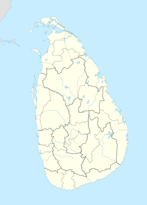
| Coordinates: 7°25′00″N 81°49′00″E / 7.41667°N 81.81667°E | |
| Country | Sri Lanka |
| Province | Eastern Province, Sri Lanka |
| District | Ampara District |
| Divisional Secretariat | Kalmunai |
| Government | |
| • Type | Kalmunai Municipal Council |
| Population | |
| • Total | 13,948 |
| Time zone | UTC+5:30 (Sri Lanka Standard Time) |
| • Summer ( DST) | UTC+6 (Summer time) |
| Postal Code | 32314 |

Maruthamunai was one of the villages most severely affected in Sri Lanka by the Indian Ocean tsunami on 26 December 2004. The disaster killed 922 residents of the village, displaced 11,086, 1,391 houses were completely destroyed and 1,359 were partially damaged. Previous to the disaster the population of the village was officially 17,393. In addition to over 1,300 homes, many public buildings were destroyed by the tsunami. [1]
Maruthamunai is bounded on the North by Periyaneelavanai village, on the West by paddy fields together with the river bed of the Batticaloa Lagoon, on the South by another conventional village - Pandiruppu, and on the East by the Bay of Bengal of the Indian Ocean. Maruthamunai had an extent area of 2.11 square kilometers and a Muslim population of about twenty thousand in 2004, before the Indian Ocean tsunami of 26 December 2004.
| GS Number | Area | Total Families | Population |
|---|---|---|---|
| KP/67B | Maruthamunai-1 | 300 | 2089 |
| KP/67 | Maruthamunai-2 | 395 | 3150 |
| KP/67A | Maruthamunai-3 | 2225 | 4160 |
| KP/67C | Maruthamunai-4 | 393 | 1911 |
| KP/67D | Maruthamunai-5 | 384 | 1953 |
| KP/68 | Maruthamunai-6 South | 610 | 2553 |
| - | Pandirupu-MD | 481 | 1928 |
| KP/72 | Periyaneelavanai-01 | 619 | 2959 |
| KP/72A | Periyaneelavanai-02 | 382 | 1965 |
Source: http://www.kalmunai.ds.gov.lk
- Shams Central College(N.S)
- Al Manar Central College(N.S)
- Al Minan Vidyalaya
- Al Madeena Vidyalaya
- Al-Hambra
- ^ "Maruthamunai: a tsunami-devastated village in Sri Lanka, by A. Shanthakumar and W.A. Sunil, 29 December 2005". Wsws.org. Retrieved 29 November 2011.
This article needs additional citations for
verification. (October 2016) |
Maruthamunai | |
|---|---|
Village | |
| Coordinates: 7°25′00″N 81°49′00″E / 7.41667°N 81.81667°E | |
| Country | Sri Lanka |
| Province | Eastern Province, Sri Lanka |
| District | Ampara District |
| Divisional Secretariat | Kalmunai |
| Government | |
| • Type | Kalmunai Municipal Council |
| Population | |
| • Total | 13,948 |
| Time zone | UTC+5:30 (Sri Lanka Standard Time) |
| • Summer ( DST) | UTC+6 (Summer time) |
| Postal Code | 32314 |

Maruthamunai was one of the villages most severely affected in Sri Lanka by the Indian Ocean tsunami on 26 December 2004. The disaster killed 922 residents of the village, displaced 11,086, 1,391 houses were completely destroyed and 1,359 were partially damaged. Previous to the disaster the population of the village was officially 17,393. In addition to over 1,300 homes, many public buildings were destroyed by the tsunami. [1]
Maruthamunai is bounded on the North by Periyaneelavanai village, on the West by paddy fields together with the river bed of the Batticaloa Lagoon, on the South by another conventional village - Pandiruppu, and on the East by the Bay of Bengal of the Indian Ocean. Maruthamunai had an extent area of 2.11 square kilometers and a Muslim population of about twenty thousand in 2004, before the Indian Ocean tsunami of 26 December 2004.
| GS Number | Area | Total Families | Population |
|---|---|---|---|
| KP/67B | Maruthamunai-1 | 300 | 2089 |
| KP/67 | Maruthamunai-2 | 395 | 3150 |
| KP/67A | Maruthamunai-3 | 2225 | 4160 |
| KP/67C | Maruthamunai-4 | 393 | 1911 |
| KP/67D | Maruthamunai-5 | 384 | 1953 |
| KP/68 | Maruthamunai-6 South | 610 | 2553 |
| - | Pandirupu-MD | 481 | 1928 |
| KP/72 | Periyaneelavanai-01 | 619 | 2959 |
| KP/72A | Periyaneelavanai-02 | 382 | 1965 |
Source: http://www.kalmunai.ds.gov.lk
- Shams Central College(N.S)
- Al Manar Central College(N.S)
- Al Minan Vidyalaya
- Al Madeena Vidyalaya
- Al-Hambra
- ^ "Maruthamunai: a tsunami-devastated village in Sri Lanka, by A. Shanthakumar and W.A. Sunil, 29 December 2005". Wsws.org. Retrieved 29 November 2011.
