Photos • Location
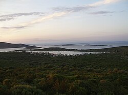
View from the highest hill of the island
Ilovik


Vele Orjule (left) and Male Orjule (right) from
Sveti Petar | |
|
| |
| Geography | |
|---|---|
| Location | Adriatic Sea |
| Coordinates | 44°29′25″N 14°33′51″E / 44.49028°N 14.56417°E |
| Archipelago | Cres-Lošinj |
| Area | 0.33 km2 (0.13 sq mi) |
| Highest elevation | 11 m (36 ft) |
| Administration | |
Croatia | |
| Demographics | |
| Population | 0 |
Male Orjule is an uninhabited Croatian island in the Adriatic Sea located southeast of Lošinj. Its area is 0.33 km2 (0.13 sq mi). [1]

References
- ^ Duplančić Leder, Tea; Ujević, Tin; Čala, Mendi (June 2004). "Coastline lengths and areas of islands in the Croatian part of the Adriatic Sea determined from the topographic maps at the scale of 1 : 25 000" (PDF). Geoadria. 9 (1). Zadar: 5–32. doi: 10.15291/geoadria.127. Retrieved 2019-12-26.
|
| This Primorje-Gorski Kotar County geography article is a stub. You can help Wikipedia by expanding it. |
|
Vele Orjule (left) and Male Orjule (right) from
Sveti Petar | |
|
| |
| Geography | |
|---|---|
| Location | Adriatic Sea |
| Coordinates | 44°29′25″N 14°33′51″E / 44.49028°N 14.56417°E |
| Archipelago | Cres-Lošinj |
| Area | 0.33 km2 (0.13 sq mi) |
| Highest elevation | 11 m (36 ft) |
| Administration | |
Croatia | |
| Demographics | |
| Population | 0 |
Male Orjule is an uninhabited Croatian island in the Adriatic Sea located southeast of Lošinj. Its area is 0.33 km2 (0.13 sq mi). [1]
References
- ^ Duplančić Leder, Tea; Ujević, Tin; Čala, Mendi (June 2004). "Coastline lengths and areas of islands in the Croatian part of the Adriatic Sea determined from the topographic maps at the scale of 1 : 25 000" (PDF). Geoadria. 9 (1). Zadar: 5–32. doi: 10.15291/geoadria.127. Retrieved 2019-12-26.
|
| This Primorje-Gorski Kotar County geography article is a stub. You can help Wikipedia by expanding it. |