| Maidens | |
|---|---|
 View of Maidens | |
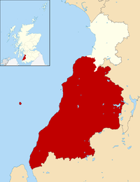
Location within
South Ayrshire | |
| Population | 567 [1] |
| OS grid reference | NS215080 |
| • Edinburgh | 77 mi (124 km) |
| • London | 327 mi (526 km) |
| Council area | |
| Lieutenancy area | |
| Country | Scotland |
| Sovereign state | United Kingdom |
| Post town | GIRVAN |
| Postcode district | KA26 |
| Police | Scotland |
| Fire | Scottish |
| Ambulance | Scottish |
| UK Parliament | |
| Scottish Parliament | |
Maidens is a village in the Kirkoswald parish of Ayrshire, Scotland. Situated on the coast of the Firth of Clyde at the southern end of Maidenhead Bay, a series of rocks known as the "Maidens” form a natural harbour. The village lies 2 miles (3 km) north of the ruinous Turnberry Castle, ancient seat of the Earls of Carrick, and 5 miles (8 km) west of Maybole. It formerly had its own railway station on the Maidens and Dunure Light Railway. In 1991, Maidens had a population of 567.
- ^ Census, 1991
- "Maidens". The Gazetteer for Scotland. Retrieved 5 October 2015.
| Maidens | |
|---|---|
 View of Maidens | |
Location within
South Ayrshire | |
| Population | 567 [1] |
| OS grid reference | NS215080 |
| • Edinburgh | 77 mi (124 km) |
| • London | 327 mi (526 km) |
| Council area | |
| Lieutenancy area | |
| Country | Scotland |
| Sovereign state | United Kingdom |
| Post town | GIRVAN |
| Postcode district | KA26 |
| Police | Scotland |
| Fire | Scottish |
| Ambulance | Scottish |
| UK Parliament | |
| Scottish Parliament | |
Maidens is a village in the Kirkoswald parish of Ayrshire, Scotland. Situated on the coast of the Firth of Clyde at the southern end of Maidenhead Bay, a series of rocks known as the "Maidens” form a natural harbour. The village lies 2 miles (3 km) north of the ruinous Turnberry Castle, ancient seat of the Earls of Carrick, and 5 miles (8 km) west of Maybole. It formerly had its own railway station on the Maidens and Dunure Light Railway. In 1991, Maidens had a population of 567.
- ^ Census, 1991
- "Maidens". The Gazetteer for Scotland. Retrieved 5 October 2015.

