Photos • Location

Lyons Point | |
|---|---|
 Lyons Point Location of Lyons Point in Louisiana | |
| Coordinates: 30°05′41″N 92°22′41″W / 30.09472°N 92.37806°W | |
| Country | United States |
| State | Louisiana |
| Parish | Acadia |
| Elevation | 16 ft (5 m) |
| Time zone | UTC-6 ( CST) |
| • Summer ( DST) | UTC-5 ( CDT) |
| Area code | 337 |
Lyons Point is a small unincorporated community in Acadia Parish, Louisiana, United States, located at the intersection of LA Hwy 1115 and Benton Road. [1] The community is part of the Crowley Micropolitan Statistical Area. [2]
References
Municipalities and communities of
Acadia Parish, Louisiana, United States | ||
|---|---|---|
| Cities | 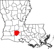 | |
| Towns | ||
| Villages | ||
| CDPs | ||
|
Other unincorporated communities | ||
| Footnotes | ‡This populated place also has portions in an adjacent parish or parishes | |
|
| This Louisiana state location article is a stub. You can help Wikipedia by expanding it. |
Lyons Point | |
|---|---|
Lyons Point Location of Lyons Point in Louisiana | |
| Coordinates: 30°05′41″N 92°22′41″W / 30.09472°N 92.37806°W | |
| Country | United States |
| State | Louisiana |
| Parish | Acadia |
| Elevation | 16 ft (5 m) |
| Time zone | UTC-6 ( CST) |
| • Summer ( DST) | UTC-5 ( CDT) |
| Area code | 337 |
Lyons Point is a small unincorporated community in Acadia Parish, Louisiana, United States, located at the intersection of LA Hwy 1115 and Benton Road. [1] The community is part of the Crowley Micropolitan Statistical Area. [2]
References
Municipalities and communities of
Acadia Parish, Louisiana, United States | ||
|---|---|---|
| Cities | | |
| Towns | ||
| Villages | ||
| CDPs | ||
|
Other unincorporated communities | ||
| Footnotes | ‡This populated place also has portions in an adjacent parish or parishes | |
|
| This Louisiana state location article is a stub. You can help Wikipedia by expanding it. |