Photos • Location


40°10′N 45°41′E / 40.167°N 45.683°E
Lusakunk
Լուսակունք | |
|---|---|
 A view of Lusakunk | |
 Lusakunk  Lusakunk | |
| Coordinates: 40°10′N 45°41′E / 40.167°N 45.683°E | |
| Country | Armenia |
| Province | Gegharkunik |
| Municipality | Vardenis |
| Population | |
| • Total | 1,440 |
| Time zone | UTC+4 ( AMT) |
| Lusakunk at GEOnet Names Server | |
Lusakunk ( Armenian: Լուսակունք) is a village in the Vardenis Municipality of the Gegharkunik Province of Armenia.
Etymology
The village was previously known as Tuskyulu.
Gallery
-
 Skyline in Lusakunk
 -
 Shrine in Lusakunk
 -
 WWII monument
 -
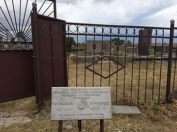 Cemetery


References
External links
Wikimedia Commons has media related to
Lusakunk.
- Report of the results of the 2001 Armenian Census, Statistical Committee of Armenia
- Kiesling, Brady (June 2000). Rediscovering Armenia: An Archaeological/Touristic Gazetteer and Map Set for the Historical Monuments of Armenia (PDF). Archived (PDF) from the original on 6 November 2021.
- World Gazeteer: Armenia[ dead link] – World-Gazetteer.com

|
| This article about a location in Gegharkunik Province, Armenia is a stub. You can help Wikipedia by expanding it. |
40°10′N 45°41′E / 40.167°N 45.683°E
Lusakunk
Լուսակունք | |
|---|---|
|
A view of Lusakunk | |
Lusakunk Lusakunk | |
| Coordinates: 40°10′N 45°41′E / 40.167°N 45.683°E | |
| Country | Armenia |
| Province | Gegharkunik |
| Municipality | Vardenis |
| Population | |
| • Total | 1,440 |
| Time zone | UTC+4 ( AMT) |
| Lusakunk at GEOnet Names Server | |
Lusakunk ( Armenian: Լուսակունք) is a village in the Vardenis Municipality of the Gegharkunik Province of Armenia.
Etymology
The village was previously known as Tuskyulu.
Gallery
-
Skyline in Lusakunk
-
Shrine in Lusakunk
-
WWII monument
-
Cemetery
References
External links
Wikimedia Commons has media related to
Lusakunk.
- Report of the results of the 2001 Armenian Census, Statistical Committee of Armenia
- Kiesling, Brady (June 2000). Rediscovering Armenia: An Archaeological/Touristic Gazetteer and Map Set for the Historical Monuments of Armenia (PDF). Archived (PDF) from the original on 6 November 2021.
- World Gazeteer: Armenia[ dead link] – World-Gazetteer.com
|
| This article about a location in Gegharkunik Province, Armenia is a stub. You can help Wikipedia by expanding it. |