| Lunca Joasă a Prutului Inferior Natural Park | |
|---|---|
| Parcul Natural Lunca Joasă a Prutului Inferior | |
IUCN category V (protected landscape/seascape) | |

Prut River near
Giurgiulești, on the Romanian-Moldovan border | |
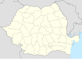
Location within
Romania | |
| Location | |
| Nearest city | Tecuci |
| Coordinates | 46°05′17″N 28°05′35″E / 46.088°N 28.093°E [1] |
| Area | 8.247 hectares (20.38 acres) |
| Established | 2005 |
The Lunca Joasă a Prutului Inferior Natural Park ( Romanian: Parcul Natural Lunca Joasă a Prutului Inferior) is a protected area ( natural park category V IUCN) situated in Romania, in Galați County. [2]
Location
The Natural Park is situated in the inferior course of Prut River, in the administrative territory of Berești-Meria, Nicorești, Cavadinești, Oancea, Suceveni, Vlădeşti, Tulucești, Vânători communes, in the north-eastern part of Galați county.
Description
The Lunca Joasă a Prutului Inferior with an area of 8.247 ha [3] was declared natural protected area by the Government Decision Number 2152 on November 30, 2004 (published in Romanian Official Paper Number 38 on January 12, 2005) [4] and represents a wetland (with canals, lakes, swamps, floodplains) of internacional importance especially for waterfowl habitat, or mammals, fish and plant species
Protected areas included in park: Ostrovul Prut, Pochina Lake and Vlășcuța Lake.
References
- ^ eunis.eea.europa.eu - Lunca Joasă a Prutului Inferior Natural Parg (coords); retrieved on June 12, 2012
- ^ protectedplanet.net - Lunca Joasă a Prutului Inferior (location); retrieved on June 12, 2012
- ^ (in Romanian) apmgl.anpm.ro - Agenţia pentru Protecţia Mediului Galaţi; retrieved on June 12, 2012
- ^ (in Romanian) muntiimaramuresului.ro - Hotărârea de Guvern Nr.2152 din 30 noiembrie 2004, publicată în Monitorul Oficial al României, Nr.38 din 12 ianuarie 2005 Archived 2013-09-27 at the Wayback Machine; retrieved on June 12, 2012
| Lunca Joasă a Prutului Inferior Natural Park | |
|---|---|
| Parcul Natural Lunca Joasă a Prutului Inferior | |
IUCN category V (protected landscape/seascape) | |

Prut River near
Giurgiulești, on the Romanian-Moldovan border | |
Location within
Romania | |
| Location | |
| Nearest city | Tecuci |
| Coordinates | 46°05′17″N 28°05′35″E / 46.088°N 28.093°E [1] |
| Area | 8.247 hectares (20.38 acres) |
| Established | 2005 |
The Lunca Joasă a Prutului Inferior Natural Park ( Romanian: Parcul Natural Lunca Joasă a Prutului Inferior) is a protected area ( natural park category V IUCN) situated in Romania, in Galați County. [2]
Location
The Natural Park is situated in the inferior course of Prut River, in the administrative territory of Berești-Meria, Nicorești, Cavadinești, Oancea, Suceveni, Vlădeşti, Tulucești, Vânători communes, in the north-eastern part of Galați county.
Description
The Lunca Joasă a Prutului Inferior with an area of 8.247 ha [3] was declared natural protected area by the Government Decision Number 2152 on November 30, 2004 (published in Romanian Official Paper Number 38 on January 12, 2005) [4] and represents a wetland (with canals, lakes, swamps, floodplains) of internacional importance especially for waterfowl habitat, or mammals, fish and plant species
Protected areas included in park: Ostrovul Prut, Pochina Lake and Vlășcuța Lake.
References
- ^ eunis.eea.europa.eu - Lunca Joasă a Prutului Inferior Natural Parg (coords); retrieved on June 12, 2012
- ^ protectedplanet.net - Lunca Joasă a Prutului Inferior (location); retrieved on June 12, 2012
- ^ (in Romanian) apmgl.anpm.ro - Agenţia pentru Protecţia Mediului Galaţi; retrieved on June 12, 2012
- ^ (in Romanian) muntiimaramuresului.ro - Hotărârea de Guvern Nr.2152 din 30 noiembrie 2004, publicată în Monitorul Oficial al României, Nr.38 din 12 ianuarie 2005 Archived 2013-09-27 at the Wayback Machine; retrieved on June 12, 2012

