Luchtenburg | |
|---|---|
Hamlet | |
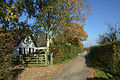
 Street view of Luchtenburg | |
 Luchtenburg Location in the Netherlands  Luchtenburg Luchtenburg (Netherlands) | |
| Coordinates: 51°58′11″N 5°29′15″E / 51.96972°N 5.48750°E | |
| Country | Netherlands |
| Province | Gelderland |
| Municipality | Buren |
| Elevation | 7 m (23 ft) |
| Time zone | UTC+1 ( CET) |
| • Summer ( DST) | UTC+2 ( CEST) |
| Postal code | 4031 |
| Dialing code | 0344 |
Luchtenburg is a hamlet in the Dutch province of Gelderland. It is a part of the municipality of Buren, and is located in about 8 km southwest of Veenendaal. [2]
Luchtenburg is not a statistical entity, [3] and the postal authorities have placed it under Ingen. [4] The hamlet consists of about 40 houses. [5]
-
 Farm in Luchtenburg
 -
 Farm in Luchtenburg


- ^ "Postcodetool for 4031JA". Actueel Hoogtebestand Nederland (in Dutch). Het Waterschapshuis. Retrieved 21 March 2022.
- ^ ANWB Topografische Atlas Nederland, Topografische Dienst and ANWB, 2005.
-
^
"Kerncijfers wijken en buurten 2021". Central Bureau of Statistics. Retrieved 21 March 2022.
not found
- ^ "Postcode 4031 in Ingen". Postcode bij adres (in Dutch). Retrieved 21 March 2022.
- ^ "Luchtenburg". Plaatsengids (in Dutch). Retrieved 21 March 2022.
|
| This Gelderland location article is a stub. You can help Wikipedia by expanding it. |
Luchtenburg | |
|---|---|
Hamlet | |
|
Street view of Luchtenburg | |
Luchtenburg Location in the Netherlands Luchtenburg Luchtenburg (Netherlands) | |
| Coordinates: 51°58′11″N 5°29′15″E / 51.96972°N 5.48750°E | |
| Country | Netherlands |
| Province | Gelderland |
| Municipality | Buren |
| Elevation | 7 m (23 ft) |
| Time zone | UTC+1 ( CET) |
| • Summer ( DST) | UTC+2 ( CEST) |
| Postal code | 4031 |
| Dialing code | 0344 |
Luchtenburg is a hamlet in the Dutch province of Gelderland. It is a part of the municipality of Buren, and is located in about 8 km southwest of Veenendaal. [2]
Luchtenburg is not a statistical entity, [3] and the postal authorities have placed it under Ingen. [4] The hamlet consists of about 40 houses. [5]
-
Farm in Luchtenburg
-
Farm in Luchtenburg
- ^ "Postcodetool for 4031JA". Actueel Hoogtebestand Nederland (in Dutch). Het Waterschapshuis. Retrieved 21 March 2022.
- ^ ANWB Topografische Atlas Nederland, Topografische Dienst and ANWB, 2005.
-
^
"Kerncijfers wijken en buurten 2021". Central Bureau of Statistics. Retrieved 21 March 2022.
not found
- ^ "Postcode 4031 in Ingen". Postcode bij adres (in Dutch). Retrieved 21 March 2022.
- ^ "Luchtenburg". Plaatsengids (in Dutch). Retrieved 21 March 2022.
|
| This Gelderland location article is a stub. You can help Wikipedia by expanding it. |