Lucas is an unincorporated community in Gregory County, in the U.S. state of South Dakota. [1] The community is located approximately eight miles west of Lake Francis Case between the north and south forks of Whetstone Creek. [2] Gregory lies approximately 12 miles to the west-southwest and Burke lies about seven miles to the south-southwest. [3]
History
A post office called Lucas was established in 1905, and remained in operation until 1985. [4] The community has the name of S. F. Lucas, a member of the town company. [5]
References
- ^ U.S. Geological Survey Geographic Names Information System: Lucas, South Dakota
- ^ Lucas, SD, 7.5 Minute Topographic Quadrangle, USGS, 1971 (1983 rev.)
- ^ Gregory, SD and Burke, SD, 7.5 Minute Topographic Quadrangle, USGS, 1964
- ^ "Gregory County". Jim Forte Postal History. Retrieved February 2, 2015.
- ^ Federal Writers' Project (1940). South Dakota place-names, v.1-3. University of South Dakota. p. 49.
Municipalities and communities of
Gregory County, South Dakota, United States | ||
|---|---|---|
| Cities | 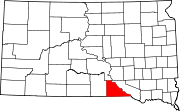 | |
| Towns | ||
| CDP | ||
|
Other communities | ||
| Indian reservation | ||
| Footnotes | ‡This populated place also has portions in an adjacent county or counties | |
43°17′23″N 99°12′59″W / 43.28972°N 99.21639°W
|
| This South Dakota state location article is a stub. You can help Wikipedia by expanding it. |
Lucas is an unincorporated community in Gregory County, in the U.S. state of South Dakota. [1] The community is located approximately eight miles west of Lake Francis Case between the north and south forks of Whetstone Creek. [2] Gregory lies approximately 12 miles to the west-southwest and Burke lies about seven miles to the south-southwest. [3]
History
A post office called Lucas was established in 1905, and remained in operation until 1985. [4] The community has the name of S. F. Lucas, a member of the town company. [5]
References
- ^ U.S. Geological Survey Geographic Names Information System: Lucas, South Dakota
- ^ Lucas, SD, 7.5 Minute Topographic Quadrangle, USGS, 1971 (1983 rev.)
- ^ Gregory, SD and Burke, SD, 7.5 Minute Topographic Quadrangle, USGS, 1964
- ^ "Gregory County". Jim Forte Postal History. Retrieved February 2, 2015.
- ^ Federal Writers' Project (1940). South Dakota place-names, v.1-3. University of South Dakota. p. 49.
Municipalities and communities of
Gregory County, South Dakota, United States | ||
|---|---|---|
| Cities | | |
| Towns | ||
| CDP | ||
|
Other communities | ||
| Indian reservation | ||
| Footnotes | ‡This populated place also has portions in an adjacent county or counties | |
43°17′23″N 99°12′59″W / 43.28972°N 99.21639°W
|
| This South Dakota state location article is a stub. You can help Wikipedia by expanding it. |