| Lowesdale New South Wales | |
|---|---|
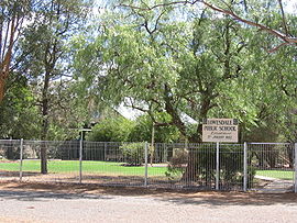
 Lowesdale Public School | |
| Coordinates | 35°51′0″S 146°22′0″E / 35.85000°S 146.36667°E |
| Population | 100 ( 2021 census) [1] |
| Postcode(s) | 2646 |
| Elevation | 132 m (433 ft) |
| Location | |
| LGA(s) | Federation Council |
| County | Hume |
| State electorate(s) | Albury |
| Federal division(s) | Farrer |
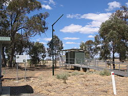
Lowesdale is a town community in Australia in the central south part of the Riverina and situated about 2 kilometres north of Buraja and 92 kilometres east of Berrigan on the Riverina Highway. At the 2021 census, Lowesdale had a population of 100. [1]
Lowesdale Post Office opened on 1 August 1876 and closed in 1994. [2]
Sport and recreation
In 1915, the small community of Lowesdale entered two football teams in the Coreen & District Football Association, Lowesdale FC and the Lowesdale Military FC [3] who went onto win the 1915 premiership. [4] Both teams went into recess in 1916 due to WW1 and neither team was ever re-established.

Notes and references
- ^ a b Australian Bureau of Statistics (28 June 2022). "Lowesdale (State Suburb)". 2021 Census QuickStats. Retrieved 19 March 2023.
- ^ Premier Postal History, Post Office List, retrieved 11 June 2009
- ^ "1915 - Lowesdale". The Corowa Free Press (NSW. 25 May 1915. p. 2. Retrieved 20 September 2021.
- ^ "1915 - Coreen Football Association". The Corowa Free Press (NSW). 31 August 1915. p. 2. Retrieved 20 September 2021.
| Lowesdale New South Wales | |
|---|---|
 Lowesdale Public School | |
| Coordinates | 35°51′0″S 146°22′0″E / 35.85000°S 146.36667°E |
| Population | 100 ( 2021 census) [1] |
| Postcode(s) | 2646 |
| Elevation | 132 m (433 ft) |
| Location | |
| LGA(s) | Federation Council |
| County | Hume |
| State electorate(s) | Albury |
| Federal division(s) | Farrer |
Lowesdale is a town community in Australia in the central south part of the Riverina and situated about 2 kilometres north of Buraja and 92 kilometres east of Berrigan on the Riverina Highway. At the 2021 census, Lowesdale had a population of 100. [1]
Lowesdale Post Office opened on 1 August 1876 and closed in 1994. [2]
Sport and recreation
In 1915, the small community of Lowesdale entered two football teams in the Coreen & District Football Association, Lowesdale FC and the Lowesdale Military FC [3] who went onto win the 1915 premiership. [4] Both teams went into recess in 1916 due to WW1 and neither team was ever re-established.

Notes and references
- ^ a b Australian Bureau of Statistics (28 June 2022). "Lowesdale (State Suburb)". 2021 Census QuickStats. Retrieved 19 March 2023.
- ^ Premier Postal History, Post Office List, retrieved 11 June 2009
- ^ "1915 - Lowesdale". The Corowa Free Press (NSW. 25 May 1915. p. 2. Retrieved 20 September 2021.
- ^ "1915 - Coreen Football Association". The Corowa Free Press (NSW). 31 August 1915. p. 2. Retrieved 20 September 2021.
