Loring, Montana | |
|---|---|
 Loring, Montana  Loring, Montana | |
| Coordinates: 48°47′32″N 107°51′42″W / 48.79222°N 107.86167°W | |
| Country | United States |
| State | Montana |
| County | Phillips |
| Elevation | 2,707 ft (825 m) |
| Time zone | UTC-7 ( Mountain (MST)) |
| • Summer ( DST) | UTC-6 (MDT) |
| ZIP code | 59537 |
| Area code | 406 |
| GNIS feature ID | 773676 [1] |
Loring is an unincorporated community in Phillips County, Montana, United States. Loring is located on U.S. Route 191, 38 miles (61 km) north of Malta and 15 miles south of the Canadian border. Loring has a post office serving ZIP code 59537, [2] a bar and grill, a vehicle repair shop, a church and homes.
Loring began as a stop on the Great Northern Railway’s branch line between Saco and Hogeland. The post office opened in 1929. [3]
Climate
According to the Köppen Climate Classification system, Loring has a semi-arid climate, abbreviated "BSk" on climate maps. [4]
References
- ^ U.S. Geological Survey Geographic Names Information System: Loring, Montana
- ^ United States Postal Service (2012). "USPS - Look Up a ZIP Code". Retrieved February 15, 2012.
- ^ "Loring". Montana Place Names Companion. Montana Historical Society. Retrieved April 5, 2021.
- ^ Climate Summary for Loring, Montana
Municipalities and communities of
Phillips County, Montana, United States | ||
|---|---|---|
| City | 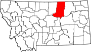 | |
| Towns | ||
| CDPs | ||
|
Other communities | ||
| Indian reservations | ||
| Footnotes | ‡This populated place also has portions in an adjacent county or counties | |
|
| This Phillips County, Montana state location article is a stub. You can help Wikipedia by expanding it. |
Loring, Montana | |
|---|---|
Loring, Montana Loring, Montana | |
| Coordinates: 48°47′32″N 107°51′42″W / 48.79222°N 107.86167°W | |
| Country | United States |
| State | Montana |
| County | Phillips |
| Elevation | 2,707 ft (825 m) |
| Time zone | UTC-7 ( Mountain (MST)) |
| • Summer ( DST) | UTC-6 (MDT) |
| ZIP code | 59537 |
| Area code | 406 |
| GNIS feature ID | 773676 [1] |
Loring is an unincorporated community in Phillips County, Montana, United States. Loring is located on U.S. Route 191, 38 miles (61 km) north of Malta and 15 miles south of the Canadian border. Loring has a post office serving ZIP code 59537, [2] a bar and grill, a vehicle repair shop, a church and homes.
Loring began as a stop on the Great Northern Railway’s branch line between Saco and Hogeland. The post office opened in 1929. [3]
Climate
According to the Köppen Climate Classification system, Loring has a semi-arid climate, abbreviated "BSk" on climate maps. [4]
References
- ^ U.S. Geological Survey Geographic Names Information System: Loring, Montana
- ^ United States Postal Service (2012). "USPS - Look Up a ZIP Code". Retrieved February 15, 2012.
- ^ "Loring". Montana Place Names Companion. Montana Historical Society. Retrieved April 5, 2021.
- ^ Climate Summary for Loring, Montana
Municipalities and communities of
Phillips County, Montana, United States | ||
|---|---|---|
| City | | |
| Towns | ||
| CDPs | ||
|
Other communities | ||
| Indian reservations | ||
| Footnotes | ‡This populated place also has portions in an adjacent county or counties | |
|
| This Phillips County, Montana state location article is a stub. You can help Wikipedia by expanding it. |