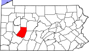
Loop was an unincorporated community in West Mahoning Township, Indiana County, Pennsylvania. [1] [2] It was named for being near a loop-like meander of Mahoning Creek. [3] Lysander Barrett settled in the area around 1842; an iron furnace was erected in 1847. [4] Before its eventual abandonment, the community had a post office (from 1885 to 1959), a schoolhouse, and a stop on the Buffalo, Rochester and Pittsburgh Railway. [4] [5]
References
- ^ U.S. Geological Survey Geographic Names Information System: Loop Retrieved 1 July 2017.
- ^ Graff, Bill (May 16, 1998). "Grafton, railroads and The Loop". The Indiana Gazette. Indiana, PA. p. 2.
- ^ Espenshade, Abraham Howry (1925). Pennsylvania Place Names. Evangelical Press. p. 311. ISBN 978-0-8063-0416-8.
- ^ a b "PastFinder Presents: Those Old Photos". The Indiana Gazette. Indiana, PA. April 21, 2012. p. 4.
- ^ "Camera Reflections: Those Old Photographs". Indiana Evening Gazette. Indiana, PA. November 16, 1974. p. 12.
40°53′59″N 79°09′56″W / 40.89972°N 79.16556°W

