Lone Oak | |
|---|---|
 Lone Oak Location within the state of Tennessee  Lone Oak Lone Oak (the United States) | |
| Coordinates: 35°12′2″N 85°21′51″W / 35.20056°N 85.36417°W | |
| Country | United States |
| State | Tennessee |
| County | Sequatchie |
| Area | |
| • Total | 6.47 sq mi (16.76 km2) |
| • Land | 6.47 sq mi (16.76 km2) |
| • Water | 0.00 sq mi (0.00 km2) |
| Elevation | 2,001 ft (610 m) |
| Population | |
| • Total | 1,198 |
| • Density | 185.11/sq mi (71.47/km2) |
| Time zone | UTC-6 ( Central (CST)) |
| • Summer ( DST) | UTC-5 (CDT) |
| ZIP codes | 37377 |
| FIPS code | 47-43420 |
| GNIS feature ID | 1291847 [2] |
Lone Oak (also Browns Chapel or Top of the Mountain) is an unincorporated community and census-designated place (CDP) in southern Sequatchie County, Tennessee, United States. It lies along U.S. Route 127 south of the city of Dunlap, the county seat of Sequatchie County. [4] Its elevation is 2,001 feet (610 m). [2] As of the 2020 census, its population was 1,198, down from 1,206 at the 2010 census. [5]
Lone Oak is part of the Chattanooga, TN– GA Metropolitan Statistical Area.
Demographics
| Census | Pop. | Note | %± |
|---|---|---|---|
| 2010 | 1,206 | — | |
| 2020 | 1,198 | −0.7% | |
| U.S. Decennial Census [6] | |||
2020 census
| Race | Number | Percentage |
|---|---|---|
| White (non-Hispanic) | 1,107 | 92.4% |
| Black or African American (non-Hispanic) | 16 | 1.34% |
| Native American | 1 | 0.08% |
| Asian | 2 | 0.17% |
| Other/Mixed | 62 | 5.18% |
| Hispanic or Latino | 10 | 0.83% |
As of the 2020 United States census, there were 1,198 people, 423 households, and 336 families residing in the CDP.
Postal service
Lone Oak does not have its own post office or zip code. It shares the zip code 37377 ( Signal Mountain) with Walden, Fairmount and Signal Mountain.
References
- ^ "ArcGIS REST Services Directory". United States Census Bureau. Retrieved October 15, 2022.
- ^ a b c U.S. Geological Survey Geographic Names Information System: Lone Oak, Tennessee
- ^ "Census Population API". United States Census Bureau. Retrieved October 15, 2022.
- ^ Rand McNally. The Road Atlas '05. Chicago: Rand McNally, 2005, p. 95.
- ^ "U.S. Census website". United States Census Bureau. Retrieved May 14, 2011.
- ^ "Census of Population and Housing". Census.gov. Retrieved June 4, 2016.
- ^ "Explore Census Data". data.census.gov. Retrieved December 26, 2021.
Municipalities and communities of
Sequatchie County, Tennessee, United States | ||
|---|---|---|
| City | 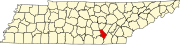 | |
| CDP | ||
|
Other communities | ||
|
| This Sequatchie County, Tennessee geography–related article is a stub. You can help Wikipedia by expanding it. |
Lone Oak | |
|---|---|
Lone Oak Location within the state of Tennessee Lone Oak Lone Oak (the United States) | |
| Coordinates: 35°12′2″N 85°21′51″W / 35.20056°N 85.36417°W | |
| Country | United States |
| State | Tennessee |
| County | Sequatchie |
| Area | |
| • Total | 6.47 sq mi (16.76 km2) |
| • Land | 6.47 sq mi (16.76 km2) |
| • Water | 0.00 sq mi (0.00 km2) |
| Elevation | 2,001 ft (610 m) |
| Population | |
| • Total | 1,198 |
| • Density | 185.11/sq mi (71.47/km2) |
| Time zone | UTC-6 ( Central (CST)) |
| • Summer ( DST) | UTC-5 (CDT) |
| ZIP codes | 37377 |
| FIPS code | 47-43420 |
| GNIS feature ID | 1291847 [2] |
Lone Oak (also Browns Chapel or Top of the Mountain) is an unincorporated community and census-designated place (CDP) in southern Sequatchie County, Tennessee, United States. It lies along U.S. Route 127 south of the city of Dunlap, the county seat of Sequatchie County. [4] Its elevation is 2,001 feet (610 m). [2] As of the 2020 census, its population was 1,198, down from 1,206 at the 2010 census. [5]
Lone Oak is part of the Chattanooga, TN– GA Metropolitan Statistical Area.
Demographics
| Census | Pop. | Note | %± |
|---|---|---|---|
| 2010 | 1,206 | — | |
| 2020 | 1,198 | −0.7% | |
| U.S. Decennial Census [6] | |||
2020 census
| Race | Number | Percentage |
|---|---|---|
| White (non-Hispanic) | 1,107 | 92.4% |
| Black or African American (non-Hispanic) | 16 | 1.34% |
| Native American | 1 | 0.08% |
| Asian | 2 | 0.17% |
| Other/Mixed | 62 | 5.18% |
| Hispanic or Latino | 10 | 0.83% |
As of the 2020 United States census, there were 1,198 people, 423 households, and 336 families residing in the CDP.
Postal service
Lone Oak does not have its own post office or zip code. It shares the zip code 37377 ( Signal Mountain) with Walden, Fairmount and Signal Mountain.
References
- ^ "ArcGIS REST Services Directory". United States Census Bureau. Retrieved October 15, 2022.
- ^ a b c U.S. Geological Survey Geographic Names Information System: Lone Oak, Tennessee
- ^ "Census Population API". United States Census Bureau. Retrieved October 15, 2022.
- ^ Rand McNally. The Road Atlas '05. Chicago: Rand McNally, 2005, p. 95.
- ^ "U.S. Census website". United States Census Bureau. Retrieved May 14, 2011.
- ^ "Census of Population and Housing". Census.gov. Retrieved June 4, 2016.
- ^ "Explore Census Data". data.census.gov. Retrieved December 26, 2021.
Municipalities and communities of
Sequatchie County, Tennessee, United States | ||
|---|---|---|
| City | | |
| CDP | ||
|
Other communities | ||
|
| This Sequatchie County, Tennessee geography–related article is a stub. You can help Wikipedia by expanding it. |