Photos • Location

There are 76 listed buildings (Swedish: byggnadsminne) in Dalarna County.
Avesta Municipality
placeholder
Borlänge Municipality
| Image | Name | Premise | Number of buildings |
Year built | Architect | Coordinates | ID |
|---|---|---|---|---|---|---|---|

|
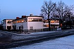
Industriskolan | Utanfors 5 Previously Stg 2948 Forsa 46:3 |
1 | 1931–1932 | Osvald Almqvist | 60°29′31″N 15°26′12″E / 60.49204°N 15.43654°E | 21300000014143 |

|
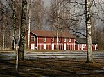
Ornässtugan | Stora Ornäs 1:2 | 4 | 16th century | 60°30′26″N 15°33′10″E / 60.50727°N 15.55283°E | 21300000014366 | |

|
Rommeheds militärläger | Norr Romme 13:6-8 | 33 | 1797–1906 | 60°26′03″N 15°30′04″E / 60.43407°N 15.50108°E | 21300000014306 |
Falun Municipality
placeholder
Gagnef Municipality
There are no listed buildings in Gagnef Municipality.
Hedemora Municipality
Leksand Municipality
placeholder
Ludvika Municipality
placeholder
Malung-Sälen Municipality
placeholder
Mora Municipality
placeholder
Orsa Municipality
placeholder
Rättvik Municipality
placeholder
Smedjebacken Municipality
placeholder
Säter Municipality
placeholder
Vansbro Municipality
placeholder
Älvdalen Municipality
placeholder
External links
Wikimedia Commons has media related to
Protected buildings in Dalarna County.
- (in Swedish) Bebyggelseregistret
There are 76 listed buildings (Swedish: byggnadsminne) in Dalarna County.
Avesta Municipality
placeholder
Borlänge Municipality
| Image | Name | Premise | Number of buildings |
Year built | Architect | Coordinates | ID |
|---|---|---|---|---|---|---|---|

|
Industriskolan | Utanfors 5 Previously Stg 2948 Forsa 46:3 |
1 | 1931–1932 | Osvald Almqvist | 60°29′31″N 15°26′12″E / 60.49204°N 15.43654°E | 21300000014143 |

|
Ornässtugan | Stora Ornäs 1:2 | 4 | 16th century | 60°30′26″N 15°33′10″E / 60.50727°N 15.55283°E | 21300000014366 | |

|
Rommeheds militärläger | Norr Romme 13:6-8 | 33 | 1797–1906 | 60°26′03″N 15°30′04″E / 60.43407°N 15.50108°E | 21300000014306 |
Falun Municipality
placeholder
Gagnef Municipality
There are no listed buildings in Gagnef Municipality.
Hedemora Municipality
Leksand Municipality
placeholder
Ludvika Municipality
placeholder
Malung-Sälen Municipality
placeholder
Mora Municipality
placeholder
Orsa Municipality
placeholder
Rättvik Municipality
placeholder
Smedjebacken Municipality
placeholder
Säter Municipality
placeholder
Vansbro Municipality
placeholder
Älvdalen Municipality
placeholder
External links
Wikimedia Commons has media related to
Protected buildings in Dalarna County.
- (in Swedish) Bebyggelseregistret


