Photos • Location

There are at least 86 named mountains in Ravalli County, Montana.
- Bald Top Mountain, 46°05′46″N 113°56′09″W / 46.09611°N 113.93583°W, el. 7,313 feet (2,229 m) [1]
- Bare Cone, 45°43′10″N 114°24′44″W / 45.71944°N 114.41222°W, el. 7,821 feet (2,384 m) [2]
- Bare Hill, 46°02′54″N 113°44′49″W / 46.04833°N 113.74694°W, el. 8,750 feet (2,670 m) [3]
- Bare Peak, 45°50′51″N 114°24′19″W / 45.84750°N 114.40528°W, el. 9,285 feet (2,830 m) [4]
- Bass Peak, 46°34′41″N 114°19′06″W / 46.57806°N 114.31833°W, el. 8,760 feet (2,670 m) [5]
- Beaver Point, 45°32′04″N 114°20′14″W / 45.53444°N 114.33722°W, el. 7,401 feet (2,256 m) [6]
- Bitterroot Mountains, 45°48′28″N 113°56′20″W / 45.80778°N 113.93889°W, el. 5,256 feet (1,602 m) [7]
- Black Bear Point, 46°08′26″N 113°55′00″W / 46.14056°N 113.91667°W, el. 7,529 feet (2,295 m) [8]
- Blacktail Point, 46°05′40″N 114°02′42″W / 46.09444°N 114.04500°W, el. 6,440 feet (1,960 m) [9]
- Blue Mountain, 45°58′17″N 113°50′28″W / 45.97139°N 113.84111°W, el. 7,454 feet (2,272 m) [10]
- Blue Nose, 45°28′22″N 114°21′32″W / 45.47278°N 114.35889°W, el. 8,642 feet (2,634 m) [11]
- Boulder Peak, 45°50′49″N 114°20′33″W / 45.84694°N 114.34250°W, el. 9,767 feet (2,977 m) [12]
- Boulder Point, 45°50′16″N 114°17′20″W / 45.83778°N 114.28889°W, el. 7,733 feet (2,357 m) [13]
- Brandy Peak, 46°06′31″N 114°19′17″W / 46.10861°N 114.32139°W, el. 7,438 feet (2,267 m) [14]
- Canyon Peak, 46°14′42″N 114°21′14″W / 46.24500°N 114.35389°W, el. 9,104 feet (2,775 m) [15]
- Castle Rock, 45°43′04″N 114°28′04″W / 45.71778°N 114.46778°W, el. 7,654 feet (2,333 m) [16]
- Chaffin Butte, 46°20′11″N 114°01′28″W / 46.33639°N 114.02444°W, el. 4,967 feet (1,514 m) [17]
- Cleveland Mountain, 46°36′54″N 113°49′00″W / 46.61500°N 113.81667°W, el. 7,329 feet (2,234 m) [18]
- Cliff Point, 45°56′23″N 113°36′33″W / 45.93972°N 113.60917°W, el. 8,333 feet (2,540 m) [19]
- Cold Spring Hill, 46°03′29″N 114°02′59″W / 46.05806°N 114.04972°W, el. 6,847 feet (2,087 m) [20]
- Como Peaks, 46°00′07″N 114°21′05″W / 46.00194°N 114.35139°W, el. 9,567 feet (2,916 m) [21]
- Coyote Peak, 45°52′06″N 114°02′05″W / 45.86833°N 114.03472°W, el. 5,000 feet (1,500 m) [22]
- Deer Creek Point, 45°34′38″N 114°25′25″W / 45.57722°N 114.42361°W, el. 8,343 feet (2,543 m) [23]
- Deer Mountain, 46°01′34″N 114°03′18″W / 46.02611°N 114.05500°W, el. 7,290 feet (2,220 m) [24]
- Dineen Hill, 46°24′32″N 114°10′52″W / 46.40889°N 114.18111°W, el. 3,625 feet (1,105 m) [25]
- Dome Shaped Mountain, 46°18′21″N 113°46′52″W / 46.30583°N 113.78111°W, el. 8,658 feet (2,639 m) [26]
- Dominic Buttes, 46°19′09″N 113°55′03″W / 46.31917°N 113.91750°W, el. 7,798 feet (2,377 m) [27]
- Dominic Point, 46°19′28″N 113°56′21″W / 46.32444°N 113.93917°W, el. 7,569 feet (2,307 m) [28]
- Don Mackey Point, 46°15′51″N 114°14′35″W / 46.26417°N 114.24306°W, el. 5,417 feet (1,651 m) [29]
- Doran Point, 45°56′48″N 114°02′33″W / 45.94667°N 114.04250°W, el. 6,253 feet (1,906 m) [30]
- Downing Mountain, 46°14′01″N 114°18′02″W / 46.23361°N 114.30056°W, el. 8,642 feet (2,634 m) [31]
- Dutch Hill, 46°19′11″N 114°11′30″W / 46.31972°N 114.19167°W, el. 3,825 feet (1,166 m) [32]
- El Capitan, 46°00′27″N 114°23′48″W / 46.00750°N 114.39667°W, el. 9,924 feet (3,025 m) [33]
- Falls Point, 45°42′01″N 114°04′00″W / 45.70028°N 114.06667°W, el. 7,982 feet (2,433 m) [34]
- Gash Point, 46°26′01″N 114°19′11″W / 46.43361°N 114.31972°W, el. 8,740 feet (2,660 m) [35]
- Goat Mountain, 46°11′59″N 114°14′57″W / 46.19972°N 114.24917°W, el. 5,978 feet (1,822 m) [36]
- Grouse Butte, 45°57′33″N 114°12′04″W / 45.95917°N 114.20111°W, el. 5,535 feet (1,687 m) [37]
- Harlan Point, 46°04′29″N 114°06′05″W / 46.07472°N 114.10139°W, el. 6,407 feet (1,953 m) [38]
- Heavenly Twins, 46°30′51″N 114°17′53″W / 46.51417°N 114.29806°W, el. 9,291 feet (2,832 m) [39]
- Hilltop, 45°49′44″N 113°51′38″W / 45.82889°N 113.86056°W, el. 7,254 feet (2,211 m) [40]
- Hughes Point, 45°40′33″N 114°01′57″W / 45.67583°N 114.03250°W, el. 8,205 feet (2,501 m) [41]
- Indian Hill, 45°47′26″N 114°32′39″W / 45.79056°N 114.54417°W, el. 8,281 feet (2,524 m) [42]
- Jew Mountain, 45°40′45″N 114°13′30″W / 45.67917°N 114.22500°W, el. 7,972 feet (2,430 m) [43]
- Jim Hell Rock, 45°50′42″N 114°00′07″W / 45.84500°N 114.00194°W, el. 4,400 feet (1,300 m) [44]
- Kent Peak, 46°03′48″N 113°47′36″W / 46.06333°N 113.79333°W, el. 8,983 feet (2,738 m) [45]
- Koch Mountain, 46°04′38″N 114°22′00″W / 46.07722°N 114.36667°W, el. 9,048 feet (2,758 m) [46]
- Lookout Mountain, 45°38′05″N 114°15′27″W / 45.63472°N 114.25750°W, el. 7,831 feet (2,387 m) [47]
- Mill Point, 46°17′25″N 114°16′45″W / 46.29028°N 114.27917°W, el. 8,415 feet (2,565 m) [48]
- Mount Jerusalem, 45°49′29″N 114°27′40″W / 45.82472°N 114.46111°W, el. 9,334 feet (2,845 m) [49]
- Mountain House, 46°14′18″N 114°00′17″W / 46.23833°N 114.00472°W, el. 5,804 feet (1,769 m) [50]
- North Trapper Peak, 45°54′03″N 114°17′25″W / 45.90083°N 114.29028°W, el. 9,741 feet (2,969 m) [51]
- Old Stormy, 46°30′18″N 114°23′01″W / 46.50500°N 114.38361°W, el. 8,169 feet (2,490 m) [52]
- Owen Point, 46°22′05″N 113°51′25″W / 46.36806°N 113.85694°W, el. 7,684 feet (2,342 m) [53]
- Palisade Mountain, 46°17′57″N 113°52′18″W / 46.29917°N 113.87167°W, el. 8,451 feet (2,576 m) [54]
- Piquett Mountain, 45°43′54″N 114°11′30″W / 45.73167°N 114.19167°W, el. 8,796 feet (2,681 m) [55]
- Pyramid Buttes, 46°37′41″N 114°15′32″W / 46.62806°N 114.25889°W, el. 8,835 feet (2,693 m) [56]
- Quartzite Mountain, 45°38′17″N 114°08′42″W / 45.63806°N 114.14500°W, el. 7,753 feet (2,363 m) [57]
- Ranger Peak, 46°30′08″N 114°23′58″W / 46.50222°N 114.39944°W, el. 8,812 feet (2,686 m) [58]
- Razorback Mountain, 45°37′37″N 114°26′45″W / 45.62694°N 114.44583°W, el. 8,553 feet (2,607 m) [59]
- Reed Butte, 46°30′32″N 113°58′45″W / 46.50889°N 113.97917°W, el. 4,731 feet (1,442 m) [60]
- Rocky Knob, 45°49′37″N 114°07′31″W / 45.82694°N 114.12528°W, el. 8,117 feet (2,474 m) [61]
- Rombo Mountain, 45°44′58″N 114°12′04″W / 45.74944°N 114.20111°W, el. 8,337 feet (2,541 m) [62]
- Saddle Mountain, 45°43′04″N 113°59′03″W / 45.71778°N 113.98417°W, el. 8,438 feet (2,572 m) [63]
- Saint Joseph Peak, 46°36′06″N 114°15′17″W / 46.60167°N 114.25472°W, el. 9,586 feet (2,922 m) [64]
- Saint Mary Peak, 46°30′42″N 114°14′40″W / 46.51167°N 114.24444°W, el. 9,321 feet (2,841 m) [65]
- School Point, 45°49′42″N 114°16′03″W / 45.82833°N 114.26750°W, el. 5,541 feet (1,689 m) [66]
- Schoolhouse Butte, 46°21′05″N 113°59′08″W / 46.35139°N 113.98556°W, el. 5,085 feet (1,550 m) [67]
- Shirley Mountain, 45°53′00″N 113°53′20″W / 45.88333°N 113.88889°W, el. 6,335 feet (1,931 m) [68]
- Shook Mountain, 45°51′44″N 114°07′16″W / 45.86222°N 114.12111°W, el. 7,562 feet (2,305 m) [69]
- Skalkaho Mountain, 46°15′51″N 113°52′37″W / 46.26417°N 113.87694°W, el. 8,448 feet (2,575 m) [70]
- Slate Point, 45°41′21″N 114°16′46″W / 45.68917°N 114.27944°W, el. 6,214 feet (1,894 m) [71]
- Sugarloaf Peak, 45°56′31″N 114°18′30″W / 45.94194°N 114.30833°W, el. 9,475 feet (2,888 m) [72]
- Sula Peak, 45°51′37″N 113°59′59″W / 45.86028°N 113.99972°W, el. 6,174 feet (1,882 m) [73]
- Sweeney Peak, 46°38′53″N 114°13′17″W / 46.64806°N 114.22139°W, el. 9,170 feet (2,800 m) [74]
- Tabor Mountain, 46°04′57″N 114°08′40″W / 46.08250°N 114.14444°W, el. 5,430 feet (1,660 m) [75]
- The Lonesome Bachelor, 45°59′59″N 114°22′27″W / 45.99972°N 114.37417°W, el. 8,970 feet (2,730 m) [76]
- Threemile Point, 46°35′40″N 113°52′12″W / 46.59444°N 113.87000°W, el. 5,942 feet (1,811 m) [77]
- Thunder Mountain, 45°34′48″N 114°16′11″W / 45.58000°N 114.26972°W, el. 7,539 feet (2,298 m) [78]
- Totem Peak, 46°22′46″N 114°23′31″W / 46.37944°N 114.39194°W, el. 8,248 feet (2,514 m) [79]
- Trapper Peak, 45°53′24″N 114°17′51″W / 45.89000°N 114.29750°W, el. 10,108 feet (3,081 m) [80]
- Ward Mountain, 46°10′09″N 114°17′08″W / 46.16917°N 114.28556°W, el. 9,108 feet (2,776 m) [81]
- West Mountain, 45°37′39″N 114°21′22″W / 45.62750°N 114.35611°W, el. 7,270 feet (2,220 m) [82]
- Whe-lha-kleh-tseen Mountain, 46°26′04″N 113°53′02″W / 46.43444°N 113.88389°W, el. 6,660 feet (2,030 m) [83]
- Whites Mountain, 46°04′23″N 114°24′47″W / 46.07306°N 114.41306°W, el. 9,157 feet (2,791 m) [84]
- Wiles Peak, 45°44′43″N 114°09′35″W / 45.74528°N 114.15972°W, el. 8,576 feet (2,614 m) [85]
- Willow Mountain, 46°19′16″N 113°54′15″W / 46.32111°N 113.90417°W, el. 8,212 feet (2,503 m) [86]
See also
Notes
- ^ "Bald Top Mountain". Geographic Names Information System. United States Geological Survey, United States Department of the Interior.
- ^ "Bare Cone". Geographic Names Information System. United States Geological Survey, United States Department of the Interior.
- ^ "Bare Hill". Geographic Names Information System. United States Geological Survey, United States Department of the Interior.
- ^ "Bare Peak". Geographic Names Information System. United States Geological Survey, United States Department of the Interior.
- ^ "Bass Peak". Geographic Names Information System. United States Geological Survey, United States Department of the Interior.
- ^ "Beaver Point". Geographic Names Information System. United States Geological Survey, United States Department of the Interior.
- ^ "Bitterroot Mountains". Geographic Names Information System. United States Geological Survey, United States Department of the Interior.
- ^ "Black Bear Point". Geographic Names Information System. United States Geological Survey, United States Department of the Interior.
- ^ "Blacktail Point". Geographic Names Information System. United States Geological Survey, United States Department of the Interior.
- ^ "Blue Mountain". Geographic Names Information System. United States Geological Survey, United States Department of the Interior.
- ^ "Blue Nose". Geographic Names Information System. United States Geological Survey, United States Department of the Interior.
- ^ "Boulder Peak". Geographic Names Information System. United States Geological Survey, United States Department of the Interior.
- ^ "Boulder Point". Geographic Names Information System. United States Geological Survey, United States Department of the Interior.
- ^ "Brandy Peak". Geographic Names Information System. United States Geological Survey, United States Department of the Interior.
- ^ "Canyon Peak". Geographic Names Information System. United States Geological Survey, United States Department of the Interior.
- ^ "Castle Rock". Geographic Names Information System. United States Geological Survey, United States Department of the Interior.
- ^ "Chaffin Butte". Geographic Names Information System. United States Geological Survey, United States Department of the Interior.
- ^ "Cleveland Mountain". Geographic Names Information System. United States Geological Survey, United States Department of the Interior.
- ^ "Cliff Point". Geographic Names Information System. United States Geological Survey, United States Department of the Interior.
- ^ "Cold Spring Hill". Geographic Names Information System. United States Geological Survey, United States Department of the Interior.
- ^ "Como Peaks". Geographic Names Information System. United States Geological Survey, United States Department of the Interior.
- ^ "Coyote Peak". Geographic Names Information System. United States Geological Survey, United States Department of the Interior.
- ^ "Deer Creek Point". Geographic Names Information System. United States Geological Survey, United States Department of the Interior.
- ^ "Deer Mountain". Geographic Names Information System. United States Geological Survey, United States Department of the Interior.
- ^ "Dineen Hill". Geographic Names Information System. United States Geological Survey, United States Department of the Interior.
- ^ "Dome Shaped Mountain". Geographic Names Information System. United States Geological Survey, United States Department of the Interior.
- ^ "Dominic Buttes". Geographic Names Information System. United States Geological Survey, United States Department of the Interior.
- ^ "Dominic Point". Geographic Names Information System. United States Geological Survey, United States Department of the Interior.
- ^ "Don Mackey Point". Geographic Names Information System. United States Geological Survey, United States Department of the Interior.
- ^ "Doran Point". Geographic Names Information System. United States Geological Survey, United States Department of the Interior.
- ^ "Downing Mountain". Geographic Names Information System. United States Geological Survey, United States Department of the Interior.
- ^ "Dutch Hill". Geographic Names Information System. United States Geological Survey, United States Department of the Interior.
- ^ "El Capitan". Geographic Names Information System. United States Geological Survey, United States Department of the Interior.
- ^ "Falls Point". Geographic Names Information System. United States Geological Survey, United States Department of the Interior.
- ^ "Gash Point". Geographic Names Information System. United States Geological Survey, United States Department of the Interior.
- ^ "Goat Mountain". Geographic Names Information System. United States Geological Survey, United States Department of the Interior.
- ^ "Grouse Butte". Geographic Names Information System. United States Geological Survey, United States Department of the Interior.
- ^ "Harlan Point". Geographic Names Information System. United States Geological Survey, United States Department of the Interior.
- ^ "Heavenly Twins". Geographic Names Information System. United States Geological Survey, United States Department of the Interior.
- ^ "Hilltop". Geographic Names Information System. United States Geological Survey, United States Department of the Interior.
- ^ "Hughes Point". Geographic Names Information System. United States Geological Survey, United States Department of the Interior.
- ^ "Indian Hill". Geographic Names Information System. United States Geological Survey, United States Department of the Interior.
- ^ "Jew Mountain". Geographic Names Information System. United States Geological Survey, United States Department of the Interior.
- ^ "Jim Hell Rock". Geographic Names Information System. United States Geological Survey, United States Department of the Interior.
- ^ "Kent Peak". Geographic Names Information System. United States Geological Survey, United States Department of the Interior.
- ^ "Koch Mountain". Geographic Names Information System. United States Geological Survey, United States Department of the Interior.
- ^ "Lookout Mountain". Geographic Names Information System. United States Geological Survey, United States Department of the Interior.
- ^ "Mill Point". Geographic Names Information System. United States Geological Survey, United States Department of the Interior.
- ^ "Mount Jerusalem". Geographic Names Information System. United States Geological Survey, United States Department of the Interior.
- ^ "Mountain House". Geographic Names Information System. United States Geological Survey, United States Department of the Interior.
- ^ "North Trapper Peak". Geographic Names Information System. United States Geological Survey, United States Department of the Interior.
- ^ "Old Stormy". Geographic Names Information System. United States Geological Survey, United States Department of the Interior.
- ^ "Owen Point". Geographic Names Information System. United States Geological Survey, United States Department of the Interior.
- ^ "Palisade Mountain". Geographic Names Information System. United States Geological Survey, United States Department of the Interior.
- ^ "Piquett Mountain". Geographic Names Information System. United States Geological Survey, United States Department of the Interior.
- ^ "Pyramid Buttes". Geographic Names Information System. United States Geological Survey, United States Department of the Interior.
- ^ "Quartzite Mountain". Geographic Names Information System. United States Geological Survey, United States Department of the Interior.
- ^ "Ranger Peak". Geographic Names Information System. United States Geological Survey, United States Department of the Interior.
- ^ "Razorback Mountain". Geographic Names Information System. United States Geological Survey, United States Department of the Interior.
- ^ "Reed Butte". Geographic Names Information System. United States Geological Survey, United States Department of the Interior.
- ^ "Rocky Knob". Geographic Names Information System. United States Geological Survey, United States Department of the Interior.
- ^ "Rombo Mountain". Geographic Names Information System. United States Geological Survey, United States Department of the Interior.
- ^ "Saddle Mountain". Geographic Names Information System. United States Geological Survey, United States Department of the Interior.
- ^ "Saint Joseph Peak". Geographic Names Information System. United States Geological Survey, United States Department of the Interior.
- ^ "Saint Mary Peak". Geographic Names Information System. United States Geological Survey, United States Department of the Interior.
- ^ "School Point". Geographic Names Information System. United States Geological Survey, United States Department of the Interior.
- ^ "Schoolhouse Butte". Geographic Names Information System. United States Geological Survey, United States Department of the Interior.
- ^ "Shirley Mountain". Geographic Names Information System. United States Geological Survey, United States Department of the Interior.
- ^ "Shook Mountain". Geographic Names Information System. United States Geological Survey, United States Department of the Interior.
- ^ "Skalkaho Mountain". Geographic Names Information System. United States Geological Survey, United States Department of the Interior.
- ^ "Slate Point". Geographic Names Information System. United States Geological Survey, United States Department of the Interior.
- ^ "Sugarloaf Peak". Geographic Names Information System. United States Geological Survey, United States Department of the Interior.
- ^ "Sula Peak". Geographic Names Information System. United States Geological Survey, United States Department of the Interior.
- ^ "Sweeney Peak". Geographic Names Information System. United States Geological Survey, United States Department of the Interior.
- ^ "Tabor Mountain". Geographic Names Information System. United States Geological Survey, United States Department of the Interior.
- ^ "The Lonesome Bachelor". Geographic Names Information System. United States Geological Survey, United States Department of the Interior.
- ^ "Threemile Point". Geographic Names Information System. United States Geological Survey, United States Department of the Interior.
- ^ "Thunder Mountain". Geographic Names Information System. United States Geological Survey, United States Department of the Interior.
- ^ "Totem Peak". Geographic Names Information System. United States Geological Survey, United States Department of the Interior.
- ^ "Trapper Peak". Geographic Names Information System. United States Geological Survey, United States Department of the Interior.
- ^ "Ward Mountain". Geographic Names Information System. United States Geological Survey, United States Department of the Interior.
- ^ "West Mountain". Geographic Names Information System. United States Geological Survey, United States Department of the Interior.
- ^ "Whe-lha-kleh-tseen Mountain". Geographic Names Information System. United States Geological Survey, United States Department of the Interior.
- ^ "Whites Mountain". Geographic Names Information System. United States Geological Survey, United States Department of the Interior.
- ^ "Wiles Peak". Geographic Names Information System. United States Geological Survey, United States Department of the Interior.
- ^ "Willow Mountain". Geographic Names Information System. United States Geological Survey, United States Department of the Interior.
Municipalities and communities of
Ravalli County, Montana, United States | ||
|---|---|---|
| City | 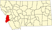 | |
| Towns | ||
| CDPs | ||
|
Other communities | ||
There are at least 86 named mountains in Ravalli County, Montana.
- Bald Top Mountain, 46°05′46″N 113°56′09″W / 46.09611°N 113.93583°W, el. 7,313 feet (2,229 m) [1]
- Bare Cone, 45°43′10″N 114°24′44″W / 45.71944°N 114.41222°W, el. 7,821 feet (2,384 m) [2]
- Bare Hill, 46°02′54″N 113°44′49″W / 46.04833°N 113.74694°W, el. 8,750 feet (2,670 m) [3]
- Bare Peak, 45°50′51″N 114°24′19″W / 45.84750°N 114.40528°W, el. 9,285 feet (2,830 m) [4]
- Bass Peak, 46°34′41″N 114°19′06″W / 46.57806°N 114.31833°W, el. 8,760 feet (2,670 m) [5]
- Beaver Point, 45°32′04″N 114°20′14″W / 45.53444°N 114.33722°W, el. 7,401 feet (2,256 m) [6]
- Bitterroot Mountains, 45°48′28″N 113°56′20″W / 45.80778°N 113.93889°W, el. 5,256 feet (1,602 m) [7]
- Black Bear Point, 46°08′26″N 113°55′00″W / 46.14056°N 113.91667°W, el. 7,529 feet (2,295 m) [8]
- Blacktail Point, 46°05′40″N 114°02′42″W / 46.09444°N 114.04500°W, el. 6,440 feet (1,960 m) [9]
- Blue Mountain, 45°58′17″N 113°50′28″W / 45.97139°N 113.84111°W, el. 7,454 feet (2,272 m) [10]
- Blue Nose, 45°28′22″N 114°21′32″W / 45.47278°N 114.35889°W, el. 8,642 feet (2,634 m) [11]
- Boulder Peak, 45°50′49″N 114°20′33″W / 45.84694°N 114.34250°W, el. 9,767 feet (2,977 m) [12]
- Boulder Point, 45°50′16″N 114°17′20″W / 45.83778°N 114.28889°W, el. 7,733 feet (2,357 m) [13]
- Brandy Peak, 46°06′31″N 114°19′17″W / 46.10861°N 114.32139°W, el. 7,438 feet (2,267 m) [14]
- Canyon Peak, 46°14′42″N 114°21′14″W / 46.24500°N 114.35389°W, el. 9,104 feet (2,775 m) [15]
- Castle Rock, 45°43′04″N 114°28′04″W / 45.71778°N 114.46778°W, el. 7,654 feet (2,333 m) [16]
- Chaffin Butte, 46°20′11″N 114°01′28″W / 46.33639°N 114.02444°W, el. 4,967 feet (1,514 m) [17]
- Cleveland Mountain, 46°36′54″N 113°49′00″W / 46.61500°N 113.81667°W, el. 7,329 feet (2,234 m) [18]
- Cliff Point, 45°56′23″N 113°36′33″W / 45.93972°N 113.60917°W, el. 8,333 feet (2,540 m) [19]
- Cold Spring Hill, 46°03′29″N 114°02′59″W / 46.05806°N 114.04972°W, el. 6,847 feet (2,087 m) [20]
- Como Peaks, 46°00′07″N 114°21′05″W / 46.00194°N 114.35139°W, el. 9,567 feet (2,916 m) [21]
- Coyote Peak, 45°52′06″N 114°02′05″W / 45.86833°N 114.03472°W, el. 5,000 feet (1,500 m) [22]
- Deer Creek Point, 45°34′38″N 114°25′25″W / 45.57722°N 114.42361°W, el. 8,343 feet (2,543 m) [23]
- Deer Mountain, 46°01′34″N 114°03′18″W / 46.02611°N 114.05500°W, el. 7,290 feet (2,220 m) [24]
- Dineen Hill, 46°24′32″N 114°10′52″W / 46.40889°N 114.18111°W, el. 3,625 feet (1,105 m) [25]
- Dome Shaped Mountain, 46°18′21″N 113°46′52″W / 46.30583°N 113.78111°W, el. 8,658 feet (2,639 m) [26]
- Dominic Buttes, 46°19′09″N 113°55′03″W / 46.31917°N 113.91750°W, el. 7,798 feet (2,377 m) [27]
- Dominic Point, 46°19′28″N 113°56′21″W / 46.32444°N 113.93917°W, el. 7,569 feet (2,307 m) [28]
- Don Mackey Point, 46°15′51″N 114°14′35″W / 46.26417°N 114.24306°W, el. 5,417 feet (1,651 m) [29]
- Doran Point, 45°56′48″N 114°02′33″W / 45.94667°N 114.04250°W, el. 6,253 feet (1,906 m) [30]
- Downing Mountain, 46°14′01″N 114°18′02″W / 46.23361°N 114.30056°W, el. 8,642 feet (2,634 m) [31]
- Dutch Hill, 46°19′11″N 114°11′30″W / 46.31972°N 114.19167°W, el. 3,825 feet (1,166 m) [32]
- El Capitan, 46°00′27″N 114°23′48″W / 46.00750°N 114.39667°W, el. 9,924 feet (3,025 m) [33]
- Falls Point, 45°42′01″N 114°04′00″W / 45.70028°N 114.06667°W, el. 7,982 feet (2,433 m) [34]
- Gash Point, 46°26′01″N 114°19′11″W / 46.43361°N 114.31972°W, el. 8,740 feet (2,660 m) [35]
- Goat Mountain, 46°11′59″N 114°14′57″W / 46.19972°N 114.24917°W, el. 5,978 feet (1,822 m) [36]
- Grouse Butte, 45°57′33″N 114°12′04″W / 45.95917°N 114.20111°W, el. 5,535 feet (1,687 m) [37]
- Harlan Point, 46°04′29″N 114°06′05″W / 46.07472°N 114.10139°W, el. 6,407 feet (1,953 m) [38]
- Heavenly Twins, 46°30′51″N 114°17′53″W / 46.51417°N 114.29806°W, el. 9,291 feet (2,832 m) [39]
- Hilltop, 45°49′44″N 113°51′38″W / 45.82889°N 113.86056°W, el. 7,254 feet (2,211 m) [40]
- Hughes Point, 45°40′33″N 114°01′57″W / 45.67583°N 114.03250°W, el. 8,205 feet (2,501 m) [41]
- Indian Hill, 45°47′26″N 114°32′39″W / 45.79056°N 114.54417°W, el. 8,281 feet (2,524 m) [42]
- Jew Mountain, 45°40′45″N 114°13′30″W / 45.67917°N 114.22500°W, el. 7,972 feet (2,430 m) [43]
- Jim Hell Rock, 45°50′42″N 114°00′07″W / 45.84500°N 114.00194°W, el. 4,400 feet (1,300 m) [44]
- Kent Peak, 46°03′48″N 113°47′36″W / 46.06333°N 113.79333°W, el. 8,983 feet (2,738 m) [45]
- Koch Mountain, 46°04′38″N 114°22′00″W / 46.07722°N 114.36667°W, el. 9,048 feet (2,758 m) [46]
- Lookout Mountain, 45°38′05″N 114°15′27″W / 45.63472°N 114.25750°W, el. 7,831 feet (2,387 m) [47]
- Mill Point, 46°17′25″N 114°16′45″W / 46.29028°N 114.27917°W, el. 8,415 feet (2,565 m) [48]
- Mount Jerusalem, 45°49′29″N 114°27′40″W / 45.82472°N 114.46111°W, el. 9,334 feet (2,845 m) [49]
- Mountain House, 46°14′18″N 114°00′17″W / 46.23833°N 114.00472°W, el. 5,804 feet (1,769 m) [50]
- North Trapper Peak, 45°54′03″N 114°17′25″W / 45.90083°N 114.29028°W, el. 9,741 feet (2,969 m) [51]
- Old Stormy, 46°30′18″N 114°23′01″W / 46.50500°N 114.38361°W, el. 8,169 feet (2,490 m) [52]
- Owen Point, 46°22′05″N 113°51′25″W / 46.36806°N 113.85694°W, el. 7,684 feet (2,342 m) [53]
- Palisade Mountain, 46°17′57″N 113°52′18″W / 46.29917°N 113.87167°W, el. 8,451 feet (2,576 m) [54]
- Piquett Mountain, 45°43′54″N 114°11′30″W / 45.73167°N 114.19167°W, el. 8,796 feet (2,681 m) [55]
- Pyramid Buttes, 46°37′41″N 114°15′32″W / 46.62806°N 114.25889°W, el. 8,835 feet (2,693 m) [56]
- Quartzite Mountain, 45°38′17″N 114°08′42″W / 45.63806°N 114.14500°W, el. 7,753 feet (2,363 m) [57]
- Ranger Peak, 46°30′08″N 114°23′58″W / 46.50222°N 114.39944°W, el. 8,812 feet (2,686 m) [58]
- Razorback Mountain, 45°37′37″N 114°26′45″W / 45.62694°N 114.44583°W, el. 8,553 feet (2,607 m) [59]
- Reed Butte, 46°30′32″N 113°58′45″W / 46.50889°N 113.97917°W, el. 4,731 feet (1,442 m) [60]
- Rocky Knob, 45°49′37″N 114°07′31″W / 45.82694°N 114.12528°W, el. 8,117 feet (2,474 m) [61]
- Rombo Mountain, 45°44′58″N 114°12′04″W / 45.74944°N 114.20111°W, el. 8,337 feet (2,541 m) [62]
- Saddle Mountain, 45°43′04″N 113°59′03″W / 45.71778°N 113.98417°W, el. 8,438 feet (2,572 m) [63]
- Saint Joseph Peak, 46°36′06″N 114°15′17″W / 46.60167°N 114.25472°W, el. 9,586 feet (2,922 m) [64]
- Saint Mary Peak, 46°30′42″N 114°14′40″W / 46.51167°N 114.24444°W, el. 9,321 feet (2,841 m) [65]
- School Point, 45°49′42″N 114°16′03″W / 45.82833°N 114.26750°W, el. 5,541 feet (1,689 m) [66]
- Schoolhouse Butte, 46°21′05″N 113°59′08″W / 46.35139°N 113.98556°W, el. 5,085 feet (1,550 m) [67]
- Shirley Mountain, 45°53′00″N 113°53′20″W / 45.88333°N 113.88889°W, el. 6,335 feet (1,931 m) [68]
- Shook Mountain, 45°51′44″N 114°07′16″W / 45.86222°N 114.12111°W, el. 7,562 feet (2,305 m) [69]
- Skalkaho Mountain, 46°15′51″N 113°52′37″W / 46.26417°N 113.87694°W, el. 8,448 feet (2,575 m) [70]
- Slate Point, 45°41′21″N 114°16′46″W / 45.68917°N 114.27944°W, el. 6,214 feet (1,894 m) [71]
- Sugarloaf Peak, 45°56′31″N 114°18′30″W / 45.94194°N 114.30833°W, el. 9,475 feet (2,888 m) [72]
- Sula Peak, 45°51′37″N 113°59′59″W / 45.86028°N 113.99972°W, el. 6,174 feet (1,882 m) [73]
- Sweeney Peak, 46°38′53″N 114°13′17″W / 46.64806°N 114.22139°W, el. 9,170 feet (2,800 m) [74]
- Tabor Mountain, 46°04′57″N 114°08′40″W / 46.08250°N 114.14444°W, el. 5,430 feet (1,660 m) [75]
- The Lonesome Bachelor, 45°59′59″N 114°22′27″W / 45.99972°N 114.37417°W, el. 8,970 feet (2,730 m) [76]
- Threemile Point, 46°35′40″N 113°52′12″W / 46.59444°N 113.87000°W, el. 5,942 feet (1,811 m) [77]
- Thunder Mountain, 45°34′48″N 114°16′11″W / 45.58000°N 114.26972°W, el. 7,539 feet (2,298 m) [78]
- Totem Peak, 46°22′46″N 114°23′31″W / 46.37944°N 114.39194°W, el. 8,248 feet (2,514 m) [79]
- Trapper Peak, 45°53′24″N 114°17′51″W / 45.89000°N 114.29750°W, el. 10,108 feet (3,081 m) [80]
- Ward Mountain, 46°10′09″N 114°17′08″W / 46.16917°N 114.28556°W, el. 9,108 feet (2,776 m) [81]
- West Mountain, 45°37′39″N 114°21′22″W / 45.62750°N 114.35611°W, el. 7,270 feet (2,220 m) [82]
- Whe-lha-kleh-tseen Mountain, 46°26′04″N 113°53′02″W / 46.43444°N 113.88389°W, el. 6,660 feet (2,030 m) [83]
- Whites Mountain, 46°04′23″N 114°24′47″W / 46.07306°N 114.41306°W, el. 9,157 feet (2,791 m) [84]
- Wiles Peak, 45°44′43″N 114°09′35″W / 45.74528°N 114.15972°W, el. 8,576 feet (2,614 m) [85]
- Willow Mountain, 46°19′16″N 113°54′15″W / 46.32111°N 113.90417°W, el. 8,212 feet (2,503 m) [86]
See also
Notes
- ^ "Bald Top Mountain". Geographic Names Information System. United States Geological Survey, United States Department of the Interior.
- ^ "Bare Cone". Geographic Names Information System. United States Geological Survey, United States Department of the Interior.
- ^ "Bare Hill". Geographic Names Information System. United States Geological Survey, United States Department of the Interior.
- ^ "Bare Peak". Geographic Names Information System. United States Geological Survey, United States Department of the Interior.
- ^ "Bass Peak". Geographic Names Information System. United States Geological Survey, United States Department of the Interior.
- ^ "Beaver Point". Geographic Names Information System. United States Geological Survey, United States Department of the Interior.
- ^ "Bitterroot Mountains". Geographic Names Information System. United States Geological Survey, United States Department of the Interior.
- ^ "Black Bear Point". Geographic Names Information System. United States Geological Survey, United States Department of the Interior.
- ^ "Blacktail Point". Geographic Names Information System. United States Geological Survey, United States Department of the Interior.
- ^ "Blue Mountain". Geographic Names Information System. United States Geological Survey, United States Department of the Interior.
- ^ "Blue Nose". Geographic Names Information System. United States Geological Survey, United States Department of the Interior.
- ^ "Boulder Peak". Geographic Names Information System. United States Geological Survey, United States Department of the Interior.
- ^ "Boulder Point". Geographic Names Information System. United States Geological Survey, United States Department of the Interior.
- ^ "Brandy Peak". Geographic Names Information System. United States Geological Survey, United States Department of the Interior.
- ^ "Canyon Peak". Geographic Names Information System. United States Geological Survey, United States Department of the Interior.
- ^ "Castle Rock". Geographic Names Information System. United States Geological Survey, United States Department of the Interior.
- ^ "Chaffin Butte". Geographic Names Information System. United States Geological Survey, United States Department of the Interior.
- ^ "Cleveland Mountain". Geographic Names Information System. United States Geological Survey, United States Department of the Interior.
- ^ "Cliff Point". Geographic Names Information System. United States Geological Survey, United States Department of the Interior.
- ^ "Cold Spring Hill". Geographic Names Information System. United States Geological Survey, United States Department of the Interior.
- ^ "Como Peaks". Geographic Names Information System. United States Geological Survey, United States Department of the Interior.
- ^ "Coyote Peak". Geographic Names Information System. United States Geological Survey, United States Department of the Interior.
- ^ "Deer Creek Point". Geographic Names Information System. United States Geological Survey, United States Department of the Interior.
- ^ "Deer Mountain". Geographic Names Information System. United States Geological Survey, United States Department of the Interior.
- ^ "Dineen Hill". Geographic Names Information System. United States Geological Survey, United States Department of the Interior.
- ^ "Dome Shaped Mountain". Geographic Names Information System. United States Geological Survey, United States Department of the Interior.
- ^ "Dominic Buttes". Geographic Names Information System. United States Geological Survey, United States Department of the Interior.
- ^ "Dominic Point". Geographic Names Information System. United States Geological Survey, United States Department of the Interior.
- ^ "Don Mackey Point". Geographic Names Information System. United States Geological Survey, United States Department of the Interior.
- ^ "Doran Point". Geographic Names Information System. United States Geological Survey, United States Department of the Interior.
- ^ "Downing Mountain". Geographic Names Information System. United States Geological Survey, United States Department of the Interior.
- ^ "Dutch Hill". Geographic Names Information System. United States Geological Survey, United States Department of the Interior.
- ^ "El Capitan". Geographic Names Information System. United States Geological Survey, United States Department of the Interior.
- ^ "Falls Point". Geographic Names Information System. United States Geological Survey, United States Department of the Interior.
- ^ "Gash Point". Geographic Names Information System. United States Geological Survey, United States Department of the Interior.
- ^ "Goat Mountain". Geographic Names Information System. United States Geological Survey, United States Department of the Interior.
- ^ "Grouse Butte". Geographic Names Information System. United States Geological Survey, United States Department of the Interior.
- ^ "Harlan Point". Geographic Names Information System. United States Geological Survey, United States Department of the Interior.
- ^ "Heavenly Twins". Geographic Names Information System. United States Geological Survey, United States Department of the Interior.
- ^ "Hilltop". Geographic Names Information System. United States Geological Survey, United States Department of the Interior.
- ^ "Hughes Point". Geographic Names Information System. United States Geological Survey, United States Department of the Interior.
- ^ "Indian Hill". Geographic Names Information System. United States Geological Survey, United States Department of the Interior.
- ^ "Jew Mountain". Geographic Names Information System. United States Geological Survey, United States Department of the Interior.
- ^ "Jim Hell Rock". Geographic Names Information System. United States Geological Survey, United States Department of the Interior.
- ^ "Kent Peak". Geographic Names Information System. United States Geological Survey, United States Department of the Interior.
- ^ "Koch Mountain". Geographic Names Information System. United States Geological Survey, United States Department of the Interior.
- ^ "Lookout Mountain". Geographic Names Information System. United States Geological Survey, United States Department of the Interior.
- ^ "Mill Point". Geographic Names Information System. United States Geological Survey, United States Department of the Interior.
- ^ "Mount Jerusalem". Geographic Names Information System. United States Geological Survey, United States Department of the Interior.
- ^ "Mountain House". Geographic Names Information System. United States Geological Survey, United States Department of the Interior.
- ^ "North Trapper Peak". Geographic Names Information System. United States Geological Survey, United States Department of the Interior.
- ^ "Old Stormy". Geographic Names Information System. United States Geological Survey, United States Department of the Interior.
- ^ "Owen Point". Geographic Names Information System. United States Geological Survey, United States Department of the Interior.
- ^ "Palisade Mountain". Geographic Names Information System. United States Geological Survey, United States Department of the Interior.
- ^ "Piquett Mountain". Geographic Names Information System. United States Geological Survey, United States Department of the Interior.
- ^ "Pyramid Buttes". Geographic Names Information System. United States Geological Survey, United States Department of the Interior.
- ^ "Quartzite Mountain". Geographic Names Information System. United States Geological Survey, United States Department of the Interior.
- ^ "Ranger Peak". Geographic Names Information System. United States Geological Survey, United States Department of the Interior.
- ^ "Razorback Mountain". Geographic Names Information System. United States Geological Survey, United States Department of the Interior.
- ^ "Reed Butte". Geographic Names Information System. United States Geological Survey, United States Department of the Interior.
- ^ "Rocky Knob". Geographic Names Information System. United States Geological Survey, United States Department of the Interior.
- ^ "Rombo Mountain". Geographic Names Information System. United States Geological Survey, United States Department of the Interior.
- ^ "Saddle Mountain". Geographic Names Information System. United States Geological Survey, United States Department of the Interior.
- ^ "Saint Joseph Peak". Geographic Names Information System. United States Geological Survey, United States Department of the Interior.
- ^ "Saint Mary Peak". Geographic Names Information System. United States Geological Survey, United States Department of the Interior.
- ^ "School Point". Geographic Names Information System. United States Geological Survey, United States Department of the Interior.
- ^ "Schoolhouse Butte". Geographic Names Information System. United States Geological Survey, United States Department of the Interior.
- ^ "Shirley Mountain". Geographic Names Information System. United States Geological Survey, United States Department of the Interior.
- ^ "Shook Mountain". Geographic Names Information System. United States Geological Survey, United States Department of the Interior.
- ^ "Skalkaho Mountain". Geographic Names Information System. United States Geological Survey, United States Department of the Interior.
- ^ "Slate Point". Geographic Names Information System. United States Geological Survey, United States Department of the Interior.
- ^ "Sugarloaf Peak". Geographic Names Information System. United States Geological Survey, United States Department of the Interior.
- ^ "Sula Peak". Geographic Names Information System. United States Geological Survey, United States Department of the Interior.
- ^ "Sweeney Peak". Geographic Names Information System. United States Geological Survey, United States Department of the Interior.
- ^ "Tabor Mountain". Geographic Names Information System. United States Geological Survey, United States Department of the Interior.
- ^ "The Lonesome Bachelor". Geographic Names Information System. United States Geological Survey, United States Department of the Interior.
- ^ "Threemile Point". Geographic Names Information System. United States Geological Survey, United States Department of the Interior.
- ^ "Thunder Mountain". Geographic Names Information System. United States Geological Survey, United States Department of the Interior.
- ^ "Totem Peak". Geographic Names Information System. United States Geological Survey, United States Department of the Interior.
- ^ "Trapper Peak". Geographic Names Information System. United States Geological Survey, United States Department of the Interior.
- ^ "Ward Mountain". Geographic Names Information System. United States Geological Survey, United States Department of the Interior.
- ^ "West Mountain". Geographic Names Information System. United States Geological Survey, United States Department of the Interior.
- ^ "Whe-lha-kleh-tseen Mountain". Geographic Names Information System. United States Geological Survey, United States Department of the Interior.
- ^ "Whites Mountain". Geographic Names Information System. United States Geological Survey, United States Department of the Interior.
- ^ "Wiles Peak". Geographic Names Information System. United States Geological Survey, United States Department of the Interior.
- ^ "Willow Mountain". Geographic Names Information System. United States Geological Survey, United States Department of the Interior.
Municipalities and communities of
Ravalli County, Montana, United States | ||
|---|---|---|
| City | | |
| Towns | ||
| CDPs | ||
|
Other communities | ||