Photos • Location

There are at least 7 named lakes and reservoirs in Dallas County, Arkansas.
Lakes
- Shell Lake, 33°49′23″N 092°51′3″W / 33.82306°N 92.85083°W, el. 121 feet (37 m) [1]
- Long Lake, 33°53′31″N 092°53′1″W / 33.89194°N 92.88361°W, el. 131 feet (40 m) [2]
- Round Lake, 33°52′49″N 092°52′9″W / 33.88028°N 92.86917°W, el. 138 feet (42 m) [3]
- Horseshoe Lake, 33°48′39″N 092°53′9″W / 33.81083°N 92.88583°W, el. 118 feet (36 m) [4]
Reservoirs
- Lake Lansdale, 35°47′57″N 092°27′43″W / 35.79917°N 92.46194°W, el. 299 feet (91 m) [5]
- Jacobs Lake, 33°50′54″N 092°28′48″W / 33.84833°N 92.48000°W, el. 285 feet (87 m) [6]
- Kervin Lake Number One, 33°51′31″N 092°26′00″W / 33.85861°N 92.43333°W, el. 262 feet (80 m) [7]
See also
Notes
- ^ "Shell Lake". Geographic Names Information System. United States Geological Survey, United States Department of the Interior.
- ^ "Long Lake". Geographic Names Information System. United States Geological Survey, United States Department of the Interior.
- ^ "Round Lake". Geographic Names Information System. United States Geological Survey, United States Department of the Interior.
- ^ "Horseshoe Lake". Geographic Names Information System. United States Geological Survey, United States Department of the Interior.
- ^ "Lake Lansdale". Geographic Names Information System. United States Geological Survey, United States Department of the Interior.
- ^ "Jacobs Lake". Geographic Names Information System. United States Geological Survey, United States Department of the Interior.
- ^ "Kervin Lake Number One". Geographic Names Information System. United States Geological Survey, United States Department of the Interior.
Municipalities and communities of
Dallas County, Arkansas, United States | ||
|---|---|---|
| Cities | 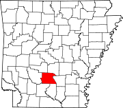 | |
| CDPs | ||
|
Unincorporated communities | ||
There are at least 7 named lakes and reservoirs in Dallas County, Arkansas.
Lakes
- Shell Lake, 33°49′23″N 092°51′3″W / 33.82306°N 92.85083°W, el. 121 feet (37 m) [1]
- Long Lake, 33°53′31″N 092°53′1″W / 33.89194°N 92.88361°W, el. 131 feet (40 m) [2]
- Round Lake, 33°52′49″N 092°52′9″W / 33.88028°N 92.86917°W, el. 138 feet (42 m) [3]
- Horseshoe Lake, 33°48′39″N 092°53′9″W / 33.81083°N 92.88583°W, el. 118 feet (36 m) [4]
Reservoirs
- Lake Lansdale, 35°47′57″N 092°27′43″W / 35.79917°N 92.46194°W, el. 299 feet (91 m) [5]
- Jacobs Lake, 33°50′54″N 092°28′48″W / 33.84833°N 92.48000°W, el. 285 feet (87 m) [6]
- Kervin Lake Number One, 33°51′31″N 092°26′00″W / 33.85861°N 92.43333°W, el. 262 feet (80 m) [7]
See also
Notes
- ^ "Shell Lake". Geographic Names Information System. United States Geological Survey, United States Department of the Interior.
- ^ "Long Lake". Geographic Names Information System. United States Geological Survey, United States Department of the Interior.
- ^ "Round Lake". Geographic Names Information System. United States Geological Survey, United States Department of the Interior.
- ^ "Horseshoe Lake". Geographic Names Information System. United States Geological Survey, United States Department of the Interior.
- ^ "Lake Lansdale". Geographic Names Information System. United States Geological Survey, United States Department of the Interior.
- ^ "Jacobs Lake". Geographic Names Information System. United States Geological Survey, United States Department of the Interior.
- ^ "Kervin Lake Number One". Geographic Names Information System. United States Geological Survey, United States Department of the Interior.
Municipalities and communities of
Dallas County, Arkansas, United States | ||
|---|---|---|
| Cities | | |
| CDPs | ||
|
Unincorporated communities | ||