Photos • Location

There are at least 52 named lakes and reservoirs in Carter County, Montana.
Lakes
- Soda Lakes, 45°43′38″N 104°30′24″W / 45.72722°N 104.50667°W, el. 3,278 feet (999 m) [1]
Reservoirs
- Abel Reservoir, 45°43′31″N 104°11′20″W / 45.72528°N 104.18889°W, el. 3,510 feet (1,070 m) [2]
- Apache Reservoir, 45°40′27″N 104°36′17″W / 45.67417°N 104.60472°W, el. 3,369 feet (1,027 m) [3]
- Bar C Reservoir, 45°47′40″N 104°13′13″W / 45.79444°N 104.22028°W, el. 3,287 feet (1,002 m) [4]
- Blackfoot Reservoir, 45°41′04″N 104°31′51″W / 45.68444°N 104.53083°W, el. 3,251 feet (991 m) [5]
- Brewer Reservoir, 45°36′28″N 104°14′02″W / 45.60778°N 104.23389°W, el. 3,839 feet (1,170 m) [6]
- Bucholtz Reservoir, 45°35′09″N 104°03′39″W / 45.58583°N 104.06083°W, el. 3,399 feet (1,036 m) [7]
- Burditt Reservoir, 45°39′51″N 104°16′08″W / 45.66417°N 104.26889°W, el. 3,422 feet (1,043 m) [8]
- Cherokee Reservoir, 45°40′13″N 104°31′53″W / 45.67028°N 104.53139°W, el. 3,281 feet (1,000 m) [9]
- Cheyenne Reservoir, 45°41′22″N 104°34′00″W / 45.68944°N 104.56667°W, el. 3,304 feet (1,007 m) [10]
- Cochran Reservoir, 45°05′45″N 104°41′37″W / 45.09583°N 104.69361°W, el. 3,550 feet (1,080 m) [11]
- Dead Horse Reservoir, 45°40′31″N 104°14′40″W / 45.67528°N 104.24444°W, el. 3,697 feet (1,127 m) [12]
- Devils Canyon Reservoir, 45°41′35″N 104°15′55″W / 45.69306°N 104.26528°W, el. 3,376 feet (1,029 m) [13]
- Dewdrop Reservoir, 45°36′49″N 104°16′12″W / 45.61361°N 104.27000°W, el. 3,622 feet (1,104 m) [14]
- Dugout Reservoir, 45°55′01″N 104°49′09″W / 45.91694°N 104.81917°W, el. 3,291 feet (1,003 m) [15]
- E-B Reservoir, 45°40′30″N 104°16′13″W / 45.67500°N 104.27028°W, el. 3,481 feet (1,061 m) [16]
- Etta Reservoir, 45°39′25″N 104°14′30″W / 45.65694°N 104.24167°W, el. 3,478 feet (1,060 m) [17]
- Evans Reservoir, 45°57′20″N 104°49′44″W / 45.95556°N 104.82889°W, el. 3,143 feet (958 m) [18]
- Flat Reservoir, 45°46′50″N 104°11′50″W / 45.78056°N 104.19722°W, el. 3,576 feet (1,090 m) [19]
- Gergen Reservoir, 45°35′31″N 104°14′42″W / 45.59194°N 104.24500°W, el. 3,743 feet (1,141 m) [20]
- Gravel Pit Reservoir, 45°37′56″N 104°04′05″W / 45.63222°N 104.06806°W, el. 3,343 feet (1,019 m) [21]
- Gros Ventre Reservoir, 45°40′34″N 104°33′12″W / 45.67611°N 104.55333°W, el. 3,291 feet (1,003 m) [22]
- Herman Reservoir, 45°45′12″N 104°10′07″W / 45.75333°N 104.16861°W, el. 3,373 feet (1,028 m) [23]
- Horse Killer Reservoir, 45°43′19″N 104°15′25″W / 45.72194°N 104.25694°W, el. 3,402 feet (1,037 m) [24]
- J Oliver Reservoir, 45°12′24″N 104°12′38″W / 45.20667°N 104.21056°W, el. 3,314 feet (1,010 m) [25]
- Jay Reservoir, 45°37′09″N 104°15′45″W / 45.61917°N 104.26250°W, el. 3,592 feet (1,095 m) [26]
- L O Reservoir, 45°47′18″N 104°09′46″W / 45.78833°N 104.16278°W, el. 3,399 feet (1,036 m) [27]
- L/W Reservoir, 45°44′47″N 104°12′12″W / 45.74639°N 104.20333°W, el. 3,504 feet (1,068 m) [28]
- Lampkin Gulch Reservoir, 45°44′16″N 104°15′29″W / 45.73778°N 104.25806°W, el. 3,494 feet (1,065 m) [29]
- Lindsey Reservoir, 45°33′26″N 104°05′06″W / 45.55722°N 104.08500°W, el. 3,402 feet (1,037 m) [30]
- Little Britches Reservoir, 45°56′31″N 104°50′27″W / 45.94194°N 104.84083°W, el. 3,182 feet (970 m) [31]
- Lone Tree Reservoir Number One, 45°40′16″N 104°32′21″W / 45.67111°N 104.53917°W, el. 3,284 feet (1,001 m) [32]
- Lone Tree Reservoir Number Two, 45°39′34″N 104°33′30″W / 45.65944°N 104.55833°W, el. 3,330 feet (1,010 m) [33]
- Long Reservoir, 45°40′00″N 104°30′43″W / 45.66667°N 104.51194°W, el. 3,274 feet (998 m) [34]
- Maverick Reservoir, 45°37′52″N 104°15′14″W / 45.63111°N 104.25389°W, el. 3,468 feet (1,057 m) [35]
- Mobray Reservoir Number 2, 45°42′29″N 104°11′10″W / 45.70806°N 104.18611°W, el. 3,563 feet (1,086 m) [36]
- Mobray Reservoir Number 3, 45°42′33″N 104°11′24″W / 45.70917°N 104.19000°W, el. 3,586 feet (1,093 m) [37]
- Navaho Reservoir, 45°40′23″N 104°35′30″W / 45.67306°N 104.59167°W, el. 3,343 feet (1,019 m) [38]
- Pendleton Reservoir, 45°38′01″N 104°07′01″W / 45.63361°N 104.11694°W, el. 3,425 feet (1,044 m) [39]
- Pentecost Reservoir, 45°23′01″N 104°57′45″W / 45.38361°N 104.96250°W, el. 3,310 feet (1,010 m) [40]
- Phillippi Reservoir, 45°19′31″N 104°49′21″W / 45.32528°N 104.82250°W, el. 3,543 feet (1,080 m) [41]
- Pot Hole Reservoir, 45°37′24″N 104°08′16″W / 45.62333°N 104.13778°W, el. 3,602 feet (1,098 m) [42]
- Schmidt Reservoir, 45°55′31″N 104°47′57″W / 45.92528°N 104.79917°W, el. 3,264 feet (995 m) [43]
- Section 21 Reservoir, 45°38′25″N 104°05′09″W / 45.64028°N 104.08583°W, el. 3,422 feet (1,043 m) [44]
- Sioux Reservoir, 45°40′35″N 104°34′16″W / 45.67639°N 104.57111°W, el. 3,304 feet (1,007 m) [45]
- Summers Reservoir, 45°38′23″N 104°14′46″W / 45.63972°N 104.24611°W, el. 3,514 feet (1,071 m) [46]
- Trenk Reservoir, 45°44′02″N 104°43′25″W / 45.73389°N 104.72361°W, el. 3,455 feet (1,053 m) [47]
- Ute Reservoir, 45°41′11″N 104°33′20″W / 45.68639°N 104.55556°W, el. 3,291 feet (1,003 m) [48]
- V-Bar-S Reservoir, 45°42′47″N 104°15′33″W / 45.71306°N 104.25917°W, el. 3,445 feet (1,050 m) [49]
- West Lindsey Reservoir, 45°33′17″N 104°05′42″W / 45.55472°N 104.09500°W, el. 3,383 feet (1,031 m) [50]
- West Plum Creek Reservoir, 45°37′42″N 104°06′00″W / 45.62833°N 104.10000°W, el. 3,455 feet (1,053 m) [51]
- Wichiup Reservoir, 45°41′07″N 104°31′09″W / 45.68528°N 104.51917°W, el. 3,251 feet (991 m) [52]
See also
Notes
- ^ "Soda Lakes". Geographic Names Information System. United States Geological Survey, United States Department of the Interior.
- ^ "Abel Reservoir". Geographic Names Information System. United States Geological Survey, United States Department of the Interior.
- ^ "Apache Reservoir". Geographic Names Information System. United States Geological Survey, United States Department of the Interior.
- ^ "Bar C Reservoir". Geographic Names Information System. United States Geological Survey, United States Department of the Interior.
- ^ "Blackfoot Reservoir". Geographic Names Information System. United States Geological Survey, United States Department of the Interior.
- ^ "Brewer Reservoir". Geographic Names Information System. United States Geological Survey, United States Department of the Interior.
- ^ "Bucholtz Reservoir". Geographic Names Information System. United States Geological Survey, United States Department of the Interior.
- ^ "Burditt Reservoir". Geographic Names Information System. United States Geological Survey, United States Department of the Interior.
- ^ "Cherokee Reservoir". Geographic Names Information System. United States Geological Survey, United States Department of the Interior.
- ^ "Cheyenne Reservoir". Geographic Names Information System. United States Geological Survey, United States Department of the Interior.
- ^ "Cochran Reservoir". Geographic Names Information System. United States Geological Survey, United States Department of the Interior.
- ^ "Dead Horse Reservoir". Geographic Names Information System. United States Geological Survey, United States Department of the Interior.
- ^ "Devils Canyon Reservoir". Geographic Names Information System. United States Geological Survey, United States Department of the Interior.
- ^ "Dewdrop Reservoir". Geographic Names Information System. United States Geological Survey, United States Department of the Interior.
- ^ "Dugout Reservoir". Geographic Names Information System. United States Geological Survey, United States Department of the Interior.
- ^ "E-B Reservoir". Geographic Names Information System. United States Geological Survey, United States Department of the Interior.
- ^ "Etta Reservoir". Geographic Names Information System. United States Geological Survey, United States Department of the Interior.
- ^ "Evans Reservoir". Geographic Names Information System. United States Geological Survey, United States Department of the Interior.
- ^ "Flat Reservoir". Geographic Names Information System. United States Geological Survey, United States Department of the Interior.
- ^ "Gergen Reservoir". Geographic Names Information System. United States Geological Survey, United States Department of the Interior.
- ^ "Gravel Pit Reservoir". Geographic Names Information System. United States Geological Survey, United States Department of the Interior.
- ^ "Gros Ventre Reservoir". Geographic Names Information System. United States Geological Survey, United States Department of the Interior.
- ^ "Herman Reservoir". Geographic Names Information System. United States Geological Survey, United States Department of the Interior.
- ^ "Horse Killer Reservoir". Geographic Names Information System. United States Geological Survey, United States Department of the Interior.
- ^ "J Oliver Reservoir". Geographic Names Information System. United States Geological Survey, United States Department of the Interior.
- ^ "Jay Reservoir". Geographic Names Information System. United States Geological Survey, United States Department of the Interior.
- ^ "L O Reservoir". Geographic Names Information System. United States Geological Survey, United States Department of the Interior.
- ^ "L/W Reservoir". Geographic Names Information System. United States Geological Survey, United States Department of the Interior.
- ^ "Lampkin Gulch Reservoir". Geographic Names Information System. United States Geological Survey, United States Department of the Interior.
- ^ "Lindsey Reservoir". Geographic Names Information System. United States Geological Survey, United States Department of the Interior.
- ^ "Little Britches Reservoir". Geographic Names Information System. United States Geological Survey, United States Department of the Interior.
- ^ "Lone Tree Reservoir Number One". Geographic Names Information System. United States Geological Survey, United States Department of the Interior.
- ^ "Lone Tree Reservoir Number Two". Geographic Names Information System. United States Geological Survey, United States Department of the Interior.
- ^ "Long Reservoir". Geographic Names Information System. United States Geological Survey, United States Department of the Interior.
- ^ "Maverick Reservoir". Geographic Names Information System. United States Geological Survey, United States Department of the Interior.
- ^ "Mobray Reservoir Number 2". Geographic Names Information System. United States Geological Survey, United States Department of the Interior.
- ^ "Mobray Reservoir Number 3". Geographic Names Information System. United States Geological Survey, United States Department of the Interior.
- ^ "Navaho Reservoir". Geographic Names Information System. United States Geological Survey, United States Department of the Interior.
- ^ "Pendleton Reservoir". Geographic Names Information System. United States Geological Survey, United States Department of the Interior.
- ^ "Pentecost Reservoir". Geographic Names Information System. United States Geological Survey, United States Department of the Interior.
- ^ "Phillippi Reservoir". Geographic Names Information System. United States Geological Survey, United States Department of the Interior.
- ^ "Pot Hole Reservoir". Geographic Names Information System. United States Geological Survey, United States Department of the Interior.
- ^ "Schmidt Reservoir". Geographic Names Information System. United States Geological Survey, United States Department of the Interior.
- ^ "Section 21 Reservoir". Geographic Names Information System. United States Geological Survey, United States Department of the Interior.
- ^ "Sioux Reservoir". Geographic Names Information System. United States Geological Survey, United States Department of the Interior.
- ^ "Summers Reservoir". Geographic Names Information System. United States Geological Survey, United States Department of the Interior.
- ^ "Trenk Reservoir". Geographic Names Information System. United States Geological Survey, United States Department of the Interior.
- ^ "Ute Reservoir". Geographic Names Information System. United States Geological Survey, United States Department of the Interior.
- ^ "V-Bar-S Reservoir". Geographic Names Information System. United States Geological Survey, United States Department of the Interior.
- ^ "West Lindsey Reservoir". Geographic Names Information System. United States Geological Survey, United States Department of the Interior.
- ^ "West Plum Creek Reservoir". Geographic Names Information System. United States Geological Survey, United States Department of the Interior.
- ^ "Wichiup Reservoir". Geographic Names Information System. United States Geological Survey, United States Department of the Interior.
Municipalities and communities of
Carter County, Montana, United States | ||
|---|---|---|
| Town | 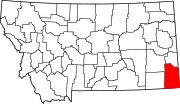 | |
| CDP | ||
|
Other communities | ||
| Indian reservation | ||
| Footnotes | ‡This populated place also has portions in an adjacent county or counties | |
There are at least 52 named lakes and reservoirs in Carter County, Montana.
Lakes
- Soda Lakes, 45°43′38″N 104°30′24″W / 45.72722°N 104.50667°W, el. 3,278 feet (999 m) [1]
Reservoirs
- Abel Reservoir, 45°43′31″N 104°11′20″W / 45.72528°N 104.18889°W, el. 3,510 feet (1,070 m) [2]
- Apache Reservoir, 45°40′27″N 104°36′17″W / 45.67417°N 104.60472°W, el. 3,369 feet (1,027 m) [3]
- Bar C Reservoir, 45°47′40″N 104°13′13″W / 45.79444°N 104.22028°W, el. 3,287 feet (1,002 m) [4]
- Blackfoot Reservoir, 45°41′04″N 104°31′51″W / 45.68444°N 104.53083°W, el. 3,251 feet (991 m) [5]
- Brewer Reservoir, 45°36′28″N 104°14′02″W / 45.60778°N 104.23389°W, el. 3,839 feet (1,170 m) [6]
- Bucholtz Reservoir, 45°35′09″N 104°03′39″W / 45.58583°N 104.06083°W, el. 3,399 feet (1,036 m) [7]
- Burditt Reservoir, 45°39′51″N 104°16′08″W / 45.66417°N 104.26889°W, el. 3,422 feet (1,043 m) [8]
- Cherokee Reservoir, 45°40′13″N 104°31′53″W / 45.67028°N 104.53139°W, el. 3,281 feet (1,000 m) [9]
- Cheyenne Reservoir, 45°41′22″N 104°34′00″W / 45.68944°N 104.56667°W, el. 3,304 feet (1,007 m) [10]
- Cochran Reservoir, 45°05′45″N 104°41′37″W / 45.09583°N 104.69361°W, el. 3,550 feet (1,080 m) [11]
- Dead Horse Reservoir, 45°40′31″N 104°14′40″W / 45.67528°N 104.24444°W, el. 3,697 feet (1,127 m) [12]
- Devils Canyon Reservoir, 45°41′35″N 104°15′55″W / 45.69306°N 104.26528°W, el. 3,376 feet (1,029 m) [13]
- Dewdrop Reservoir, 45°36′49″N 104°16′12″W / 45.61361°N 104.27000°W, el. 3,622 feet (1,104 m) [14]
- Dugout Reservoir, 45°55′01″N 104°49′09″W / 45.91694°N 104.81917°W, el. 3,291 feet (1,003 m) [15]
- E-B Reservoir, 45°40′30″N 104°16′13″W / 45.67500°N 104.27028°W, el. 3,481 feet (1,061 m) [16]
- Etta Reservoir, 45°39′25″N 104°14′30″W / 45.65694°N 104.24167°W, el. 3,478 feet (1,060 m) [17]
- Evans Reservoir, 45°57′20″N 104°49′44″W / 45.95556°N 104.82889°W, el. 3,143 feet (958 m) [18]
- Flat Reservoir, 45°46′50″N 104°11′50″W / 45.78056°N 104.19722°W, el. 3,576 feet (1,090 m) [19]
- Gergen Reservoir, 45°35′31″N 104°14′42″W / 45.59194°N 104.24500°W, el. 3,743 feet (1,141 m) [20]
- Gravel Pit Reservoir, 45°37′56″N 104°04′05″W / 45.63222°N 104.06806°W, el. 3,343 feet (1,019 m) [21]
- Gros Ventre Reservoir, 45°40′34″N 104°33′12″W / 45.67611°N 104.55333°W, el. 3,291 feet (1,003 m) [22]
- Herman Reservoir, 45°45′12″N 104°10′07″W / 45.75333°N 104.16861°W, el. 3,373 feet (1,028 m) [23]
- Horse Killer Reservoir, 45°43′19″N 104°15′25″W / 45.72194°N 104.25694°W, el. 3,402 feet (1,037 m) [24]
- J Oliver Reservoir, 45°12′24″N 104°12′38″W / 45.20667°N 104.21056°W, el. 3,314 feet (1,010 m) [25]
- Jay Reservoir, 45°37′09″N 104°15′45″W / 45.61917°N 104.26250°W, el. 3,592 feet (1,095 m) [26]
- L O Reservoir, 45°47′18″N 104°09′46″W / 45.78833°N 104.16278°W, el. 3,399 feet (1,036 m) [27]
- L/W Reservoir, 45°44′47″N 104°12′12″W / 45.74639°N 104.20333°W, el. 3,504 feet (1,068 m) [28]
- Lampkin Gulch Reservoir, 45°44′16″N 104°15′29″W / 45.73778°N 104.25806°W, el. 3,494 feet (1,065 m) [29]
- Lindsey Reservoir, 45°33′26″N 104°05′06″W / 45.55722°N 104.08500°W, el. 3,402 feet (1,037 m) [30]
- Little Britches Reservoir, 45°56′31″N 104°50′27″W / 45.94194°N 104.84083°W, el. 3,182 feet (970 m) [31]
- Lone Tree Reservoir Number One, 45°40′16″N 104°32′21″W / 45.67111°N 104.53917°W, el. 3,284 feet (1,001 m) [32]
- Lone Tree Reservoir Number Two, 45°39′34″N 104°33′30″W / 45.65944°N 104.55833°W, el. 3,330 feet (1,010 m) [33]
- Long Reservoir, 45°40′00″N 104°30′43″W / 45.66667°N 104.51194°W, el. 3,274 feet (998 m) [34]
- Maverick Reservoir, 45°37′52″N 104°15′14″W / 45.63111°N 104.25389°W, el. 3,468 feet (1,057 m) [35]
- Mobray Reservoir Number 2, 45°42′29″N 104°11′10″W / 45.70806°N 104.18611°W, el. 3,563 feet (1,086 m) [36]
- Mobray Reservoir Number 3, 45°42′33″N 104°11′24″W / 45.70917°N 104.19000°W, el. 3,586 feet (1,093 m) [37]
- Navaho Reservoir, 45°40′23″N 104°35′30″W / 45.67306°N 104.59167°W, el. 3,343 feet (1,019 m) [38]
- Pendleton Reservoir, 45°38′01″N 104°07′01″W / 45.63361°N 104.11694°W, el. 3,425 feet (1,044 m) [39]
- Pentecost Reservoir, 45°23′01″N 104°57′45″W / 45.38361°N 104.96250°W, el. 3,310 feet (1,010 m) [40]
- Phillippi Reservoir, 45°19′31″N 104°49′21″W / 45.32528°N 104.82250°W, el. 3,543 feet (1,080 m) [41]
- Pot Hole Reservoir, 45°37′24″N 104°08′16″W / 45.62333°N 104.13778°W, el. 3,602 feet (1,098 m) [42]
- Schmidt Reservoir, 45°55′31″N 104°47′57″W / 45.92528°N 104.79917°W, el. 3,264 feet (995 m) [43]
- Section 21 Reservoir, 45°38′25″N 104°05′09″W / 45.64028°N 104.08583°W, el. 3,422 feet (1,043 m) [44]
- Sioux Reservoir, 45°40′35″N 104°34′16″W / 45.67639°N 104.57111°W, el. 3,304 feet (1,007 m) [45]
- Summers Reservoir, 45°38′23″N 104°14′46″W / 45.63972°N 104.24611°W, el. 3,514 feet (1,071 m) [46]
- Trenk Reservoir, 45°44′02″N 104°43′25″W / 45.73389°N 104.72361°W, el. 3,455 feet (1,053 m) [47]
- Ute Reservoir, 45°41′11″N 104°33′20″W / 45.68639°N 104.55556°W, el. 3,291 feet (1,003 m) [48]
- V-Bar-S Reservoir, 45°42′47″N 104°15′33″W / 45.71306°N 104.25917°W, el. 3,445 feet (1,050 m) [49]
- West Lindsey Reservoir, 45°33′17″N 104°05′42″W / 45.55472°N 104.09500°W, el. 3,383 feet (1,031 m) [50]
- West Plum Creek Reservoir, 45°37′42″N 104°06′00″W / 45.62833°N 104.10000°W, el. 3,455 feet (1,053 m) [51]
- Wichiup Reservoir, 45°41′07″N 104°31′09″W / 45.68528°N 104.51917°W, el. 3,251 feet (991 m) [52]
See also
Notes
- ^ "Soda Lakes". Geographic Names Information System. United States Geological Survey, United States Department of the Interior.
- ^ "Abel Reservoir". Geographic Names Information System. United States Geological Survey, United States Department of the Interior.
- ^ "Apache Reservoir". Geographic Names Information System. United States Geological Survey, United States Department of the Interior.
- ^ "Bar C Reservoir". Geographic Names Information System. United States Geological Survey, United States Department of the Interior.
- ^ "Blackfoot Reservoir". Geographic Names Information System. United States Geological Survey, United States Department of the Interior.
- ^ "Brewer Reservoir". Geographic Names Information System. United States Geological Survey, United States Department of the Interior.
- ^ "Bucholtz Reservoir". Geographic Names Information System. United States Geological Survey, United States Department of the Interior.
- ^ "Burditt Reservoir". Geographic Names Information System. United States Geological Survey, United States Department of the Interior.
- ^ "Cherokee Reservoir". Geographic Names Information System. United States Geological Survey, United States Department of the Interior.
- ^ "Cheyenne Reservoir". Geographic Names Information System. United States Geological Survey, United States Department of the Interior.
- ^ "Cochran Reservoir". Geographic Names Information System. United States Geological Survey, United States Department of the Interior.
- ^ "Dead Horse Reservoir". Geographic Names Information System. United States Geological Survey, United States Department of the Interior.
- ^ "Devils Canyon Reservoir". Geographic Names Information System. United States Geological Survey, United States Department of the Interior.
- ^ "Dewdrop Reservoir". Geographic Names Information System. United States Geological Survey, United States Department of the Interior.
- ^ "Dugout Reservoir". Geographic Names Information System. United States Geological Survey, United States Department of the Interior.
- ^ "E-B Reservoir". Geographic Names Information System. United States Geological Survey, United States Department of the Interior.
- ^ "Etta Reservoir". Geographic Names Information System. United States Geological Survey, United States Department of the Interior.
- ^ "Evans Reservoir". Geographic Names Information System. United States Geological Survey, United States Department of the Interior.
- ^ "Flat Reservoir". Geographic Names Information System. United States Geological Survey, United States Department of the Interior.
- ^ "Gergen Reservoir". Geographic Names Information System. United States Geological Survey, United States Department of the Interior.
- ^ "Gravel Pit Reservoir". Geographic Names Information System. United States Geological Survey, United States Department of the Interior.
- ^ "Gros Ventre Reservoir". Geographic Names Information System. United States Geological Survey, United States Department of the Interior.
- ^ "Herman Reservoir". Geographic Names Information System. United States Geological Survey, United States Department of the Interior.
- ^ "Horse Killer Reservoir". Geographic Names Information System. United States Geological Survey, United States Department of the Interior.
- ^ "J Oliver Reservoir". Geographic Names Information System. United States Geological Survey, United States Department of the Interior.
- ^ "Jay Reservoir". Geographic Names Information System. United States Geological Survey, United States Department of the Interior.
- ^ "L O Reservoir". Geographic Names Information System. United States Geological Survey, United States Department of the Interior.
- ^ "L/W Reservoir". Geographic Names Information System. United States Geological Survey, United States Department of the Interior.
- ^ "Lampkin Gulch Reservoir". Geographic Names Information System. United States Geological Survey, United States Department of the Interior.
- ^ "Lindsey Reservoir". Geographic Names Information System. United States Geological Survey, United States Department of the Interior.
- ^ "Little Britches Reservoir". Geographic Names Information System. United States Geological Survey, United States Department of the Interior.
- ^ "Lone Tree Reservoir Number One". Geographic Names Information System. United States Geological Survey, United States Department of the Interior.
- ^ "Lone Tree Reservoir Number Two". Geographic Names Information System. United States Geological Survey, United States Department of the Interior.
- ^ "Long Reservoir". Geographic Names Information System. United States Geological Survey, United States Department of the Interior.
- ^ "Maverick Reservoir". Geographic Names Information System. United States Geological Survey, United States Department of the Interior.
- ^ "Mobray Reservoir Number 2". Geographic Names Information System. United States Geological Survey, United States Department of the Interior.
- ^ "Mobray Reservoir Number 3". Geographic Names Information System. United States Geological Survey, United States Department of the Interior.
- ^ "Navaho Reservoir". Geographic Names Information System. United States Geological Survey, United States Department of the Interior.
- ^ "Pendleton Reservoir". Geographic Names Information System. United States Geological Survey, United States Department of the Interior.
- ^ "Pentecost Reservoir". Geographic Names Information System. United States Geological Survey, United States Department of the Interior.
- ^ "Phillippi Reservoir". Geographic Names Information System. United States Geological Survey, United States Department of the Interior.
- ^ "Pot Hole Reservoir". Geographic Names Information System. United States Geological Survey, United States Department of the Interior.
- ^ "Schmidt Reservoir". Geographic Names Information System. United States Geological Survey, United States Department of the Interior.
- ^ "Section 21 Reservoir". Geographic Names Information System. United States Geological Survey, United States Department of the Interior.
- ^ "Sioux Reservoir". Geographic Names Information System. United States Geological Survey, United States Department of the Interior.
- ^ "Summers Reservoir". Geographic Names Information System. United States Geological Survey, United States Department of the Interior.
- ^ "Trenk Reservoir". Geographic Names Information System. United States Geological Survey, United States Department of the Interior.
- ^ "Ute Reservoir". Geographic Names Information System. United States Geological Survey, United States Department of the Interior.
- ^ "V-Bar-S Reservoir". Geographic Names Information System. United States Geological Survey, United States Department of the Interior.
- ^ "West Lindsey Reservoir". Geographic Names Information System. United States Geological Survey, United States Department of the Interior.
- ^ "West Plum Creek Reservoir". Geographic Names Information System. United States Geological Survey, United States Department of the Interior.
- ^ "Wichiup Reservoir". Geographic Names Information System. United States Geological Survey, United States Department of the Interior.
Municipalities and communities of
Carter County, Montana, United States | ||
|---|---|---|
| Town | | |
| CDP | ||
|
Other communities | ||
| Indian reservation | ||
| Footnotes | ‡This populated place also has portions in an adjacent county or counties | |