Photos • Location

(Redirected from
List of lakes in Deer Lodge County, Montana)
There are at least 25 named lakes and reservoirs in Deer Lodge County, Montana.
Lakes
- Barker Lakes, 46°06′09″N 113°07′18″W / 46.10250°N 113.12167°W, el. 7,953 feet (2,424 m) [1]
- Daly Lake, 46°10′32″N 113°14′34″W / 46.17556°N 113.24278°W, el. 6,424 feet (1,958 m) [2]
- Emerald Lake, 46°01′01″N 113°16′29″W / 46.01694°N 113.27472°W, el. 8,963 feet (2,732 m) [3]
- Fourmile Basin Lakes, 46°05′22″N 113°14′08″W / 46.08944°N 113.23556°W, el. 8,195 feet (2,498 m) [4]
- Haggin Lake, 46°06′10″N 113°05′30″W / 46.10278°N 113.09167°W, el. 8,107 feet (2,471 m) [5]
- Hearst Lake, 46°05′47″N 113°04′16″W / 46.09639°N 113.07111°W, el. 8,199 feet (2,499 m) [6]
- Hicks Lake (Montana), 46°00′11″N 113°21′07″W / 46.00306°N 113.35194°W, el. 8,760 feet (2,670 m) [7]
- Lake of the Isle, 46°04′22″N 113°11′17″W / 46.07278°N 113.18806°W, el. 8,340 feet (2,540 m) [8]
- LaMarche Lake, 46°00′44″N 113°18′06″W / 46.01222°N 113.30167°W, el. 8,261 feet (2,518 m) [9]
- Lost Lakes, 45°57′37″N 113°22′57″W / 45.96028°N 113.38250°W, el. 9,567 feet (2,916 m) [10]
- Lower Seymour Lake, 45°59′06″N 113°11′07″W / 45.98500°N 113.18528°W, el. 6,758 feet (2,060 m) [11]
- Miller Lake, 46°04′24″N 113°08′29″W / 46.07333°N 113.14139°W, el. 8,428 feet (2,569 m) [12]
- Mudd Lake, 45°54′42″N 113°24′59″W / 45.91167°N 113.41639°W, el. 7,641 feet (2,329 m) [13]
- Oreamnos Lake, 45°56′32″N 113°30′20″W / 45.94222°N 113.50556°W, el. 8,366 feet (2,550 m) [14]
- Pintler Lake, 45°50′26″N 113°26′28″W / 45.84056°N 113.44111°W, el. 6,306 feet (1,922 m) [15]
- Rainbow Lake, 45°57′28″N 113°27′12″W / 45.95778°N 113.45333°W, el. 8,218 feet (2,505 m) [16]
- Tenmile Lakes, 46°02′45″N 113°08′27″W / 46.04583°N 113.14083°W, el. 8,740 feet (2,660 m) [17]
- Toomey Lake, 45°49′06″N 113°18′21″W / 45.81833°N 113.30583°W, el. 5,889 feet (1,795 m) [18]
- Twin Lakes, 46°04′54″N 113°12′44″W / 46.08167°N 113.21222°W, el. 7,615 feet (2,321 m) [19]
- Upper Seymour Lake, 46°02′12″N 113°16′12″W / 46.03667°N 113.27000°W, el. 8,261 feet (2,518 m) [20]
- Warren Lake, 45°58′37″N 113°25′04″W / 45.97694°N 113.41778°W, el. 8,468 feet (2,581 m) [21]
Reservoirs
- Georgetown Lake, 46°12′55″N 113°16′50″W / 46.21528°N 113.28056°W, el. 6,361 feet (1,939 m) [22]
- Silver Lake, 46°10′12″N 113°14′09″W / 46.17000°N 113.23583°W, el. 6,437 feet (1,962 m) [23]
- Storm Lake, 46°04′28″N 113°16′04″W / 46.07444°N 113.26778°W, el. 8,186 feet (2,495 m) [24]
- Thornton Lake, 46°15′36″N 113°02′03″W / 46.26000°N 113.03417°W, el. 7,569 feet (2,307 m) [25]
See also
Notes
- ^ "Barker Lakes". Geographic Names Information System. United States Geological Survey, United States Department of the Interior.
- ^ "Daly Lake". Geographic Names Information System. United States Geological Survey, United States Department of the Interior.
- ^ "Emerald Lake". Geographic Names Information System. United States Geological Survey, United States Department of the Interior.
- ^ "Fourmile Basin Lakes". Geographic Names Information System. United States Geological Survey, United States Department of the Interior.
- ^ "Haggin Lake". Geographic Names Information System. United States Geological Survey, United States Department of the Interior.
- ^ "Hearst Lake". Geographic Names Information System. United States Geological Survey, United States Department of the Interior.
- ^ "Hicks Lake". Geographic Names Information System. United States Geological Survey, United States Department of the Interior.
- ^ "Lake of the Isle". Geographic Names Information System. United States Geological Survey, United States Department of the Interior.
- ^ "LaMarche Lake". Geographic Names Information System. United States Geological Survey, United States Department of the Interior.
- ^ "Lost Lakes". Geographic Names Information System. United States Geological Survey, United States Department of the Interior.
- ^ "Lower Seymour Lake". Geographic Names Information System. United States Geological Survey, United States Department of the Interior.
- ^ "Miller Lake". Geographic Names Information System. United States Geological Survey, United States Department of the Interior.
- ^ "Mudd Lake". Geographic Names Information System. United States Geological Survey, United States Department of the Interior.
- ^ "Oreamnos Lake". Geographic Names Information System. United States Geological Survey, United States Department of the Interior.
- ^ "Pintler Lake". Geographic Names Information System. United States Geological Survey, United States Department of the Interior.
- ^ "Rainbow Lake". Geographic Names Information System. United States Geological Survey, United States Department of the Interior.
- ^ "Tenmile Lakes". Geographic Names Information System. United States Geological Survey, United States Department of the Interior.
- ^ "Toomey Lake". Geographic Names Information System. United States Geological Survey, United States Department of the Interior.
- ^ "Twin Lakes". Geographic Names Information System. United States Geological Survey, United States Department of the Interior.
- ^ "Upper Seymour Lake". Geographic Names Information System. United States Geological Survey, United States Department of the Interior.
- ^ "Warren Lake". Geographic Names Information System. United States Geological Survey, United States Department of the Interior.
- ^ "Georgetown Lake". Geographic Names Information System. United States Geological Survey, United States Department of the Interior.
- ^ "Silver Lake". Geographic Names Information System. United States Geological Survey, United States Department of the Interior.
- ^ "Storm Lake". Geographic Names Information System. United States Geological Survey, United States Department of the Interior.
- ^ "Thornton Lake". Geographic Names Information System. United States Geological Survey, United States Department of the Interior.
Municipalities and communities of
Deer Lodge County, Montana, United States | ||
|---|---|---|
| City | 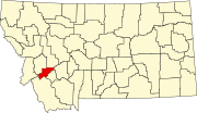 | |
|
Unincorporated communities | ||
| Ghost town | ||
| Footnotes | ‡This populated place also has portions in an adjacent county or counties | |
(Redirected from
List of lakes in Deer Lodge County, Montana)
There are at least 25 named lakes and reservoirs in Deer Lodge County, Montana.
Lakes
- Barker Lakes, 46°06′09″N 113°07′18″W / 46.10250°N 113.12167°W, el. 7,953 feet (2,424 m) [1]
- Daly Lake, 46°10′32″N 113°14′34″W / 46.17556°N 113.24278°W, el. 6,424 feet (1,958 m) [2]
- Emerald Lake, 46°01′01″N 113°16′29″W / 46.01694°N 113.27472°W, el. 8,963 feet (2,732 m) [3]
- Fourmile Basin Lakes, 46°05′22″N 113°14′08″W / 46.08944°N 113.23556°W, el. 8,195 feet (2,498 m) [4]
- Haggin Lake, 46°06′10″N 113°05′30″W / 46.10278°N 113.09167°W, el. 8,107 feet (2,471 m) [5]
- Hearst Lake, 46°05′47″N 113°04′16″W / 46.09639°N 113.07111°W, el. 8,199 feet (2,499 m) [6]
- Hicks Lake (Montana), 46°00′11″N 113°21′07″W / 46.00306°N 113.35194°W, el. 8,760 feet (2,670 m) [7]
- Lake of the Isle, 46°04′22″N 113°11′17″W / 46.07278°N 113.18806°W, el. 8,340 feet (2,540 m) [8]
- LaMarche Lake, 46°00′44″N 113°18′06″W / 46.01222°N 113.30167°W, el. 8,261 feet (2,518 m) [9]
- Lost Lakes, 45°57′37″N 113°22′57″W / 45.96028°N 113.38250°W, el. 9,567 feet (2,916 m) [10]
- Lower Seymour Lake, 45°59′06″N 113°11′07″W / 45.98500°N 113.18528°W, el. 6,758 feet (2,060 m) [11]
- Miller Lake, 46°04′24″N 113°08′29″W / 46.07333°N 113.14139°W, el. 8,428 feet (2,569 m) [12]
- Mudd Lake, 45°54′42″N 113°24′59″W / 45.91167°N 113.41639°W, el. 7,641 feet (2,329 m) [13]
- Oreamnos Lake, 45°56′32″N 113°30′20″W / 45.94222°N 113.50556°W, el. 8,366 feet (2,550 m) [14]
- Pintler Lake, 45°50′26″N 113°26′28″W / 45.84056°N 113.44111°W, el. 6,306 feet (1,922 m) [15]
- Rainbow Lake, 45°57′28″N 113°27′12″W / 45.95778°N 113.45333°W, el. 8,218 feet (2,505 m) [16]
- Tenmile Lakes, 46°02′45″N 113°08′27″W / 46.04583°N 113.14083°W, el. 8,740 feet (2,660 m) [17]
- Toomey Lake, 45°49′06″N 113°18′21″W / 45.81833°N 113.30583°W, el. 5,889 feet (1,795 m) [18]
- Twin Lakes, 46°04′54″N 113°12′44″W / 46.08167°N 113.21222°W, el. 7,615 feet (2,321 m) [19]
- Upper Seymour Lake, 46°02′12″N 113°16′12″W / 46.03667°N 113.27000°W, el. 8,261 feet (2,518 m) [20]
- Warren Lake, 45°58′37″N 113°25′04″W / 45.97694°N 113.41778°W, el. 8,468 feet (2,581 m) [21]
Reservoirs
- Georgetown Lake, 46°12′55″N 113°16′50″W / 46.21528°N 113.28056°W, el. 6,361 feet (1,939 m) [22]
- Silver Lake, 46°10′12″N 113°14′09″W / 46.17000°N 113.23583°W, el. 6,437 feet (1,962 m) [23]
- Storm Lake, 46°04′28″N 113°16′04″W / 46.07444°N 113.26778°W, el. 8,186 feet (2,495 m) [24]
- Thornton Lake, 46°15′36″N 113°02′03″W / 46.26000°N 113.03417°W, el. 7,569 feet (2,307 m) [25]
See also
Notes
- ^ "Barker Lakes". Geographic Names Information System. United States Geological Survey, United States Department of the Interior.
- ^ "Daly Lake". Geographic Names Information System. United States Geological Survey, United States Department of the Interior.
- ^ "Emerald Lake". Geographic Names Information System. United States Geological Survey, United States Department of the Interior.
- ^ "Fourmile Basin Lakes". Geographic Names Information System. United States Geological Survey, United States Department of the Interior.
- ^ "Haggin Lake". Geographic Names Information System. United States Geological Survey, United States Department of the Interior.
- ^ "Hearst Lake". Geographic Names Information System. United States Geological Survey, United States Department of the Interior.
- ^ "Hicks Lake". Geographic Names Information System. United States Geological Survey, United States Department of the Interior.
- ^ "Lake of the Isle". Geographic Names Information System. United States Geological Survey, United States Department of the Interior.
- ^ "LaMarche Lake". Geographic Names Information System. United States Geological Survey, United States Department of the Interior.
- ^ "Lost Lakes". Geographic Names Information System. United States Geological Survey, United States Department of the Interior.
- ^ "Lower Seymour Lake". Geographic Names Information System. United States Geological Survey, United States Department of the Interior.
- ^ "Miller Lake". Geographic Names Information System. United States Geological Survey, United States Department of the Interior.
- ^ "Mudd Lake". Geographic Names Information System. United States Geological Survey, United States Department of the Interior.
- ^ "Oreamnos Lake". Geographic Names Information System. United States Geological Survey, United States Department of the Interior.
- ^ "Pintler Lake". Geographic Names Information System. United States Geological Survey, United States Department of the Interior.
- ^ "Rainbow Lake". Geographic Names Information System. United States Geological Survey, United States Department of the Interior.
- ^ "Tenmile Lakes". Geographic Names Information System. United States Geological Survey, United States Department of the Interior.
- ^ "Toomey Lake". Geographic Names Information System. United States Geological Survey, United States Department of the Interior.
- ^ "Twin Lakes". Geographic Names Information System. United States Geological Survey, United States Department of the Interior.
- ^ "Upper Seymour Lake". Geographic Names Information System. United States Geological Survey, United States Department of the Interior.
- ^ "Warren Lake". Geographic Names Information System. United States Geological Survey, United States Department of the Interior.
- ^ "Georgetown Lake". Geographic Names Information System. United States Geological Survey, United States Department of the Interior.
- ^ "Silver Lake". Geographic Names Information System. United States Geological Survey, United States Department of the Interior.
- ^ "Storm Lake". Geographic Names Information System. United States Geological Survey, United States Department of the Interior.
- ^ "Thornton Lake". Geographic Names Information System. United States Geological Survey, United States Department of the Interior.
Municipalities and communities of
Deer Lodge County, Montana, United States | ||
|---|---|---|
| City | | |
|
Unincorporated communities | ||
| Ghost town | ||
| Footnotes | ‡This populated place also has portions in an adjacent county or counties | |