Photos • Location
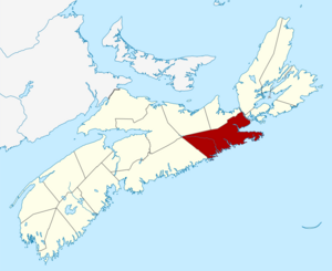


This is a list of historic places in Guysborough County, Nova Scotia.
List of historic places


_Lighthouse.jpg)
.jpg)


See also
Wikimedia Commons has media related to
Cultural heritage monuments in Nova Scotia.
- List of historic places in Nova Scotia
- List of National Historic Sites of Canada in Nova Scotia
- Heritage Property Act (Nova Scotia)
This is a list of historic places in Guysborough County, Nova Scotia.
List of historic places
See also
Wikimedia Commons has media related to
Cultural heritage monuments in Nova Scotia.
- List of historic places in Nova Scotia
- List of National Historic Sites of Canada in Nova Scotia
- Heritage Property Act (Nova Scotia)