This list is of the Places of Scenic Beauty of Japan located within the Prefecture of Saitama. [1]
National Places of Scenic Beauty
As of 1 July 2014, three Places have been designated at a national level; Sanbaseki Gorge spans the prefectural borders with Gunma and Landscape of Oku no Hosomichi is a serial designation spanning ten prefectures. [2] [3] [4]
| Site | Municipality | Comments | Image | Coordinates | Type | Ref. |
|---|---|---|---|---|---|---|
|
Nagatoro Valley 長瀞 Nagatoro |
Nagatoro/ Minano | also a Natural Monument |
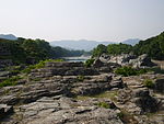 |
36°05′46″N 139°06′54″E / 36.09618973°N 139.11491542°E | 6 | [1] |
|
Sanbaseki Gorge 三波石峡 Sanbasekkyō |
Kamikawa | also a Natural Monument; designation includes an area of Fujioka in Gunma Prefecture |
 |
36°07′46″N 139°01′46″E / 36.12935391°N 139.02935467°E | 5, 6 | [2] |
|
Landscape of
Oku no Hosomichi -
Sōka-matsubara おくのほそ道の風景地 草加松原 Oku no Hosomichi no fūkei-chi Sōka-matsubara |
Sōka | designation spans ten prefectures |
 |
35°50′11″N 139°48′27″E / 35.836342°N 139.807549°E | [3] |
Prefectural Places of Scenic Beauty
As of 1 July 2014, six Places have been designated at a prefectural level. [4] [5]
| Site | Municipality | Comments | Image | Coordinates | Type | Ref. |
|---|---|---|---|---|---|---|
|
Mount Tenran Scenery 天覧山の勝 Tenran-zan no katsu |
Hannō |
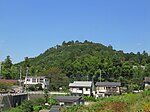 |
35°51′43″N 139°18′30″E / 35.861857°N 139.308314°E | [4] | ||
|
Mount Monomi
Iwadonosan Kannon Scenery 物見山 岩殿山観音の勝 Monomi-yama Iwadono-san Kannon no katsu |
Higashimatsuyama |
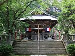 |
36°00′05″N 139°21′44″E / 36.001358°N 139.362355°E | [5] | ||
|
Tamayodo 玉淀 Tamayodo |
Yorii |
 |
36°06′55″N 139°09′54″E / 36.115274°N 139.164870°E | [6] | ||
|
Ogose Plum Grove 越生の梅林 Ogose bairin |
Ogose |
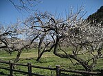 |
35°58′20″N 139°16′26″E / 35.972206°N 139.273961°E | [7] | ||
|
Nakatsu Gorge 中津峡 Nakatsu-kyō |
Chichibu |
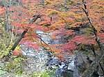 |
35°59′46″N 138°47′40″E / 35.996054°N 138.794339°E | [8] | ||
|
Heirin-ji Wooded Precinct 平林寺林泉境内 Heirinji rinsen keidai |
Niiza |
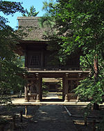 |
35°47′35″N 139°33′40″E / 35.793137°N 139.561086°E | [9] |
Municipal Places of Scenic Beauty
As of 1 May 2013, twenty-four Places have been designated at a municipal level. [6]
See also
- Cultural Properties of Japan
- List of parks and gardens of Saitama Prefecture
- List of Historic Sites of Japan (Saitama)
References
- ^ "Cultural Properties for Future Generations". Agency for Cultural Affairs. Archived from the original on 26 October 2014. Retrieved 29 July 2014.
- ^ 史跡名勝天然記念物 [Number of Monuments of Japan by Prefecture] (in Japanese). Agency for Cultural Affairs. 1 July 2014. Archived from the original on 30 June 2011. Retrieved 29 July 2014.
- ^ "Database of National Cultural Properties: 史跡名勝天然記念物 (名勝, 特別名勝 埼玉県 2県以上)" (in Japanese). Agency for Cultural Affairs. Archived from the original on 4 December 2015. Retrieved 29 July 2014.
- ^ a b 埼玉県内の国・県指定等文化財件数 [Counts of Cultural Properties] (in Japanese). Saitama Prefecture. 1 April 2014. Archived from the original on 22 August 2014. Retrieved 29 July 2014.
- ^ 都道府県別指定等文化財件数(都道府県分) [Number of Prefectural Cultural Properties by Prefecture] (in Japanese). Agency for Cultural Affairs. 1 May 2014. Archived from the original on 21 September 2013. Retrieved 29 July 2014.
- ^ 都道府県別指定等文化財件数(市町村分) [Number of Municipal Cultural Properties by Prefecture] (in Japanese). Agency for Cultural Affairs. 1 May 2014. Archived from the original on 14 May 2015. Retrieved 29 July 2014.
External links
- (in Japanese) Cultural Properties of Saitama Prefecture
This list is of the Places of Scenic Beauty of Japan located within the Prefecture of Saitama. [1]
National Places of Scenic Beauty
As of 1 July 2014, three Places have been designated at a national level; Sanbaseki Gorge spans the prefectural borders with Gunma and Landscape of Oku no Hosomichi is a serial designation spanning ten prefectures. [2] [3] [4]
| Site | Municipality | Comments | Image | Coordinates | Type | Ref. |
|---|---|---|---|---|---|---|
|
Nagatoro Valley 長瀞 Nagatoro |
Nagatoro/ Minano | also a Natural Monument |
 |
36°05′46″N 139°06′54″E / 36.09618973°N 139.11491542°E | 6 | [1] |
|
Sanbaseki Gorge 三波石峡 Sanbasekkyō |
Kamikawa | also a Natural Monument; designation includes an area of Fujioka in Gunma Prefecture |
 |
36°07′46″N 139°01′46″E / 36.12935391°N 139.02935467°E | 5, 6 | [2] |
|
Landscape of
Oku no Hosomichi -
Sōka-matsubara おくのほそ道の風景地 草加松原 Oku no Hosomichi no fūkei-chi Sōka-matsubara |
Sōka | designation spans ten prefectures |
 |
35°50′11″N 139°48′27″E / 35.836342°N 139.807549°E | [3] |
Prefectural Places of Scenic Beauty
As of 1 July 2014, six Places have been designated at a prefectural level. [4] [5]
| Site | Municipality | Comments | Image | Coordinates | Type | Ref. |
|---|---|---|---|---|---|---|
|
Mount Tenran Scenery 天覧山の勝 Tenran-zan no katsu |
Hannō |
 |
35°51′43″N 139°18′30″E / 35.861857°N 139.308314°E | [4] | ||
|
Mount Monomi
Iwadonosan Kannon Scenery 物見山 岩殿山観音の勝 Monomi-yama Iwadono-san Kannon no katsu |
Higashimatsuyama |
 |
36°00′05″N 139°21′44″E / 36.001358°N 139.362355°E | [5] | ||
|
Tamayodo 玉淀 Tamayodo |
Yorii |
 |
36°06′55″N 139°09′54″E / 36.115274°N 139.164870°E | [6] | ||
|
Ogose Plum Grove 越生の梅林 Ogose bairin |
Ogose |
 |
35°58′20″N 139°16′26″E / 35.972206°N 139.273961°E | [7] | ||
|
Nakatsu Gorge 中津峡 Nakatsu-kyō |
Chichibu |
 |
35°59′46″N 138°47′40″E / 35.996054°N 138.794339°E | [8] | ||
|
Heirin-ji Wooded Precinct 平林寺林泉境内 Heirinji rinsen keidai |
Niiza |
 |
35°47′35″N 139°33′40″E / 35.793137°N 139.561086°E | [9] |
Municipal Places of Scenic Beauty
As of 1 May 2013, twenty-four Places have been designated at a municipal level. [6]
See also
- Cultural Properties of Japan
- List of parks and gardens of Saitama Prefecture
- List of Historic Sites of Japan (Saitama)
References
- ^ "Cultural Properties for Future Generations". Agency for Cultural Affairs. Archived from the original on 26 October 2014. Retrieved 29 July 2014.
- ^ 史跡名勝天然記念物 [Number of Monuments of Japan by Prefecture] (in Japanese). Agency for Cultural Affairs. 1 July 2014. Archived from the original on 30 June 2011. Retrieved 29 July 2014.
- ^ "Database of National Cultural Properties: 史跡名勝天然記念物 (名勝, 特別名勝 埼玉県 2県以上)" (in Japanese). Agency for Cultural Affairs. Archived from the original on 4 December 2015. Retrieved 29 July 2014.
- ^ a b 埼玉県内の国・県指定等文化財件数 [Counts of Cultural Properties] (in Japanese). Saitama Prefecture. 1 April 2014. Archived from the original on 22 August 2014. Retrieved 29 July 2014.
- ^ 都道府県別指定等文化財件数(都道府県分) [Number of Prefectural Cultural Properties by Prefecture] (in Japanese). Agency for Cultural Affairs. 1 May 2014. Archived from the original on 21 September 2013. Retrieved 29 July 2014.
- ^ 都道府県別指定等文化財件数(市町村分) [Number of Municipal Cultural Properties by Prefecture] (in Japanese). Agency for Cultural Affairs. 1 May 2014. Archived from the original on 14 May 2015. Retrieved 29 July 2014.
External links
- (in Japanese) Cultural Properties of Saitama Prefecture


