| Lignon du Velay | |
|---|---|
 | |
 | |
| Location | |
| Country | France |
| Physical characteristics | |
| Source | |
| • location | Chaudeyrolles |
| • coordinates | 44°55′23″N 04°10′42″E / 44.92306°N 4.17833°E |
| • elevation | 1,440 m (4,720 ft) |
| Mouth | |
• location | Loire |
• coordinates | 45°15′31″N 04°08′42″E / 45.25861°N 4.14500°E |
• elevation | 460 m (1,510 ft) |
| Length | 85.1 km (52.9 mi) |
| Basin size | 661.3 km2 (255.3 sq mi) |
| Discharge | |
| • average | 9.8 m3/s (350 cu ft/s) |
| Basin features | |
| Progression | Loire→ Atlantic Ocean |
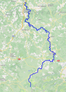
The Lignon du Velay (French pronunciation: [liɲɔ̃ dy vəlɛ], literally Lignon of the Velay) is an 85.1-kilometre (52.9 mi) long river in the Ardèche and Haute-Loire departments, south-central France. [1] Its source is near Chaudeyrolles. It flows generally north. It is a right tributary of the Loire, into which it flows at Pont de Lignon, a hamlet in Monistrol-sur-Loire.
This list is ordered from source to mouth:
- Haute-Loire: Chaudeyrolles, Saint-Front, Fay-sur-Lignon, Les Vastres, Mazet-Saint-Voy
- Ardèche: Mars
- Haute-Loire: Le Chambon-sur-Lignon, Saint-Jeures, Tence, Chenereilles, Lapte, Yssingeaux, Grazac, Les Villettes, Saint-Maurice-de-Lignon, Monistrol-sur-Loire
| Lignon du Velay | |
|---|---|
 | |
 | |
| Location | |
| Country | France |
| Physical characteristics | |
| Source | |
| • location | Chaudeyrolles |
| • coordinates | 44°55′23″N 04°10′42″E / 44.92306°N 4.17833°E |
| • elevation | 1,440 m (4,720 ft) |
| Mouth | |
• location | Loire |
• coordinates | 45°15′31″N 04°08′42″E / 45.25861°N 4.14500°E |
• elevation | 460 m (1,510 ft) |
| Length | 85.1 km (52.9 mi) |
| Basin size | 661.3 km2 (255.3 sq mi) |
| Discharge | |
| • average | 9.8 m3/s (350 cu ft/s) |
| Basin features | |
| Progression | Loire→ Atlantic Ocean |
The Lignon du Velay (French pronunciation: [liɲɔ̃ dy vəlɛ], literally Lignon of the Velay) is an 85.1-kilometre (52.9 mi) long river in the Ardèche and Haute-Loire departments, south-central France. [1] Its source is near Chaudeyrolles. It flows generally north. It is a right tributary of the Loire, into which it flows at Pont de Lignon, a hamlet in Monistrol-sur-Loire.
This list is ordered from source to mouth:
- Haute-Loire: Chaudeyrolles, Saint-Front, Fay-sur-Lignon, Les Vastres, Mazet-Saint-Voy
- Ardèche: Mars
- Haute-Loire: Le Chambon-sur-Lignon, Saint-Jeures, Tence, Chenereilles, Lapte, Yssingeaux, Grazac, Les Villettes, Saint-Maurice-de-Lignon, Monistrol-sur-Loire