Lettermore
Leitir Móir | |
|---|---|
Village | |
 Tigh Phlunkett and Siopa Phlunkett, public house and shop, Lettermore | |
| Coordinates: 53°17′20″N 9°39′18″W / 53.289°N 9.655°W | |
| Country | Ireland |
| Province | Connacht |
| County | County Galway |
| Elevation | 1 m (3 ft) |
| Population (2022
[1]) | 542 |
| Irish Grid Reference | L887279 |
| As this is a Gaeltact village, the Irish Leitir Móir is the official name. | |
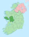
Lettermore ( Irish: Leitir Móir, lit. 'great rough hillside') [2] is a Gaeltacht village in County Galway, Ireland. It is also the name of the island, linked by road to the mainland, on which the village sits. The main spoken language of the area is Irish.
Lettermore island is in two halves. The eastern half is known as Lettermore, while the western half is known as Lettercallow ( Irish: Leitir Calaidh, lit. 'rough hillside by a marshy area'). [3]
|
|
| |||||||||||||||||||||||||||||||||||||||||||||||||||||||||||||||||||||||||||||||||||||||
| Source: Central Statistics Office. "CNA17: Population by Off Shore Island, Sex and Year". CSO.ie. Retrieved 12 October 2016. Population of Inhabited Islands Off the Coast (Report). Central Statistics Office. 2023. Retrieved 29 June 2023. | |||||||||||||||||||||||||||||||||||||||||||||||||||||||||||||||||||||||||||||||||||||||||
- List of towns and villages in the Republic of Ireland
- Darach Ó Catháin
- Gorumna
- CLG Naomh Anna, Leitir Móir
- Fiachra Breathnach
- Seoighe Inish Bearachain
- Peigín Leitir Móir
- ^ Population of Inhabited Islands Off the Coast (Report). Central Statistics Office. 2023. Retrieved 29 June 2023.
- ^ Galway County Heritage Office.
- ^ Census of Ireland, 1911: Area, Houses, and Population : Also the Ages, Civil Or Conjugal Condition, Occupations, Birthplaces, Religion, and Education of the People. United Kingdom, H.M. Stationery Office, 1912.
Lettermore
Leitir Móir | |
|---|---|
Village | |
 Tigh Phlunkett and Siopa Phlunkett, public house and shop, Lettermore | |
| Coordinates: 53°17′20″N 9°39′18″W / 53.289°N 9.655°W | |
| Country | Ireland |
| Province | Connacht |
| County | County Galway |
| Elevation | 1 m (3 ft) |
| Population (2022
[1]) | 542 |
| Irish Grid Reference | L887279 |
| As this is a Gaeltact village, the Irish Leitir Móir is the official name. | |
Lettermore ( Irish: Leitir Móir, lit. 'great rough hillside') [2] is a Gaeltacht village in County Galway, Ireland. It is also the name of the island, linked by road to the mainland, on which the village sits. The main spoken language of the area is Irish.
Lettermore island is in two halves. The eastern half is known as Lettermore, while the western half is known as Lettercallow ( Irish: Leitir Calaidh, lit. 'rough hillside by a marshy area'). [3]
|
|
| |||||||||||||||||||||||||||||||||||||||||||||||||||||||||||||||||||||||||||||||||||||||
| Source: Central Statistics Office. "CNA17: Population by Off Shore Island, Sex and Year". CSO.ie. Retrieved 12 October 2016. Population of Inhabited Islands Off the Coast (Report). Central Statistics Office. 2023. Retrieved 29 June 2023. | |||||||||||||||||||||||||||||||||||||||||||||||||||||||||||||||||||||||||||||||||||||||||
- List of towns and villages in the Republic of Ireland
- Darach Ó Catháin
- Gorumna
- CLG Naomh Anna, Leitir Móir
- Fiachra Breathnach
- Seoighe Inish Bearachain
- Peigín Leitir Móir
- ^ Population of Inhabited Islands Off the Coast (Report). Central Statistics Office. 2023. Retrieved 29 June 2023.
- ^ Galway County Heritage Office.
- ^ Census of Ireland, 1911: Area, Houses, and Population : Also the Ages, Civil Or Conjugal Condition, Occupations, Birthplaces, Religion, and Education of the People. United Kingdom, H.M. Stationery Office, 1912.

