-
 View of Manson orchards from the south shore of Lake Chelan
 -
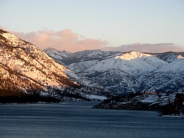 View uplake from the south shore of Lake Chelan
 -
 View of Lake Chelan from Lakeshore trail, near Stehekin
 -
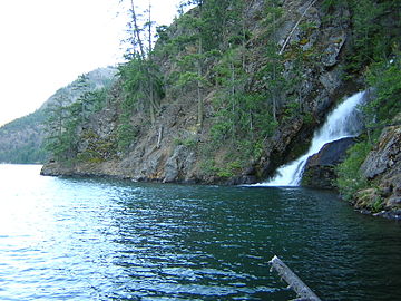 Domke Falls is the best known waterfall that drops into the lake
 -
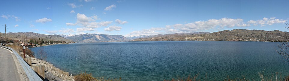 Lake Chelan as seen from the southern shore off U.S. Highway 97A
Photos • Location


| Lake Chelan | |
|---|---|
 Lake Chelan with Stehekin on the lower left | |
 Lake Chelan | |
| Location |
Chelan County,
Washington, United States |
| Coordinates | 47°50′28″N 120°02′47″W / 47.84111°N 120.04639°W |
| Type | Glacially overdeepened lake |
| Primary inflows | Stehekin River, Railroad Creek |
| Primary outflows | Chelan River |
| Catchment area | 924 sq mi (2,390 km2) |
| Basin countries | United States |
| Max. length | 50.5 mi (81.3 km) |
| Surface area | 52.1 sq mi (135 km2) |
| Average depth | 474 ft (144 m) |
| Max. depth | 1,486 ft (453 m) |
| Water volume | 4.66 cu mi (19.4 km3) |
| Residence time | 10.6 years |
| Shore length1 | 109.2 mi (175.7 km) |
| Surface elevation | 1,100 ft (340 m) |
| Settlements | see Cities |
| References | [1] [2] |
| 1 Shore length is not a well-defined measure. | |
Lake Chelan ( /ʃəˈlæn/ shə-LAN) is a narrow, 50.5 mi (81.3 km) long lake in Chelan County, north-central Washington state, U.S. [1] It is an overdeepened lake and resembles a fjord, with an average width of 1.3 mi (2.1 km). Near its upper end, the lake surface lies more than 6,600 ft (2,000 m) below peaks less than 3 mi (4.8 km) away. [3] [4] Before 1927, Lake Chelan was the largest natural lake in the state in terms of both surface area and water volume. [2] [5] Upon the completion of Lake Chelan Dam in 1927, the elevation of the lake was increased by 21 ft (6.4 m) to its present maximum-capacity elevation of 1,100 ft (340 m). [2]
With a maximum depth of 1,486 ft (453 m), Lake Chelan is the third deepest lake in the United States behind Crater Lake, the deepest, and Lake Tahoe, the second deepest. Because of overdeepening, the sides of this lake drop steeply to its bottom. The deepest part of Lake Chelan lies as much as 436 ft (133 m) below sea level. In places, the bedrock floor of the valley occupied by Lake Chelan, which is buried by Pleistocene glacial and lacustrine sediments, lies at least 1,529 ft (466 m) below sea level. Two communities lie on the southern end of the lake, and a third sits at the far north end, providing a gateway to the North Cascades National Park. [3] [4]
On an annual basis, an average of 2,200 cubic feet per second (62 m3/s) flow into the lake. [6] Approximately 75% of the water that flows into the lake comes from two tributaries. [7] The Stehekin River alone contributes 65% of all water to Lake Chelan, averaging 1,401 cu ft/s (39.7 m3/s) annually. [8] The other major tributary, Railroad Creek, averages 202 cu ft/s (5.7 m3/s) annually. [6] The remaining water is added via a number of smaller tributaries as well as direct rain and snowfall.
With a maximum depth of 1,486 feet (453 m), [6] Lake Chelan is the third deepest lake in the United States, and the 25th deepest in the world. At its deepest, the lake bottom is 388 feet (118 m) below sea level. [9] The total watershed of the lake is 924 square miles (2,390 km2) [7] [10] [11] More than 90% of the watershed is forested land. The remainder of the basin is composed of the lake itself (5.6%) and agriculture (3.5%). [12]
The fjord-like topography of the Lake Chelan valley results from repeated glacial erosion and deposition (maybe nine or ten times) during the Pleistocene Period. [4] [13] The last episode of glacial erosion and deposition in the basin occurred during the Last Glacial Maximum about 21,000 years ago. At that time, in the upper Similkameen River valley of British Columbia, the Skagit Lobe split from the Okanogan Lobe of the Cordilleran ice sheet and advanced south into the Skagit River drainage. [14] Skagit ice passed through Fisher and Rainy passes, and down Bridge Creek into the Lake Chelan valley. The glacial lobe flowed down the Lake Chelan valley until meeting glacial ice of the main Okanogan Lobe advancing up the valley from the Columbia River drainage near Manson. The deposits of the northwestward advancing Okanagan lobe are characterized by large, basalt glacial erratics. [4] As the Skagit Lobe during the Last Glacial Maximum and glacial lobes during older glaciations flowed to the southeast down the Lake Chelan valley, they excavated the deep glacial trough that is now occupied by Lake Chelan. [14] The depth of the Lucerne Basin and the elevation of glacial till and moraines and glacier-scoured bedrock on the walls of the overdeepened Lake Chelan valley indicates that the thickness of the Skagit Lobe was over 1 mi (1.6 km). [3] [4]
Lake Chelan is composed of two basins. The lower basin, Wapato, is shallower and approximately a fourth the total length of the lake. The upper basin, Lucerne, is much deeper and extends for the remainder of the length of the lake. The two basins are separated by a sill rising to within 122 ft (37 m) of the surface, at a point known as the narrows, at which the lake is only 0.35 miles (0.56 km) wide. [9]
The lower basin, Wapato, reaches a maximum depth of only 400 feet (120 m). About 600 feet (180 m) of glacial sediment and rockslide deposits rest on top of the bedrock. [15] This section of the lake is 12 miles (19 km) long, and has an average depth of 190 feet (58 m). [16] Due to the relatively modest size of this basin, water resides in this basin for only 0.8 years, compared to 10 for Lucerne Basin. [17] The upper Lucerne basin is 38 miles (61 km) long with an average depth of 1,148 feet (350 m) and thus by far the larger of the two basins. [16] It is in this part of the lake that the maximum depth of 1,486 feet (453 m) is found. Lucerne basin contains 92% of the water in Lake Chelan and 74% of the surface area, leaving Wapato with only 8% of the total volume of water and 26% of the surface area. [8] [9] [15] The upper basin of Lake Chelan is surrounded by more mountainous terrain, resulting in few beaches along the shoreline. Approximately 50 miles (80 km) of the shoreline of this basin are in National Forest lands, and 12 miles (19 km) in National Park lands. [8]
The climate of Lake Chelan's watershed is varied. From the southern end of the lake in the rain shadow of the Cascade Range, to the northern tip of the lake located in the eastern Cascades, the climate of Lake Chelan's watershed is as diverse as the lake is long. The south end's weather is notably dry, with Chelan averaging only 11.4 inches (29 cm) of rain per year, along with 21.8 inches (55 cm) of snow. Stehekin receives an average of 35.5 inches (90 cm) of rain per year, and 122.5 inches (311 cm) of snow. Other than precipitation trends, the climates are remarkably similar. Both locations average around 60 °F (16 °C) for a high, and 40 °F (4 °C) for a low throughout the course of the year.[ citation needed]
| Climate data for Chelan, Washington (south end of lake) (1991–2020 normals, extremes since 1891) | |||||||||||||
|---|---|---|---|---|---|---|---|---|---|---|---|---|---|
| Month | Jan | Feb | Mar | Apr | May | Jun | Jul | Aug | Sep | Oct | Nov | Dec | Year |
| Record high °F (°C) | 62 (17) |
63 (17) |
74 (23) |
88 (31) |
98 (37) |
111 (44) |
109 (43) |
106 (41) |
97 (36) |
88 (31) |
72 (22) |
65 (18) |
111 (44) |
| Mean maximum °F (°C) | 48 (9) |
52 (11) |
63 (17) |
75 (24) |
86 (30) |
90 (32) |
99 (37) |
99 (37) |
89 (32) |
75 (24) |
58 (14) |
48 (9) |
100 (38) |
| Mean daily maximum °F (°C) | 34.3 (1.3) |
41.7 (5.4) |
51.9 (11.1) |
62.1 (16.7) |
71.9 (22.2) |
77.9 (25.5) |
86.6 (30.3) |
87.0 (30.6) |
77.2 (25.1) |
62.2 (16.8) |
45.7 (7.6) |
34.9 (1.6) |
61.1 (16.2) |
| Daily mean °F (°C) | 28.0 (−2.2) |
33.0 (0.6) |
41.1 (5.1) |
49.8 (9.9) |
59.0 (15.0) |
65.4 (18.6) |
72.8 (22.7) |
72.5 (22.5) |
63.2 (17.3) |
50.5 (10.3) |
37.6 (3.1) |
28.7 (−1.8) |
50.1 (10.1) |
| Mean daily minimum °F (°C) | 21.6 (−5.8) |
24.3 (−4.3) |
30.3 (−0.9) |
37.5 (3.1) |
46.2 (7.9) |
53.0 (11.7) |
59.1 (15.1) |
58.1 (14.5) |
49.2 (9.6) |
38.8 (3.8) |
29.5 (−1.4) |
22.6 (−5.2) |
39.2 (4.0) |
| Mean minimum °F (°C) | 11 (−12) |
16 (−9) |
24 (−4) |
32 (0) |
39 (4) |
47 (8) |
52 (11) |
52 (11) |
42 (6) |
30 (−1) |
21 (−6) |
14 (−10) |
7 (−14) |
| Record low °F (°C) | −18 (−28) |
−15 (−26) |
4 (−16) |
21 (−6) |
28 (−2) |
33 (1) |
35 (2) |
42 (6) |
26 (−3) |
3 (−16) |
−3 (−19) |
−18 (−28) |
−18 (−28) |
| Average precipitation inches (mm) | 1.52 (39) |
1.22 (31) |
1.09 (28) |
0.75 (19) |
1.05 (27) |
0.87 (22) |
0.42 (11) |
0.32 (8.1) |
0.34 (8.6) |
1.04 (26) |
1.51 (38) |
1.83 (46) |
11.96 (303.7) |
| Average snowfall inches (cm) | 7.7 (20) |
2.0 (5.1) |
0.7 (1.8) |
0.0 (0.0) |
0.0 (0.0) |
0.0 (0.0) |
0.0 (0.0) |
0.0 (0.0) |
0.0 (0.0) |
0.0 (0.0) |
1.4 (3.6) |
8.7 (22) |
20.5 (52.5) |
| Average extreme snow depth inches (cm) | 3 (7.6) |
2 (5.1) |
1 (2.5) |
0 (0) |
0 (0) |
0 (0) |
0 (0) |
0 (0) |
0 (0) |
0 (0) |
1 (2.5) |
2 (5.1) |
4 (10) |
| Average precipitation days (≥ 0.01 inch) | 10 | 7 | 7 | 5 | 6 | 5 | 3 | 2 | 2 | 6 | 9 | 9 | 71 |
| Source: National Oceanic and Atmospheric Administration [18] | |||||||||||||
| Climate data for Stehekin, Washington (north end of the lake) (1991–2020 normals, extremes since 1906) | |||||||||||||
|---|---|---|---|---|---|---|---|---|---|---|---|---|---|
| Month | Jan | Feb | Mar | Apr | May | Jun | Jul | Aug | Sep | Oct | Nov | Dec | Year |
| Record high °F (°C) | 55 (13) |
59 (15) |
70 (21) |
85 (29) |
101 (38) |
103 (39) |
107 (42) |
105 (41) |
98 (37) |
88 (31) |
67 (19) |
62 (17) |
107 (42) |
| Mean maximum °F (°C) | 42 (6) |
48 (9) |
59 (15) |
74 (23) |
86 (30) |
92 (33) |
99 (37) |
98 (37) |
89 (32) |
72 (22) |
52 (11) |
42 (6) |
100 (38) |
| Mean daily maximum °F (°C) | 32.3 (0.2) |
37.8 (3.2) |
46.5 (8.1) |
57.5 (14.2) |
68.6 (20.3) |
74.4 (23.6) |
84.3 (29.1) |
83.3 (28.5) |
72.5 (22.5) |
55.8 (13.2) |
40.0 (4.4) |
32.3 (0.2) |
57.1 (13.9) |
| Daily mean °F (°C) | 28.5 (−1.9) |
31.9 (−0.1) |
38.1 (3.4) |
46.6 (8.1) |
56.2 (13.4) |
62.2 (16.8) |
70.1 (21.2) |
69.3 (20.7) |
60.2 (15.7) |
46.8 (8.2) |
35.2 (1.8) |
29.0 (−1.7) |
47.8 (8.8) |
| Mean daily minimum °F (°C) | 24.8 (−4.0) |
26.0 (−3.3) |
29.8 (−1.2) |
35.8 (2.1) |
43.8 (6.6) |
49.9 (9.9) |
55.9 (13.3) |
55.2 (12.9) |
47.8 (8.8) |
37.8 (3.2) |
30.4 (−0.9) |
25.6 (−3.6) |
38.6 (3.7) |
| Mean minimum °F (°C) | 12 (−11) |
15 (−9) |
22 (−6) |
28 (−2) |
34 (1) |
41 (5) |
47 (8) |
46 (8) |
38 (3) |
27 (−3) |
21 (−6) |
12 (−11) |
8 (−13) |
| Record low °F (°C) | −18 (−28) |
−16 (−27) |
−5 (−21) |
19 (−7) |
25 (−4) |
28 (−2) |
36 (2) |
30 (−1) |
22 (−6) |
16 (−9) |
0 (−18) |
−11 (−24) |
−18 (−28) |
| Average precipitation inches (mm) | 6.75 (171) |
3.72 (94) |
3.60 (91) |
1.44 (37) |
1.07 (27) |
0.75 (19) |
0.46 (12) |
0.49 (12) |
1.05 (27) |
3.66 (93) |
6.73 (171) |
7.16 (182) |
36.88 (936) |
| Average snowfall inches (cm) | 41.4 (105) |
18.5 (47) |
9.1 (23) |
0.2 (0.51) |
0.0 (0.0) |
0.0 (0.0) |
0.0 (0.0) |
0.0 (0.0) |
0.0 (0.0) |
0.2 (0.51) |
9.7 (25) |
50.6 (129) |
129.7 (330.02) |
| Average extreme snow depth inches (cm) | 36 (91) |
33 (84) |
24 (61) |
6 (15) |
0 (0) |
0 (0) |
0 (0) |
0 (0) |
0 (0) |
0 (0) |
6 (15) |
27 (69) |
41 (100) |
| Average precipitation days (≥ 0.01 in) | 17 | 11 | 11 | 8 | 6 | 6 | 3 | 3 | 6 | 11 | 16 | 16 | 114 |
| Average snowy days (≥ 0.01 in) | 11 | 5 | 3 | 0 | 0 | 0 | 0 | 0 | 0 | 0 | 3 | 11 | 33 |
| Source: NOAA [19] | |||||||||||||
The name Chelan is a Salish Indigenous word, "Tsi - Laan," meaning 'Deep Water'. [20]
Due to the isolated nature of Lake Chelan, especially at its northern reaches, there is not a large population that resides along the shore. Chelan, which had 4,222 residents at the 2020 census, [21] is currently the only incorporated city situated along the lake shore. The city is located at the southern terminus of the lake, adjacent to the Lake Chelan Dam and the Chelan River outflow. The census-designated place of Manson, which had 1,523 residents in 2020, [22] is also located at the southern end of the lake. The unincorporated community of Stehekin, [23] with approximately 75 residents, [24] is located at the northern terminus of the lake, adjacent to the Stehekin River inflow. At the mouth of the Railroad Creek sits Lucerne, a small community of private cabins served by commercial boats. [23] Lucerne is also the primary gateway to the community of Holden Village, a Lutheran retreat center located 11 mi (18 km) inland from the lake. With approximately 50 long-term residents, Holden includes one of the few remaining public K-12 two-room schools in the contiguous United States. [25]
Fishing is a popular recreating activity on Lake Chelan. The following fish are or were native to the lake: Bull Trout, Westslope cutthroat trout, Largescale sucker, Longnose sucker, Bridgelip sucker, Northern pikeminnow, Peamouth, Redside shiner, Mountain whitefish, Pygmy whitefish. [26] [27]
In addition to these native species, six species have been introduced to the lake, primarily for sport fishing purposes: Yellowstone cutthroat trout, Rainbow trout, Kokanee, Brook trout, Chinook salmon, Lake trout [26] [27]
In 2013, a 35.63 lb (16.16 kg) Lake Trout was caught, setting the state record. [28]
The Lake Chelan AVA surrounds the southernmost 12 miles of Lake Chelan. [29] A subzone of the larger Columbia Valley AVA, the Lake Chelan AVA is home to 31 tasting rooms. [30]
At the north end of the lake, surrounding the town of Stehekin, is Lake Chelan National Recreation Area (NRA). Bordering the Lake Chelan NRA is the Lake Chelan-Sawtooth Wilderness. The Wenatchee National Forest surrounds much of the lake on either side. Two state parks are located on the southern edge, not far from the city of Chelan. These state parks are Twenty-Five Mile Creek State Park and Lake Chelan State Park. [31]
In addition to the protected land located directly on the shores of Lake Chelan, Stehekin serves not only as a gateway to the Lake Chelan NRA, but also to the rest of the North Cascades National Park Complex, Stephen Mather Wilderness, and adjacent National Forest Wilderness Areas. [32] Approximately 87% of the Lake Chelan watershed is owned by either federal, state, or local entities, with the rest in private ownership. [12]


- ^ a b "TMDL Case Study: Lake Chelan, Washington". Environmental Protection Agency. January 1994. Retrieved 2015-01-17.
- ^ a b c Kendra, Will; Singleton, Lynn (January 1987). "Morphometry of Lake Chelan" (PDF). Washington State Department of Ecology. Retrieved 2023-02-03.
- ^ a b c Whetten, J.T. (1967). "Lake Chelan Washington: bottom and sub-bottom topography". Limnology and Oceanography. 12 (2): 253–259. doi: 10.4319/lo.1967.12.2.0253.
- ^ a b c d e Lillquis, Karl (2016). Moses Coulee to Chelan Field Trip, 12 June 2016. Ellensburg, Washington: Ellensburg Chapter, Ice Age Floods Institute. p. 39.
- ^ Bortleson, G.C.; Dion, N.P.; McConnell, J.B.; Nelson, L.M. (1976). "Reconnaissance data on lakes in Washington -- Vol. 5, Chelan, Ferry, Kittitas, Klickitat, Okanogan, and Yakima Counties". Washington State Department of Ecology. Retrieved 2023-02-03.
- ^ a b c "Chelan Watershed Initial Assessment" (PDF). Washington Department of Ecology. May 1985. Retrieved 2015-01-13.
- ^ a b Hillman, T.W.; Giorgi, A.E. (February 2000). "Historical Occurrences of Anadromous Salmonids in Lake Chelan, Washington" (PDF). Chelan Public Utilities District. BioAnalysts, Inc. Retrieved 2015-01-17.
- ^ a b c Coots, Randy (June 2006). "Lake Chelan Watershed DDT and PCB Total Maximum Daily Load: Water Quality Improvement Report" (PDF). Washington State Department of Ecology. Retrieved 2015-01-19.
- ^ a b c "Lake Chelan Wapato Basin Total Phosphorus Total Maximum Daily Load" (PDF). State of Washington Department of Ecology. November 2011. Retrieved 2015-01-18.
- ^ "Chelan Watershed Initial Assessment" (PDF). Washington Department of Ecology. May 1985. Retrieved 2015-01-13.
- ^ "Water Quality Improvement Project: Lake Chelan Area: Multi-Parameter". Department of Ecology - State of Washington. March 2013. Retrieved 2015-01-17.
- ^ a b "Draft In-Leau Fee Program Prospectus and Compensation Planning Framework for Lower Lake Chelan" (PDF). The Watershed Company. June 2010. Archived from the original (PDF) on 2015-09-09. Retrieved 2015-01-19.
- ^ Freeman, O.W. (1944). "Glaciation and some human relationships at Lake Chelan". Northwest Science. 18 (3): 59–62.
- ^ a b Riedel, J.L. (2017). "Deglaciation of the North Cascade Range, Washington and British Columbia, from the last glacial maximum to the Holocene". Cuadernos de investigación geográfica/Geographical Research Letters. 43: 59–62.
- ^ a b "Discover Lake Chelan" (PDF). National Park Service. Retrieved 2015-01-14.
- ^ a b Chamberlain, William; Singleton, Lynn; Jay, Joe (1985-02-20). "Lake Chelan Project Proposal" (PDF). Washington State Department of Ecology. Retrieved 2015-01-19.
- ^ Pelletier, Greg; Owes, Harper (January 1989). "Lake Chelan Water Quality Assessment" (PDF). Washington State Department of Ecology. Retrieved 2015-01-19.
- ^ "NowData – NOAA Online Weather Data". National Oceanic and Atmospheric Administration. Retrieved August 7, 2022.
- ^ "NowData – NOAA Online Weather Data". National Oceanic and Atmospheric Administration. Retrieved August 7, 2022.
- ^ "Native American Legends" (PDF). USDA Forest Service - Pacific Northwest Region. Archived from the original (PDF) on April 11, 2006. Retrieved 2007-06-26.
- ^ "Explore Census Data". data.census.gov. Retrieved 2022-03-23.
- ^ "2020 United States Census Profile: Manson CDP, Washington". U.S. Census Bureau, American Factfinder. Retrieved March 15, 2023.
- ^ a b "Shoreline Inventory" (PDF). Chelan County. 2012-04-23. Retrieved 2015-01-19.
- ^ Visit Stehekin. "Visit Stehekin, Washington". Archived from the original on 2015-01-01. Retrieved 2015-01-13.
- ^ "Holden School". Holden Village. Archived from the original on 2015-05-01. Retrieved 2022-03-17.
- ^ a b Nelson, Mark C. (2012-01-20). "What Happened to Bull Trout in Lake Chelan? An Examination of the Historical Evidence" (PDF). U.S. Fish and Wildlife Service. Archived from the original (PDF) on 2015-09-24. Retrieved 2015-01-17.
- ^ a b Hillman, T.W.; Giorgi, A.E. (February 2000). "Historical Occurrences of Anadromous Salmonids in Lake Chelan, Washington" (PDF). Chelan Public Utilities District. BioAnalysts, Inc. Retrieved 2015-01-17.
- ^ "Freshwater and Saltwater Records". Washington Department of Fish & Wildlife. Archived from the original on 2015-01-18. Retrieved 2015-01-17.
- ^ "Federal Register :: Request Access". unblock.federalregister.gov. Retrieved 2023-06-21.
- ^ "Facts and Figures – Lake Chelan Wine Valley". 2020-04-27. Archived from the original on 2020-04-27. Retrieved 2023-06-21.
- ^ "Lake Chelan Area State Parks Management Plan". Washington State Parks and Recreation Committee. January 2009. Archived from the original on 2015-01-18. Retrieved 2015-01-17.
- ^ "Stehekin". National Park Service. Retrieved 2015-01-17.
Wikimedia Commons has media related to
Lake Chelan.
- Geology Tour of Lake Chelan by Ralph and Cheryl Dawes, Wenatchee Valley college.
- Lake Chelan Geology hour-long lecture by Nick Zenter, Central Washington University.
- National Park Service, Lake Chelan, Washington Geotourism, Washington.
- University of Washington Libraries Digital Collections – Lawrence Denny Lindsley Photographs Includes 66 images (ca. 1907–1950) of Lake Chelan and nearby settlements.
| International | |
|---|---|
| National | |
| Lake Chelan | |
|---|---|
|
Lake Chelan with Stehekin on the lower left | |
Lake Chelan | |
| Location |
Chelan County,
Washington, United States |
| Coordinates | 47°50′28″N 120°02′47″W / 47.84111°N 120.04639°W |
| Type | Glacially overdeepened lake |
| Primary inflows | Stehekin River, Railroad Creek |
| Primary outflows | Chelan River |
| Catchment area | 924 sq mi (2,390 km2) |
| Basin countries | United States |
| Max. length | 50.5 mi (81.3 km) |
| Surface area | 52.1 sq mi (135 km2) |
| Average depth | 474 ft (144 m) |
| Max. depth | 1,486 ft (453 m) |
| Water volume | 4.66 cu mi (19.4 km3) |
| Residence time | 10.6 years |
| Shore length1 | 109.2 mi (175.7 km) |
| Surface elevation | 1,100 ft (340 m) |
| Settlements | see Cities |
| References | [1] [2] |
| 1 Shore length is not a well-defined measure. | |
Lake Chelan ( /ʃəˈlæn/ shə-LAN) is a narrow, 50.5 mi (81.3 km) long lake in Chelan County, north-central Washington state, U.S. [1] It is an overdeepened lake and resembles a fjord, with an average width of 1.3 mi (2.1 km). Near its upper end, the lake surface lies more than 6,600 ft (2,000 m) below peaks less than 3 mi (4.8 km) away. [3] [4] Before 1927, Lake Chelan was the largest natural lake in the state in terms of both surface area and water volume. [2] [5] Upon the completion of Lake Chelan Dam in 1927, the elevation of the lake was increased by 21 ft (6.4 m) to its present maximum-capacity elevation of 1,100 ft (340 m). [2]
With a maximum depth of 1,486 ft (453 m), Lake Chelan is the third deepest lake in the United States behind Crater Lake, the deepest, and Lake Tahoe, the second deepest. Because of overdeepening, the sides of this lake drop steeply to its bottom. The deepest part of Lake Chelan lies as much as 436 ft (133 m) below sea level. In places, the bedrock floor of the valley occupied by Lake Chelan, which is buried by Pleistocene glacial and lacustrine sediments, lies at least 1,529 ft (466 m) below sea level. Two communities lie on the southern end of the lake, and a third sits at the far north end, providing a gateway to the North Cascades National Park. [3] [4]
On an annual basis, an average of 2,200 cubic feet per second (62 m3/s) flow into the lake. [6] Approximately 75% of the water that flows into the lake comes from two tributaries. [7] The Stehekin River alone contributes 65% of all water to Lake Chelan, averaging 1,401 cu ft/s (39.7 m3/s) annually. [8] The other major tributary, Railroad Creek, averages 202 cu ft/s (5.7 m3/s) annually. [6] The remaining water is added via a number of smaller tributaries as well as direct rain and snowfall.
With a maximum depth of 1,486 feet (453 m), [6] Lake Chelan is the third deepest lake in the United States, and the 25th deepest in the world. At its deepest, the lake bottom is 388 feet (118 m) below sea level. [9] The total watershed of the lake is 924 square miles (2,390 km2) [7] [10] [11] More than 90% of the watershed is forested land. The remainder of the basin is composed of the lake itself (5.6%) and agriculture (3.5%). [12]
The fjord-like topography of the Lake Chelan valley results from repeated glacial erosion and deposition (maybe nine or ten times) during the Pleistocene Period. [4] [13] The last episode of glacial erosion and deposition in the basin occurred during the Last Glacial Maximum about 21,000 years ago. At that time, in the upper Similkameen River valley of British Columbia, the Skagit Lobe split from the Okanogan Lobe of the Cordilleran ice sheet and advanced south into the Skagit River drainage. [14] Skagit ice passed through Fisher and Rainy passes, and down Bridge Creek into the Lake Chelan valley. The glacial lobe flowed down the Lake Chelan valley until meeting glacial ice of the main Okanogan Lobe advancing up the valley from the Columbia River drainage near Manson. The deposits of the northwestward advancing Okanagan lobe are characterized by large, basalt glacial erratics. [4] As the Skagit Lobe during the Last Glacial Maximum and glacial lobes during older glaciations flowed to the southeast down the Lake Chelan valley, they excavated the deep glacial trough that is now occupied by Lake Chelan. [14] The depth of the Lucerne Basin and the elevation of glacial till and moraines and glacier-scoured bedrock on the walls of the overdeepened Lake Chelan valley indicates that the thickness of the Skagit Lobe was over 1 mi (1.6 km). [3] [4]
Lake Chelan is composed of two basins. The lower basin, Wapato, is shallower and approximately a fourth the total length of the lake. The upper basin, Lucerne, is much deeper and extends for the remainder of the length of the lake. The two basins are separated by a sill rising to within 122 ft (37 m) of the surface, at a point known as the narrows, at which the lake is only 0.35 miles (0.56 km) wide. [9]
The lower basin, Wapato, reaches a maximum depth of only 400 feet (120 m). About 600 feet (180 m) of glacial sediment and rockslide deposits rest on top of the bedrock. [15] This section of the lake is 12 miles (19 km) long, and has an average depth of 190 feet (58 m). [16] Due to the relatively modest size of this basin, water resides in this basin for only 0.8 years, compared to 10 for Lucerne Basin. [17] The upper Lucerne basin is 38 miles (61 km) long with an average depth of 1,148 feet (350 m) and thus by far the larger of the two basins. [16] It is in this part of the lake that the maximum depth of 1,486 feet (453 m) is found. Lucerne basin contains 92% of the water in Lake Chelan and 74% of the surface area, leaving Wapato with only 8% of the total volume of water and 26% of the surface area. [8] [9] [15] The upper basin of Lake Chelan is surrounded by more mountainous terrain, resulting in few beaches along the shoreline. Approximately 50 miles (80 km) of the shoreline of this basin are in National Forest lands, and 12 miles (19 km) in National Park lands. [8]
The climate of Lake Chelan's watershed is varied. From the southern end of the lake in the rain shadow of the Cascade Range, to the northern tip of the lake located in the eastern Cascades, the climate of Lake Chelan's watershed is as diverse as the lake is long. The south end's weather is notably dry, with Chelan averaging only 11.4 inches (29 cm) of rain per year, along with 21.8 inches (55 cm) of snow. Stehekin receives an average of 35.5 inches (90 cm) of rain per year, and 122.5 inches (311 cm) of snow. Other than precipitation trends, the climates are remarkably similar. Both locations average around 60 °F (16 °C) for a high, and 40 °F (4 °C) for a low throughout the course of the year.[ citation needed]
| Climate data for Chelan, Washington (south end of lake) (1991–2020 normals, extremes since 1891) | |||||||||||||
|---|---|---|---|---|---|---|---|---|---|---|---|---|---|
| Month | Jan | Feb | Mar | Apr | May | Jun | Jul | Aug | Sep | Oct | Nov | Dec | Year |
| Record high °F (°C) | 62 (17) |
63 (17) |
74 (23) |
88 (31) |
98 (37) |
111 (44) |
109 (43) |
106 (41) |
97 (36) |
88 (31) |
72 (22) |
65 (18) |
111 (44) |
| Mean maximum °F (°C) | 48 (9) |
52 (11) |
63 (17) |
75 (24) |
86 (30) |
90 (32) |
99 (37) |
99 (37) |
89 (32) |
75 (24) |
58 (14) |
48 (9) |
100 (38) |
| Mean daily maximum °F (°C) | 34.3 (1.3) |
41.7 (5.4) |
51.9 (11.1) |
62.1 (16.7) |
71.9 (22.2) |
77.9 (25.5) |
86.6 (30.3) |
87.0 (30.6) |
77.2 (25.1) |
62.2 (16.8) |
45.7 (7.6) |
34.9 (1.6) |
61.1 (16.2) |
| Daily mean °F (°C) | 28.0 (−2.2) |
33.0 (0.6) |
41.1 (5.1) |
49.8 (9.9) |
59.0 (15.0) |
65.4 (18.6) |
72.8 (22.7) |
72.5 (22.5) |
63.2 (17.3) |
50.5 (10.3) |
37.6 (3.1) |
28.7 (−1.8) |
50.1 (10.1) |
| Mean daily minimum °F (°C) | 21.6 (−5.8) |
24.3 (−4.3) |
30.3 (−0.9) |
37.5 (3.1) |
46.2 (7.9) |
53.0 (11.7) |
59.1 (15.1) |
58.1 (14.5) |
49.2 (9.6) |
38.8 (3.8) |
29.5 (−1.4) |
22.6 (−5.2) |
39.2 (4.0) |
| Mean minimum °F (°C) | 11 (−12) |
16 (−9) |
24 (−4) |
32 (0) |
39 (4) |
47 (8) |
52 (11) |
52 (11) |
42 (6) |
30 (−1) |
21 (−6) |
14 (−10) |
7 (−14) |
| Record low °F (°C) | −18 (−28) |
−15 (−26) |
4 (−16) |
21 (−6) |
28 (−2) |
33 (1) |
35 (2) |
42 (6) |
26 (−3) |
3 (−16) |
−3 (−19) |
−18 (−28) |
−18 (−28) |
| Average precipitation inches (mm) | 1.52 (39) |
1.22 (31) |
1.09 (28) |
0.75 (19) |
1.05 (27) |
0.87 (22) |
0.42 (11) |
0.32 (8.1) |
0.34 (8.6) |
1.04 (26) |
1.51 (38) |
1.83 (46) |
11.96 (303.7) |
| Average snowfall inches (cm) | 7.7 (20) |
2.0 (5.1) |
0.7 (1.8) |
0.0 (0.0) |
0.0 (0.0) |
0.0 (0.0) |
0.0 (0.0) |
0.0 (0.0) |
0.0 (0.0) |
0.0 (0.0) |
1.4 (3.6) |
8.7 (22) |
20.5 (52.5) |
| Average extreme snow depth inches (cm) | 3 (7.6) |
2 (5.1) |
1 (2.5) |
0 (0) |
0 (0) |
0 (0) |
0 (0) |
0 (0) |
0 (0) |
0 (0) |
1 (2.5) |
2 (5.1) |
4 (10) |
| Average precipitation days (≥ 0.01 inch) | 10 | 7 | 7 | 5 | 6 | 5 | 3 | 2 | 2 | 6 | 9 | 9 | 71 |
| Source: National Oceanic and Atmospheric Administration [18] | |||||||||||||
| Climate data for Stehekin, Washington (north end of the lake) (1991–2020 normals, extremes since 1906) | |||||||||||||
|---|---|---|---|---|---|---|---|---|---|---|---|---|---|
| Month | Jan | Feb | Mar | Apr | May | Jun | Jul | Aug | Sep | Oct | Nov | Dec | Year |
| Record high °F (°C) | 55 (13) |
59 (15) |
70 (21) |
85 (29) |
101 (38) |
103 (39) |
107 (42) |
105 (41) |
98 (37) |
88 (31) |
67 (19) |
62 (17) |
107 (42) |
| Mean maximum °F (°C) | 42 (6) |
48 (9) |
59 (15) |
74 (23) |
86 (30) |
92 (33) |
99 (37) |
98 (37) |
89 (32) |
72 (22) |
52 (11) |
42 (6) |
100 (38) |
| Mean daily maximum °F (°C) | 32.3 (0.2) |
37.8 (3.2) |
46.5 (8.1) |
57.5 (14.2) |
68.6 (20.3) |
74.4 (23.6) |
84.3 (29.1) |
83.3 (28.5) |
72.5 (22.5) |
55.8 (13.2) |
40.0 (4.4) |
32.3 (0.2) |
57.1 (13.9) |
| Daily mean °F (°C) | 28.5 (−1.9) |
31.9 (−0.1) |
38.1 (3.4) |
46.6 (8.1) |
56.2 (13.4) |
62.2 (16.8) |
70.1 (21.2) |
69.3 (20.7) |
60.2 (15.7) |
46.8 (8.2) |
35.2 (1.8) |
29.0 (−1.7) |
47.8 (8.8) |
| Mean daily minimum °F (°C) | 24.8 (−4.0) |
26.0 (−3.3) |
29.8 (−1.2) |
35.8 (2.1) |
43.8 (6.6) |
49.9 (9.9) |
55.9 (13.3) |
55.2 (12.9) |
47.8 (8.8) |
37.8 (3.2) |
30.4 (−0.9) |
25.6 (−3.6) |
38.6 (3.7) |
| Mean minimum °F (°C) | 12 (−11) |
15 (−9) |
22 (−6) |
28 (−2) |
34 (1) |
41 (5) |
47 (8) |
46 (8) |
38 (3) |
27 (−3) |
21 (−6) |
12 (−11) |
8 (−13) |
| Record low °F (°C) | −18 (−28) |
−16 (−27) |
−5 (−21) |
19 (−7) |
25 (−4) |
28 (−2) |
36 (2) |
30 (−1) |
22 (−6) |
16 (−9) |
0 (−18) |
−11 (−24) |
−18 (−28) |
| Average precipitation inches (mm) | 6.75 (171) |
3.72 (94) |
3.60 (91) |
1.44 (37) |
1.07 (27) |
0.75 (19) |
0.46 (12) |
0.49 (12) |
1.05 (27) |
3.66 (93) |
6.73 (171) |
7.16 (182) |
36.88 (936) |
| Average snowfall inches (cm) | 41.4 (105) |
18.5 (47) |
9.1 (23) |
0.2 (0.51) |
0.0 (0.0) |
0.0 (0.0) |
0.0 (0.0) |
0.0 (0.0) |
0.0 (0.0) |
0.2 (0.51) |
9.7 (25) |
50.6 (129) |
129.7 (330.02) |
| Average extreme snow depth inches (cm) | 36 (91) |
33 (84) |
24 (61) |
6 (15) |
0 (0) |
0 (0) |
0 (0) |
0 (0) |
0 (0) |
0 (0) |
6 (15) |
27 (69) |
41 (100) |
| Average precipitation days (≥ 0.01 in) | 17 | 11 | 11 | 8 | 6 | 6 | 3 | 3 | 6 | 11 | 16 | 16 | 114 |
| Average snowy days (≥ 0.01 in) | 11 | 5 | 3 | 0 | 0 | 0 | 0 | 0 | 0 | 0 | 3 | 11 | 33 |
| Source: NOAA [19] | |||||||||||||
The name Chelan is a Salish Indigenous word, "Tsi - Laan," meaning 'Deep Water'. [20]
Due to the isolated nature of Lake Chelan, especially at its northern reaches, there is not a large population that resides along the shore. Chelan, which had 4,222 residents at the 2020 census, [21] is currently the only incorporated city situated along the lake shore. The city is located at the southern terminus of the lake, adjacent to the Lake Chelan Dam and the Chelan River outflow. The census-designated place of Manson, which had 1,523 residents in 2020, [22] is also located at the southern end of the lake. The unincorporated community of Stehekin, [23] with approximately 75 residents, [24] is located at the northern terminus of the lake, adjacent to the Stehekin River inflow. At the mouth of the Railroad Creek sits Lucerne, a small community of private cabins served by commercial boats. [23] Lucerne is also the primary gateway to the community of Holden Village, a Lutheran retreat center located 11 mi (18 km) inland from the lake. With approximately 50 long-term residents, Holden includes one of the few remaining public K-12 two-room schools in the contiguous United States. [25]
Fishing is a popular recreating activity on Lake Chelan. The following fish are or were native to the lake: Bull Trout, Westslope cutthroat trout, Largescale sucker, Longnose sucker, Bridgelip sucker, Northern pikeminnow, Peamouth, Redside shiner, Mountain whitefish, Pygmy whitefish. [26] [27]
In addition to these native species, six species have been introduced to the lake, primarily for sport fishing purposes: Yellowstone cutthroat trout, Rainbow trout, Kokanee, Brook trout, Chinook salmon, Lake trout [26] [27]
In 2013, a 35.63 lb (16.16 kg) Lake Trout was caught, setting the state record. [28]
The Lake Chelan AVA surrounds the southernmost 12 miles of Lake Chelan. [29] A subzone of the larger Columbia Valley AVA, the Lake Chelan AVA is home to 31 tasting rooms. [30]
At the north end of the lake, surrounding the town of Stehekin, is Lake Chelan National Recreation Area (NRA). Bordering the Lake Chelan NRA is the Lake Chelan-Sawtooth Wilderness. The Wenatchee National Forest surrounds much of the lake on either side. Two state parks are located on the southern edge, not far from the city of Chelan. These state parks are Twenty-Five Mile Creek State Park and Lake Chelan State Park. [31]
In addition to the protected land located directly on the shores of Lake Chelan, Stehekin serves not only as a gateway to the Lake Chelan NRA, but also to the rest of the North Cascades National Park Complex, Stephen Mather Wilderness, and adjacent National Forest Wilderness Areas. [32] Approximately 87% of the Lake Chelan watershed is owned by either federal, state, or local entities, with the rest in private ownership. [12]
-
View of Manson orchards from the south shore of Lake Chelan
-
View uplake from the south shore of Lake Chelan
-
View of Lake Chelan from Lakeshore trail, near Stehekin
-
Domke Falls is the best known waterfall that drops into the lake
-
Lake Chelan as seen from the southern shore off U.S. Highway 97A
- ^ a b "TMDL Case Study: Lake Chelan, Washington". Environmental Protection Agency. January 1994. Retrieved 2015-01-17.
- ^ a b c Kendra, Will; Singleton, Lynn (January 1987). "Morphometry of Lake Chelan" (PDF). Washington State Department of Ecology. Retrieved 2023-02-03.
- ^ a b c Whetten, J.T. (1967). "Lake Chelan Washington: bottom and sub-bottom topography". Limnology and Oceanography. 12 (2): 253–259. doi: 10.4319/lo.1967.12.2.0253.
- ^ a b c d e Lillquis, Karl (2016). Moses Coulee to Chelan Field Trip, 12 June 2016. Ellensburg, Washington: Ellensburg Chapter, Ice Age Floods Institute. p. 39.
- ^ Bortleson, G.C.; Dion, N.P.; McConnell, J.B.; Nelson, L.M. (1976). "Reconnaissance data on lakes in Washington -- Vol. 5, Chelan, Ferry, Kittitas, Klickitat, Okanogan, and Yakima Counties". Washington State Department of Ecology. Retrieved 2023-02-03.
- ^ a b c "Chelan Watershed Initial Assessment" (PDF). Washington Department of Ecology. May 1985. Retrieved 2015-01-13.
- ^ a b Hillman, T.W.; Giorgi, A.E. (February 2000). "Historical Occurrences of Anadromous Salmonids in Lake Chelan, Washington" (PDF). Chelan Public Utilities District. BioAnalysts, Inc. Retrieved 2015-01-17.
- ^ a b c Coots, Randy (June 2006). "Lake Chelan Watershed DDT and PCB Total Maximum Daily Load: Water Quality Improvement Report" (PDF). Washington State Department of Ecology. Retrieved 2015-01-19.
- ^ a b c "Lake Chelan Wapato Basin Total Phosphorus Total Maximum Daily Load" (PDF). State of Washington Department of Ecology. November 2011. Retrieved 2015-01-18.
- ^ "Chelan Watershed Initial Assessment" (PDF). Washington Department of Ecology. May 1985. Retrieved 2015-01-13.
- ^ "Water Quality Improvement Project: Lake Chelan Area: Multi-Parameter". Department of Ecology - State of Washington. March 2013. Retrieved 2015-01-17.
- ^ a b "Draft In-Leau Fee Program Prospectus and Compensation Planning Framework for Lower Lake Chelan" (PDF). The Watershed Company. June 2010. Archived from the original (PDF) on 2015-09-09. Retrieved 2015-01-19.
- ^ Freeman, O.W. (1944). "Glaciation and some human relationships at Lake Chelan". Northwest Science. 18 (3): 59–62.
- ^ a b Riedel, J.L. (2017). "Deglaciation of the North Cascade Range, Washington and British Columbia, from the last glacial maximum to the Holocene". Cuadernos de investigación geográfica/Geographical Research Letters. 43: 59–62.
- ^ a b "Discover Lake Chelan" (PDF). National Park Service. Retrieved 2015-01-14.
- ^ a b Chamberlain, William; Singleton, Lynn; Jay, Joe (1985-02-20). "Lake Chelan Project Proposal" (PDF). Washington State Department of Ecology. Retrieved 2015-01-19.
- ^ Pelletier, Greg; Owes, Harper (January 1989). "Lake Chelan Water Quality Assessment" (PDF). Washington State Department of Ecology. Retrieved 2015-01-19.
- ^ "NowData – NOAA Online Weather Data". National Oceanic and Atmospheric Administration. Retrieved August 7, 2022.
- ^ "NowData – NOAA Online Weather Data". National Oceanic and Atmospheric Administration. Retrieved August 7, 2022.
- ^ "Native American Legends" (PDF). USDA Forest Service - Pacific Northwest Region. Archived from the original (PDF) on April 11, 2006. Retrieved 2007-06-26.
- ^ "Explore Census Data". data.census.gov. Retrieved 2022-03-23.
- ^ "2020 United States Census Profile: Manson CDP, Washington". U.S. Census Bureau, American Factfinder. Retrieved March 15, 2023.
- ^ a b "Shoreline Inventory" (PDF). Chelan County. 2012-04-23. Retrieved 2015-01-19.
- ^ Visit Stehekin. "Visit Stehekin, Washington". Archived from the original on 2015-01-01. Retrieved 2015-01-13.
- ^ "Holden School". Holden Village. Archived from the original on 2015-05-01. Retrieved 2022-03-17.
- ^ a b Nelson, Mark C. (2012-01-20). "What Happened to Bull Trout in Lake Chelan? An Examination of the Historical Evidence" (PDF). U.S. Fish and Wildlife Service. Archived from the original (PDF) on 2015-09-24. Retrieved 2015-01-17.
- ^ a b Hillman, T.W.; Giorgi, A.E. (February 2000). "Historical Occurrences of Anadromous Salmonids in Lake Chelan, Washington" (PDF). Chelan Public Utilities District. BioAnalysts, Inc. Retrieved 2015-01-17.
- ^ "Freshwater and Saltwater Records". Washington Department of Fish & Wildlife. Archived from the original on 2015-01-18. Retrieved 2015-01-17.
- ^ "Federal Register :: Request Access". unblock.federalregister.gov. Retrieved 2023-06-21.
- ^ "Facts and Figures – Lake Chelan Wine Valley". 2020-04-27. Archived from the original on 2020-04-27. Retrieved 2023-06-21.
- ^ "Lake Chelan Area State Parks Management Plan". Washington State Parks and Recreation Committee. January 2009. Archived from the original on 2015-01-18. Retrieved 2015-01-17.
- ^ "Stehekin". National Park Service. Retrieved 2015-01-17.
Wikimedia Commons has media related to
Lake Chelan.
- Geology Tour of Lake Chelan by Ralph and Cheryl Dawes, Wenatchee Valley college.
- Lake Chelan Geology hour-long lecture by Nick Zenter, Central Washington University.
- National Park Service, Lake Chelan, Washington Geotourism, Washington.
- University of Washington Libraries Digital Collections – Lawrence Denny Lindsley Photographs Includes 66 images (ca. 1907–1950) of Lake Chelan and nearby settlements.
| International | |
|---|---|
| National | |