Photos • Location
| Kuh-e Safed Khers | |
|---|---|
 Kuh-e Safed Khers | |
| Highest point | |
| Elevation | 5,326 m (17,474 ft) |
| Coordinates | 38°5′56″N 71°5′56″E / 38.09889°N 71.09889°E |
| Geography | |
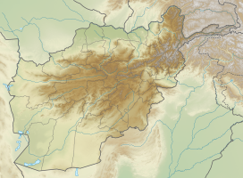
| Location | Darwaz between Maimay and Nusay in Badakhshan Province |
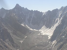
Kuh-e Safed Khers ( Persian: کوه سفید خرس) is a mountain in the Darwaz district of Badakhshan province, Afghanistan. This peak is 5,326 metres (17,474 ft) high.
- Wikipamp. <Kuh-e Safed Khers
- Wikipedia Persian. <kuh-e safed khers
| Kuh-e Safed Khers | |
|---|---|
 Kuh-e Safed Khers | |
| Highest point | |
| Elevation | 5,326 m (17,474 ft) |
| Coordinates | 38°5′56″N 71°5′56″E / 38.09889°N 71.09889°E |
| Geography | |
| Location | Darwaz between Maimay and Nusay in Badakhshan Province |
Kuh-e Safed Khers ( Persian: کوه سفید خرس) is a mountain in the Darwaz district of Badakhshan province, Afghanistan. This peak is 5,326 metres (17,474 ft) high.
- Wikipamp. <Kuh-e Safed Khers
- Wikipedia Persian. <kuh-e safed khers
