Kreischa | |
|---|---|
 Coat of arms | |
Location of Kreischa within Sächsische Schweiz-Osterzgebirge district 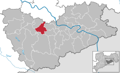 | |
 Kreischa  Kreischa | |
| Coordinates: 50°57′N 13°46′E / 50.950°N 13.767°E | |
| Country | Germany |
| State | Saxony |
| District | Sächsische Schweiz-Osterzgebirge |
| Subdivisions | 14 |
| Government | |
| • Mayor (2022–29) | Frank Schöning [1] |
| Area | |
| • Total | 28.97 km2 (11.19 sq mi) |
| Elevation | 257 m (843 ft) |
| Population (2022-12-31)
[2] | |
| • Total | 4,629 |
| • Density | 160/km2 (410/sq mi) |
| Time zone | UTC+01:00 ( CET) |
| • Summer ( DST) | UTC+02:00 ( CEST) |
| Postal codes | 01731 |
| Dialling codes | 035206 |
| Vehicle registration | PIR |
| Website | www.kreischa.de |
Kreischa is a municipality in the Sächsische Schweiz-Osterzgebirge district, Saxony, Germany. It directly borders the Saxon capital Dresden and consists of 14 districts.
Kreischa was first mentioned in 1282 in the name Heinricus de Kryschowe. The name could be derived from an Old Slavic word meaning "crooked" or "lame".
Kreischa is twinned with:
-
 Loffenau district
Rastatt,
Baden-Württemberg,
Germany since 1990
Loffenau district
Rastatt,
Baden-Württemberg,
Germany since 1990
- Babisnau
- Bärenklause
- Brösgen
- Gombsen
- Kautzsch
- Kleba
- Kleincarsdorf
- Lungkwitz
- Quohren
- Saida
- Sobrigau
- Theisewitz
- Kreischa-Wittgensdorf
- Zscheckwitz
- ^ Gewählte Bürgermeisterinnen und Bürgermeister im Freistaat Sachsen, Stand: 17. Juli 2022, Statistisches Landesamt des Freistaates Sachsen.
- ^ "Einwohnerzahlen nach Gemeinden als Excel-Arbeitsmappe" (XLS) (in German). Statistisches Landesamt des Freistaates Sachsen. 2024.

| International | |
|---|---|
| National | |
| Geographic | |
|
| This Sächsische Schweiz-Osterzgebirge location article is a stub. You can help Wikipedia by expanding it. |
Kreischa | |
|---|---|
|
Coat of arms | |
Location of Kreischa within Sächsische Schweiz-Osterzgebirge district | |
Kreischa Kreischa | |
| Coordinates: 50°57′N 13°46′E / 50.950°N 13.767°E | |
| Country | Germany |
| State | Saxony |
| District | Sächsische Schweiz-Osterzgebirge |
| Subdivisions | 14 |
| Government | |
| • Mayor (2022–29) | Frank Schöning [1] |
| Area | |
| • Total | 28.97 km2 (11.19 sq mi) |
| Elevation | 257 m (843 ft) |
| Population (2022-12-31)
[2] | |
| • Total | 4,629 |
| • Density | 160/km2 (410/sq mi) |
| Time zone | UTC+01:00 ( CET) |
| • Summer ( DST) | UTC+02:00 ( CEST) |
| Postal codes | 01731 |
| Dialling codes | 035206 |
| Vehicle registration | PIR |
| Website | www.kreischa.de |
Kreischa is a municipality in the Sächsische Schweiz-Osterzgebirge district, Saxony, Germany. It directly borders the Saxon capital Dresden and consists of 14 districts.
Kreischa was first mentioned in 1282 in the name Heinricus de Kryschowe. The name could be derived from an Old Slavic word meaning "crooked" or "lame".
Kreischa is twinned with:
-
Loffenau district
Rastatt,
Baden-Württemberg,
Germany since 1990
- Babisnau
- Bärenklause
- Brösgen
- Gombsen
- Kautzsch
- Kleba
- Kleincarsdorf
- Lungkwitz
- Quohren
- Saida
- Sobrigau
- Theisewitz
- Kreischa-Wittgensdorf
- Zscheckwitz
- ^ Gewählte Bürgermeisterinnen und Bürgermeister im Freistaat Sachsen, Stand: 17. Juli 2022, Statistisches Landesamt des Freistaates Sachsen.
- ^ "Einwohnerzahlen nach Gemeinden als Excel-Arbeitsmappe" (XLS) (in German). Statistisches Landesamt des Freistaates Sachsen. 2024.
| International | |
|---|---|
| National | |
| Geographic | |
|
| This Sächsische Schweiz-Osterzgebirge location article is a stub. You can help Wikipedia by expanding it. |