Krasnopol | |
|---|---|
Village | |
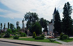
 Church of the Transfiguration of Christ | |
| Coordinates: 54°6′57″N 23°12′25″E / 54.11583°N 23.20694°E | |
| Country | |
| Voivodeship | Podlaskie |
| County | Sejny |
| Gmina | Krasnopol |
| Population | |
| • Total | 1,300 |
Krasnopol ( [krasˈnɔpɔl]; Lithuanian: Krasnapolis [1]) is a village in Sejny County, Podlaskie Voivodeship, in north-eastern Poland. [2] It is the seat of the gmina (administrative district) called Gmina Krasnopol. It lies approximately 11 kilometres (7 mi) west of Sejny and 111 km (69 mi) north of the regional capital Białystok.
Krasnopol was founded in 1770 on the order of Antoni Tyzenhauz in the Opidemie forest on the road from Sejny to Wigry and Suwałki. It was probably granted town privileges in 1782.
- ^ VLKK 2002.
- ^ "Central Statistical Office (GUS) - TERYT (National Register of Territorial Land Apportionment Journal)" (in Polish). 2008-06-01.
- VLKK (2002). "Atvirkštinis lietuvių kalboje vartojamų tradicinių Lenkijos vietovardžių formų sąrašas" (PDF). VLKK (in Lithuanian).
Krasnopol | |
|---|---|
Village | |
 Church of the Transfiguration of Christ | |
| Coordinates: 54°6′57″N 23°12′25″E / 54.11583°N 23.20694°E | |
| Country | |
| Voivodeship | Podlaskie |
| County | Sejny |
| Gmina | Krasnopol |
| Population | |
| • Total | 1,300 |
Krasnopol ( [krasˈnɔpɔl]; Lithuanian: Krasnapolis [1]) is a village in Sejny County, Podlaskie Voivodeship, in north-eastern Poland. [2] It is the seat of the gmina (administrative district) called Gmina Krasnopol. It lies approximately 11 kilometres (7 mi) west of Sejny and 111 km (69 mi) north of the regional capital Białystok.
Krasnopol was founded in 1770 on the order of Antoni Tyzenhauz in the Opidemie forest on the road from Sejny to Wigry and Suwałki. It was probably granted town privileges in 1782.
- ^ VLKK 2002.
- ^ "Central Statistical Office (GUS) - TERYT (National Register of Territorial Land Apportionment Journal)" (in Polish). 2008-06-01.
- VLKK (2002). "Atvirkštinis lietuvių kalboje vartojamų tradicinių Lenkijos vietovardžių formų sąrašas" (PDF). VLKK (in Lithuanian).
