Kokomo | |
|---|---|
Mining
ghost town | |
 The Kokomo historical marker along
State Highway 91 | |
 Kokomo Location within the state of Colorado | |
| Coordinates: 39°25′27″N 106°11′23″W / 39.42417°N 106.18972°W | |
| Country | United States |
| State | Colorado |
| County | Summit |
| Elevation | 10,695 ft (3,260 m) |
| Time zone | UTC-7 ( Mountain (MST)) |
| • Summer ( DST) | UTC-6 (MDT) |
| ZIP codes | 80424
[1] |
| GNIS feature ID | 179601 [2] |
Kokomo is a silver- and gold- mining ghost town in Summit County, in the U.S. state of Colorado. [3] Before being depopulated in the 1960s, Kokomo was at its height home to over 10,000 people. [4]
History
The community took its name from nearby Kokomo Gulch which was named after Kokomo, Indiana. Some placer gold was discovered in the 1860s, but intensive mining did not begin until after the sharp increase of mining at Leadville in 1877. [5] A post office called Kokomo was established in 1879, and remained in operation until 1965. [6] A neighboring community, Recen, was heavily intertwined with Kokomo. The original town constructed of wood burned in 1879. [7] The town burned again in 1881, marking the beginning of decline and resulting in a merger with the community of Recen. [4] Also in 1881, the first Free Mason meeting was held, and a lodge was opened in 1882. A historical marker near the old townsite recognizes the lodge, which was existent until 1966. [5]
In the 1890s, Kokomo was at the highest elevation (10,618 feet) of any incorporated town in the state. [8] The town reached zero population in the 1960s when the land was bought by Climax Molybdenum Company to use as a tailings dump. [9]
References
- ^ "Kokomo (historical) in Summit County CO". CO HomeTownLocator. Retrieved March 10, 2020.
- ^ "Kokomo, Colorado". Geographic Names Information System. United States Geological Survey, United States Department of the Interior. October 13, 1978. Retrieved March 10, 2020.
- ^ U.S. Geological Survey Geographic Names Information System: Kokomo (historical)
- ^ a b Taylor, Jack (January 23, 2019). "Colorado Mining Towns: I Wanna Take You to Kokomo". 99.9 KEKB. Retrieved March 10, 2020.
- ^ a b "Kokomo Masonic Lodge". Historical Marker Database. September 6, 2017. Retrieved March 11, 2020.
- ^ "Post offices". Jim Forte Postal History. Retrieved June 29, 2016.
- ^ "KOKOMO and RACEN". Ghosttowns.com. Retrieved March 10, 2020.
- ^ Dawson, John Frank. Place names in Colorado: why 700 communities were so named, 150 of Spanish or Indian origin. Denver, CO: The J. Frank Dawson Publishing Co. p. 30.
- ^ "Kokomo Colorado". www.westernmininghistory.com. Retrieved September 7, 2016.
Municipalities and communities of
Summit County, Colorado, United States | ||
|---|---|---|
| Towns | 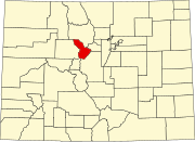 | |
| CDPs | ||
| Ghost towns |
| |
|
| This Colorado state location article is a stub. You can help Wikipedia by expanding it. |
Kokomo | |
|---|---|
Mining
ghost town | |
|
The Kokomo historical marker along
State Highway 91 | |
Kokomo Location within the state of Colorado | |
| Coordinates: 39°25′27″N 106°11′23″W / 39.42417°N 106.18972°W | |
| Country | United States |
| State | Colorado |
| County | Summit |
| Elevation | 10,695 ft (3,260 m) |
| Time zone | UTC-7 ( Mountain (MST)) |
| • Summer ( DST) | UTC-6 (MDT) |
| ZIP codes | 80424
[1] |
| GNIS feature ID | 179601 [2] |
Kokomo is a silver- and gold- mining ghost town in Summit County, in the U.S. state of Colorado. [3] Before being depopulated in the 1960s, Kokomo was at its height home to over 10,000 people. [4]
History
The community took its name from nearby Kokomo Gulch which was named after Kokomo, Indiana. Some placer gold was discovered in the 1860s, but intensive mining did not begin until after the sharp increase of mining at Leadville in 1877. [5] A post office called Kokomo was established in 1879, and remained in operation until 1965. [6] A neighboring community, Recen, was heavily intertwined with Kokomo. The original town constructed of wood burned in 1879. [7] The town burned again in 1881, marking the beginning of decline and resulting in a merger with the community of Recen. [4] Also in 1881, the first Free Mason meeting was held, and a lodge was opened in 1882. A historical marker near the old townsite recognizes the lodge, which was existent until 1966. [5]
In the 1890s, Kokomo was at the highest elevation (10,618 feet) of any incorporated town in the state. [8] The town reached zero population in the 1960s when the land was bought by Climax Molybdenum Company to use as a tailings dump. [9]
References
- ^ "Kokomo (historical) in Summit County CO". CO HomeTownLocator. Retrieved March 10, 2020.
- ^ "Kokomo, Colorado". Geographic Names Information System. United States Geological Survey, United States Department of the Interior. October 13, 1978. Retrieved March 10, 2020.
- ^ U.S. Geological Survey Geographic Names Information System: Kokomo (historical)
- ^ a b Taylor, Jack (January 23, 2019). "Colorado Mining Towns: I Wanna Take You to Kokomo". 99.9 KEKB. Retrieved March 10, 2020.
- ^ a b "Kokomo Masonic Lodge". Historical Marker Database. September 6, 2017. Retrieved March 11, 2020.
- ^ "Post offices". Jim Forte Postal History. Retrieved June 29, 2016.
- ^ "KOKOMO and RACEN". Ghosttowns.com. Retrieved March 10, 2020.
- ^ Dawson, John Frank. Place names in Colorado: why 700 communities were so named, 150 of Spanish or Indian origin. Denver, CO: The J. Frank Dawson Publishing Co. p. 30.
- ^ "Kokomo Colorado". www.westernmininghistory.com. Retrieved September 7, 2016.
Municipalities and communities of
Summit County, Colorado, United States | ||
|---|---|---|
| Towns | | |
| CDPs | ||
| Ghost towns |
| |
|
| This Colorado state location article is a stub. You can help Wikipedia by expanding it. |