 | |
| General information | |
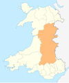
| Location |
Knucklas,
Powys Wales |
| Coordinates | 52°21′36″N 3°05′49″W / 52.360°N 3.097°W |
| Grid reference | SO254740 |
| Managed by | Transport for Wales |
| Platforms | 1 |
| Other information | |
| Station code | KNU |
| Classification | DfT category F2 |
| History | |
| Opened | 1865 |
| Passengers | |
| 2018/19 | |
| 2019/20 | |
| 2020/21 | |
| 2021/22 | |
| 2022/23 | |
| Notes | |
Passenger statistics from the
Office of Rail and Road | |
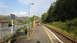
Knucklas railway station serves the village of Knucklas, Powys, Wales, 34+3⁄4 miles (55.9 km) south west of Shrewsbury.
This railway station is located on a steep hill above the village. It is a request stop, so intending passengers have to signal to the driver that they wish to board the train, while those wishing to alight from the train must convey their wish to the train staff.
After departing from the station in the westerly direction, trains pass over the 190 yd (173 m) long Knucklas viaduct. [1] This is one of the major structures on the route, its 13 stone arches carrying the line at a maximum height of 75 feet (23 m) across the Heyope valley and Knucklas village. [2] The route then climbs sharply from east to west for the next 4 miles (6.4 km) on a ruling gradient of 1 in 60, en route to the summit of the line just to the south of Llangynllo Tunnel.
All trains serving the station are operated by Transport for Wales.
Facilities
The station is unstaffed and has no remaining permanent buildings aside from a brick and timber waiting shelter. Other amenities offered include CIS screen, customer help point, public telephone and timetable poster board. Step-free access is available from the car park and entry road from the adjoining residential estate, though the access ramp is quite steep. [3]
Services
There are five trains a day to Swansea southbound and six to Shrewsbury northbound from Monday to Friday (five on Saturdays), along with two services each way on Sundays. [4]
| Preceding station |
|
Following station | ||
|---|---|---|---|---|
| Llangynllo |
Transport for Wales Heart of Wales Line |
Knighton | ||
References
- ^ Yonge, John (November 2005) [1989]. Jacobs, Gerald (ed.). Railway Track Diagrams 3: Western (4th ed.). Bradford on Avon: Trackmaps. map 31A. ISBN 0-9549866-1-X.
- ^ "Knucklas Viaduct - History & Statistics"knucklas.org; Retrieved 6 July 2016
- ^ Knucklas station facilities National Rail Enquiries
- ^ GB eNRT May 2023 Edition, Table 130
Further reading
- Organ, John (2008). Mitchell, Vic (ed.). Craven Arms to Llandeilo. West Sussex: Middleton Press. figs. 32-34. ISBN 9781906008352. OCLC 648080889.
External links
![]() Media related to
Knucklas railway station at Wikimedia Commons
Media related to
Knucklas railway station at Wikimedia Commons
- Train times and station information for Knucklas railway station from National Rail
