Knife River, Minnesota | |
|---|---|
 Knife River Location in Minnesota  Knife River Location in the United States | |
| Coordinates: 46°56′58″N 91°46′45″W / 46.94944°N 91.77917°W | |
| Country | United States |
| State | Minnesota |
| County | Lake |
| Area | |
| • Total | 0.69 sq mi (1.79 km2) |
| • Land | 0.67 sq mi (1.73 km2) |
| • Water | 0.02 sq mi (0.06 km2) |
| Elevation | 600 ft (200 m) |
| Population (
2020) | |
| • Total | 212 |
| • Density | 318.32/sq mi (122.83/km2) |
| Time zone | UTC-6 ( Central (CST)) |
| • Summer ( DST) | UTC-5 (CDT) |
| ZIP code | 55609 |
| Area code | 218 |
| GNIS feature ID | 646206 [2] |
Knife River is an unincorporated community in Lake County, Minnesota, United States; located on the North Shore of Lake Superior.
The community is located between Duluth and Two Harbors on the North Shore Scenic Drive ( County 61), at the mouth of the Knife River, from which it gets its name.
Knife River is located 8 miles southwest of the city of Two Harbors. The boundary line between Lake and Saint Louis counties is nearby.
Knife River is located within Lake No. 2 Unorganized Territory of Lake County.
History
The community of Knife River was originally established in 1856 as Buchanan, located on the west side of the Knife River. [3] A separate community of Mellie, located on the east side of the river was platted in 1899 following the building of the Alger–Smith Lumber Company's railroad in 1898; Mellie changed its name to Knife River in 1903. The two communities incorporated themselves as the village of Knife River on October 2, 1909; but since have returned to being an unincorporated community.
The SS Benjamin Noble foundered off Knife River in April 1914, with the loss of all hands. [4] [5]
| Census | Pop. | Note | %± |
|---|---|---|---|
| 1910 | 491 | — | |
| 2020 | 212 | — | |
| U.S. Decennial Census [6] | |||
References
- ^ "2020 U.S. Gazetteer Files". United States Census Bureau. Retrieved July 24, 2022.
- ^ "Knife River, Minnesota". Geographic Names Information System. United States Geological Survey, United States Department of the Interior.
- ^ Upham, Warren (1920). Minnesota Geographic Names: Their Origin and Historic Significance. Minnesota Historical Society. p. 478.
- ^ "Mystery ship found". Minnesota Public Radio. Retrieved March 16, 2016.
- ^ "Benjamin Noble (shipwreck)". National Park Service. Retrieved March 16, 2016.
- ^ United States Census Bureau. "Census of Population and Housing". Archived from the original on May 7, 2015.
Municipalities and communities of
Lake County, Minnesota, United States | ||
|---|---|---|
| Cities | 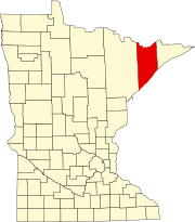 | |
| Townships | ||
| CDPs | ||
|
Other communities | ||
|
Unorganized territories | ||
| Ghost town | ||
|
| This article about a location in Lake County, Minnesota is a stub. You can help Wikipedia by expanding it. |
Knife River, Minnesota | |
|---|---|
Knife River Location in Minnesota Knife River Location in the United States | |
| Coordinates: 46°56′58″N 91°46′45″W / 46.94944°N 91.77917°W | |
| Country | United States |
| State | Minnesota |
| County | Lake |
| Area | |
| • Total | 0.69 sq mi (1.79 km2) |
| • Land | 0.67 sq mi (1.73 km2) |
| • Water | 0.02 sq mi (0.06 km2) |
| Elevation | 600 ft (200 m) |
| Population (
2020) | |
| • Total | 212 |
| • Density | 318.32/sq mi (122.83/km2) |
| Time zone | UTC-6 ( Central (CST)) |
| • Summer ( DST) | UTC-5 (CDT) |
| ZIP code | 55609 |
| Area code | 218 |
| GNIS feature ID | 646206 [2] |
Knife River is an unincorporated community in Lake County, Minnesota, United States; located on the North Shore of Lake Superior.
The community is located between Duluth and Two Harbors on the North Shore Scenic Drive ( County 61), at the mouth of the Knife River, from which it gets its name.
Knife River is located 8 miles southwest of the city of Two Harbors. The boundary line between Lake and Saint Louis counties is nearby.
Knife River is located within Lake No. 2 Unorganized Territory of Lake County.
History
The community of Knife River was originally established in 1856 as Buchanan, located on the west side of the Knife River. [3] A separate community of Mellie, located on the east side of the river was platted in 1899 following the building of the Alger–Smith Lumber Company's railroad in 1898; Mellie changed its name to Knife River in 1903. The two communities incorporated themselves as the village of Knife River on October 2, 1909; but since have returned to being an unincorporated community.
The SS Benjamin Noble foundered off Knife River in April 1914, with the loss of all hands. [4] [5]
| Census | Pop. | Note | %± |
|---|---|---|---|
| 1910 | 491 | — | |
| 2020 | 212 | — | |
| U.S. Decennial Census [6] | |||
References
- ^ "2020 U.S. Gazetteer Files". United States Census Bureau. Retrieved July 24, 2022.
- ^ "Knife River, Minnesota". Geographic Names Information System. United States Geological Survey, United States Department of the Interior.
- ^ Upham, Warren (1920). Minnesota Geographic Names: Their Origin and Historic Significance. Minnesota Historical Society. p. 478.
- ^ "Mystery ship found". Minnesota Public Radio. Retrieved March 16, 2016.
- ^ "Benjamin Noble (shipwreck)". National Park Service. Retrieved March 16, 2016.
- ^ United States Census Bureau. "Census of Population and Housing". Archived from the original on May 7, 2015.
Municipalities and communities of
Lake County, Minnesota, United States | ||
|---|---|---|
| Cities | | |
| Townships | ||
| CDPs | ||
|
Other communities | ||
|
Unorganized territories | ||
| Ghost town | ||
|
| This article about a location in Lake County, Minnesota is a stub. You can help Wikipedia by expanding it. |