Kirkstall | |
|---|---|
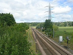
 Last location of the station north of Kirkstall Bridge (2011) | |
| General information | |
| Location |
Kirkstall,
City of Leeds England |
| Coordinates | 53°48′54″N 1°36′26″W / 53.8151°N 1.6073°W |
| Grid reference | SE258356 |
| Platforms | 2 |
| Other information | |
| Status | Disused |
| History | |
| Original company | Leeds and Bradford Railway |
| Pre-grouping | Midland Railway |
| Post-grouping | London, Midland and Scottish Railway |
| Key dates | |
| 1846 | Opened |
| 1906 | Relocated |
| 22 March 1965 | Closed |
Kirkstall was a railway station in Kirkstall, City of Leeds, West Yorkshire. It was located between Kirkstall Forge and Armley Canal Road on the right bank of the River Aire.
History

The station was opened by the Midland Railway in 1860 and closed in March 1965 as part of the Beeching cuts. [1] Originally located south of Kirkstall Bridge next to today's Wyther Lane, [2] it had been moved north of it by 1906. [3] It was demolished after closure and no trace of the station now remains. However, the goods shed, south of Kirkstall Bridge, still exists.
| Preceding station | Historical railways | Following station | ||
|---|---|---|---|---|
| Kirkstall Forge |
Midland Railway Leeds and Bradford Railway |
Armley Canal Road | ||
References
- ^ John Whitaker. "List of West Yorkshire passenger stations". Lost Railways West Yorkshire. Retrieved 14 March 2018.
- ^ Yorkshire 202 (includes: Aireborough; Horsforth; Pudsey.) (Map). OS Six-inch England and Wales, 1842-1952. Ordnance Survey. 1851. Retrieved 14 March 2018.
- ^ Yorkshire CCII.SE (includes: Horsforth; Leeds.) (Map). OS Six-inch England and Wales, 1842-1952. Ordnance Survey. 1909. Retrieved 14 March 2018.
Kirkstall | |
|---|---|
 Last location of the station north of Kirkstall Bridge (2011) | |
| General information | |
| Location |
Kirkstall,
City of Leeds England |
| Coordinates | 53°48′54″N 1°36′26″W / 53.8151°N 1.6073°W |
| Grid reference | SE258356 |
| Platforms | 2 |
| Other information | |
| Status | Disused |
| History | |
| Original company | Leeds and Bradford Railway |
| Pre-grouping | Midland Railway |
| Post-grouping | London, Midland and Scottish Railway |
| Key dates | |
| 1846 | Opened |
| 1906 | Relocated |
| 22 March 1965 | Closed |
Kirkstall was a railway station in Kirkstall, City of Leeds, West Yorkshire. It was located between Kirkstall Forge and Armley Canal Road on the right bank of the River Aire.
History

The station was opened by the Midland Railway in 1860 and closed in March 1965 as part of the Beeching cuts. [1] Originally located south of Kirkstall Bridge next to today's Wyther Lane, [2] it had been moved north of it by 1906. [3] It was demolished after closure and no trace of the station now remains. However, the goods shed, south of Kirkstall Bridge, still exists.
| Preceding station | Historical railways | Following station | ||
|---|---|---|---|---|
| Kirkstall Forge |
Midland Railway Leeds and Bradford Railway |
Armley Canal Road | ||
References
- ^ John Whitaker. "List of West Yorkshire passenger stations". Lost Railways West Yorkshire. Retrieved 14 March 2018.
- ^ Yorkshire 202 (includes: Aireborough; Horsforth; Pudsey.) (Map). OS Six-inch England and Wales, 1842-1952. Ordnance Survey. 1851. Retrieved 14 March 2018.
- ^ Yorkshire CCII.SE (includes: Horsforth; Leeds.) (Map). OS Six-inch England and Wales, 1842-1952. Ordnance Survey. 1909. Retrieved 14 March 2018.