Photos • Location
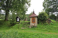
Shrine near cemetery in Kiełczawa

Kiełczawa | |
|---|---|
Village | |
 Kiełczawa | |
| Coordinates: 49°21′30″N 22°12′10″E / 49.35833°N 22.20278°E | |
| Country | |
| Voivodeship | Subcarpathian |
| County | Lesko |
| Gmina | Baligród |

Kiełczawa [kʲɛu̯ˈt͡ʂava] is a village in the administrative district of Gmina Baligród, within Lesko County, Subcarpathian Voivodeship, in south-eastern Poland. It lies approximately 6 kilometres (4 mi) west of Baligród, 16 km (10 mi) south-west of Lesko, and 77 km (48 mi) south of the regional capital Rzeszów. [1]
References
| Seat |  | |
|---|---|---|
| Other villages | ||
Kiełczawa | |
|---|---|
Village | |
Kiełczawa | |
| Coordinates: 49°21′30″N 22°12′10″E / 49.35833°N 22.20278°E | |
| Country | |
| Voivodeship | Subcarpathian |
| County | Lesko |
| Gmina | Baligród |
Kiełczawa [kʲɛu̯ˈt͡ʂava] is a village in the administrative district of Gmina Baligród, within Lesko County, Subcarpathian Voivodeship, in south-eastern Poland. It lies approximately 6 kilometres (4 mi) west of Baligród, 16 km (10 mi) south-west of Lesko, and 77 km (48 mi) south of the regional capital Rzeszów. [1]
References
| Seat | | |
|---|---|---|
| Other villages | ||